
Bestand:Former Yugoslavia Map.png
Oorspronkelijk bestand (3.280 × 2.398 pixels, bestandsgrootte: 2,55 MB, MIME-type: image/png)
| Dit is een bestand van Wikimedia Commons. Onderstaande beschrijving komt van de beschrijving van het bestand daar. |
Kosovo is Serbia
I saw michel morpisdkjnfalsdkjvcasd.Ken.
Beschrijving
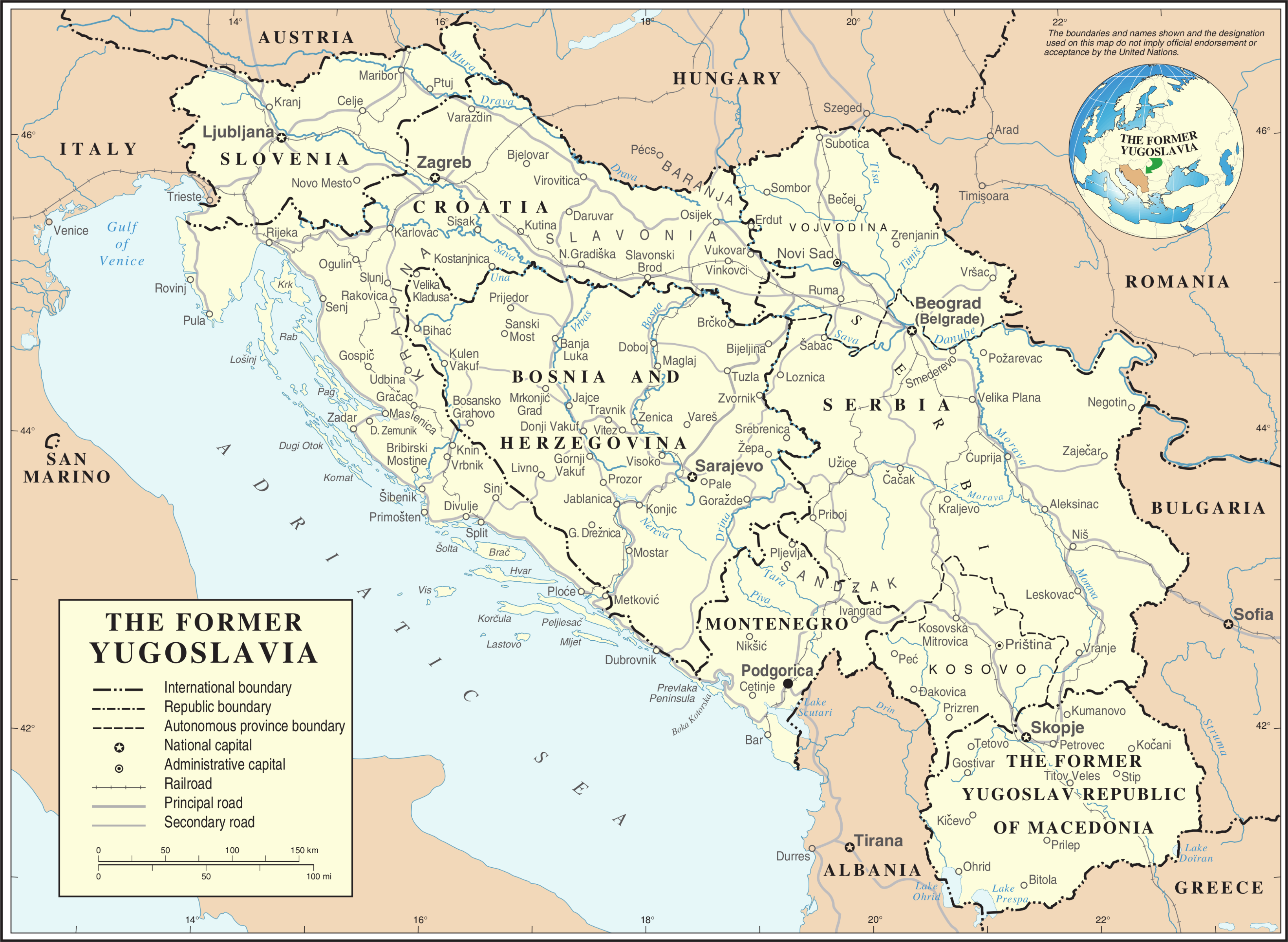
| Beschrijving | Map of former Yugoslavia. | |||
| Datum | ||||
| Bron | The Cartographic Section of the United Nations (CSUN) | |||
| Auteur | Cartographer of the United Nations | |||
| Toestemming (Hergebruik van dit bestand) |
|
|||
| Andere versies |
|


Bestandsgeschiedenis
Klik op een datum/tijd om het bestand te zien zoals het destijds was.
| Datum/tijd | Miniatuur | Afmetingen | Gebruiker | Opmerking | |
|---|---|---|---|---|---|
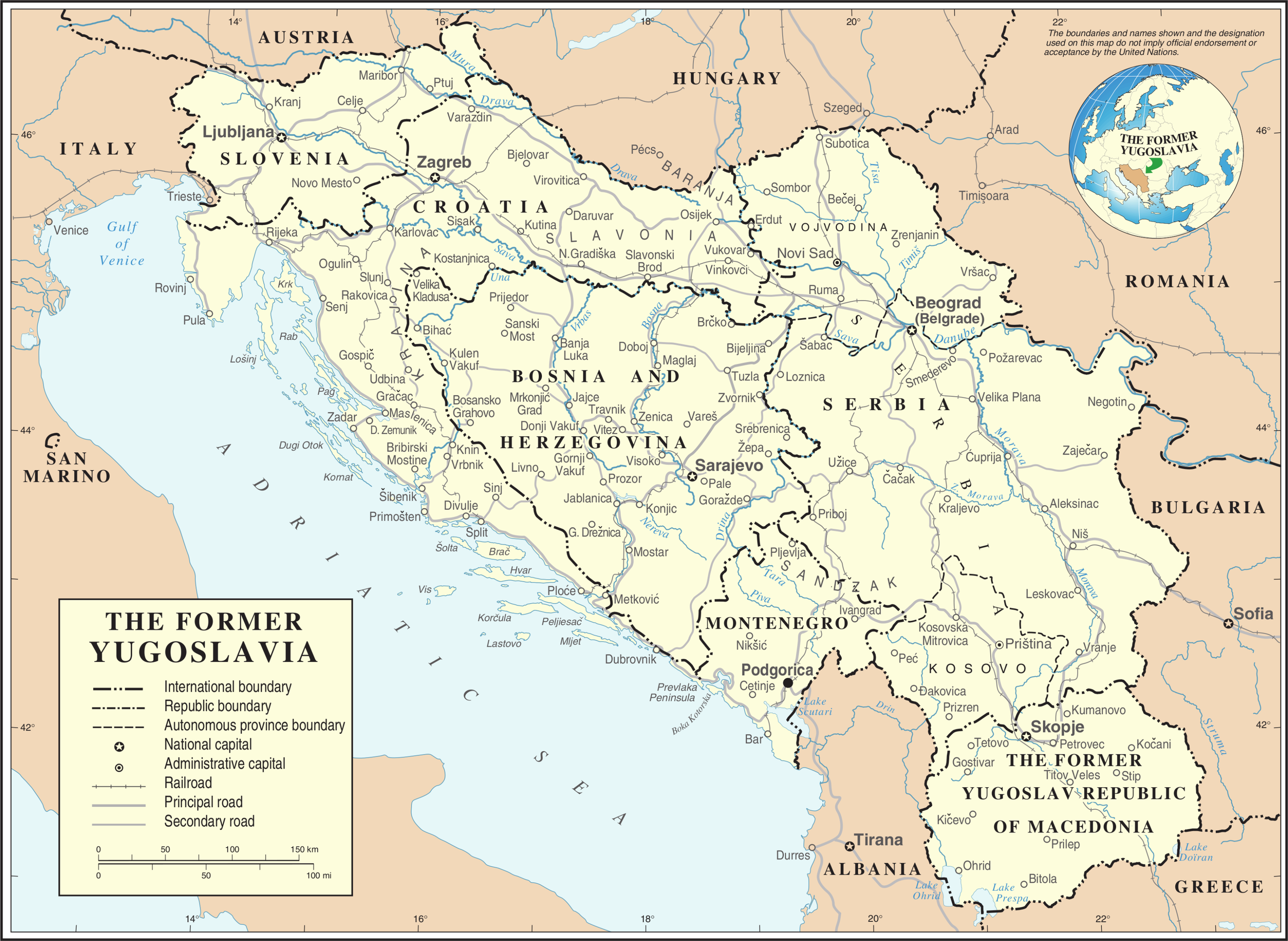
| huidige versie | 21 okt 2007 22:39 | | 3.280 × 2.398 (2,55 MB) | Jeroen | Recreated an updated map from the same source, but now incl. Montenegro and Serbia as independent nations. |
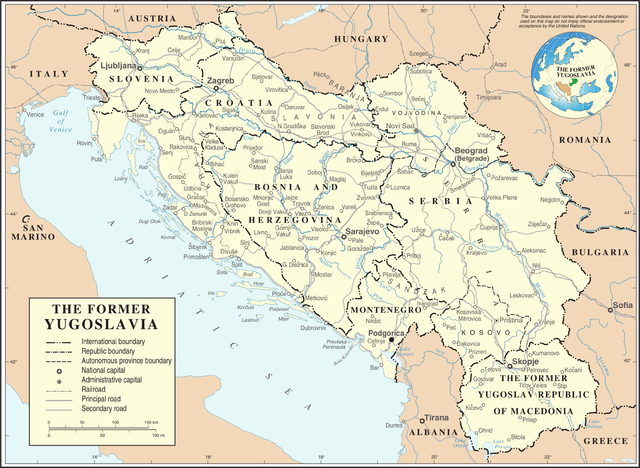
| 10 mrt 2007 19:02 |  | 3.231 × 2.367 (1,6 MB) | Minestrone | Former Yugoslavia Map {{Information |Description=Former Yugoslavia Map |Source=The Cartographic Section of the United Nations (CSUN) |Date=2007-03-10 |Author=Cartographer of the United Nations |Permission={{Template:UN map}} and the cartographer of |
Bestandsgebruik
Dit bestand wordt op de volgende 5 pagina's gebruikt:
Globaal bestandsgebruik
De volgende andere wiki's gebruiken dit bestand:
- Gebruikt op ar.wikipedia.org
- Gebruikt op az.wikipedia.org
- Gebruikt op bs.wikipedia.org
- Gebruikt op ca.wikipedia.org
- Gebruikt op ckb.wikipedia.org
- Gebruikt op cs.wikipedia.org
- Gebruikt op de.wikipedia.org
- Gebruikt op el.wiktionary.org
- Gebruikt op en.wikipedia.org
- Gebruikt op es.wikipedia.org
- Gebruikt op fa.wikipedia.org
- Gebruikt op fr.wikipedia.org
- Gebruikt op fr.wiktionary.org
- Gebruikt op id.wikipedia.org
- Gebruikt op ja.wikipedia.org
- Gebruikt op ka.wikipedia.org
- Gebruikt op ko.wikipedia.org
- Gebruikt op lb.wikipedia.org
- Gebruikt op mzn.wikipedia.org
Globaal gebruik van dit bestand bekijken.