
Bestand:NPS pinnacles-map.jpg

Grootte van deze voorvertoning: 461 × 599 pixels. Andere resoluties: 185 × 240 pixels | 369 × 480 pixels | 591 × 768 pixels | 788 × 1.024 pixels | 1.862 × 2.420 pixels.
Oorspronkelijk bestand (1.862 × 2.420 pixels, bestandsgrootte: 600 kB, MIME-type: image/jpeg)
| Dit is een bestand van Wikimedia Commons. Onderstaande beschrijving komt van de beschrijving van het bestand daar. |
Beschrijving
| Beschrijving |
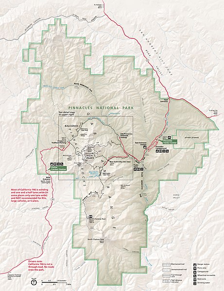
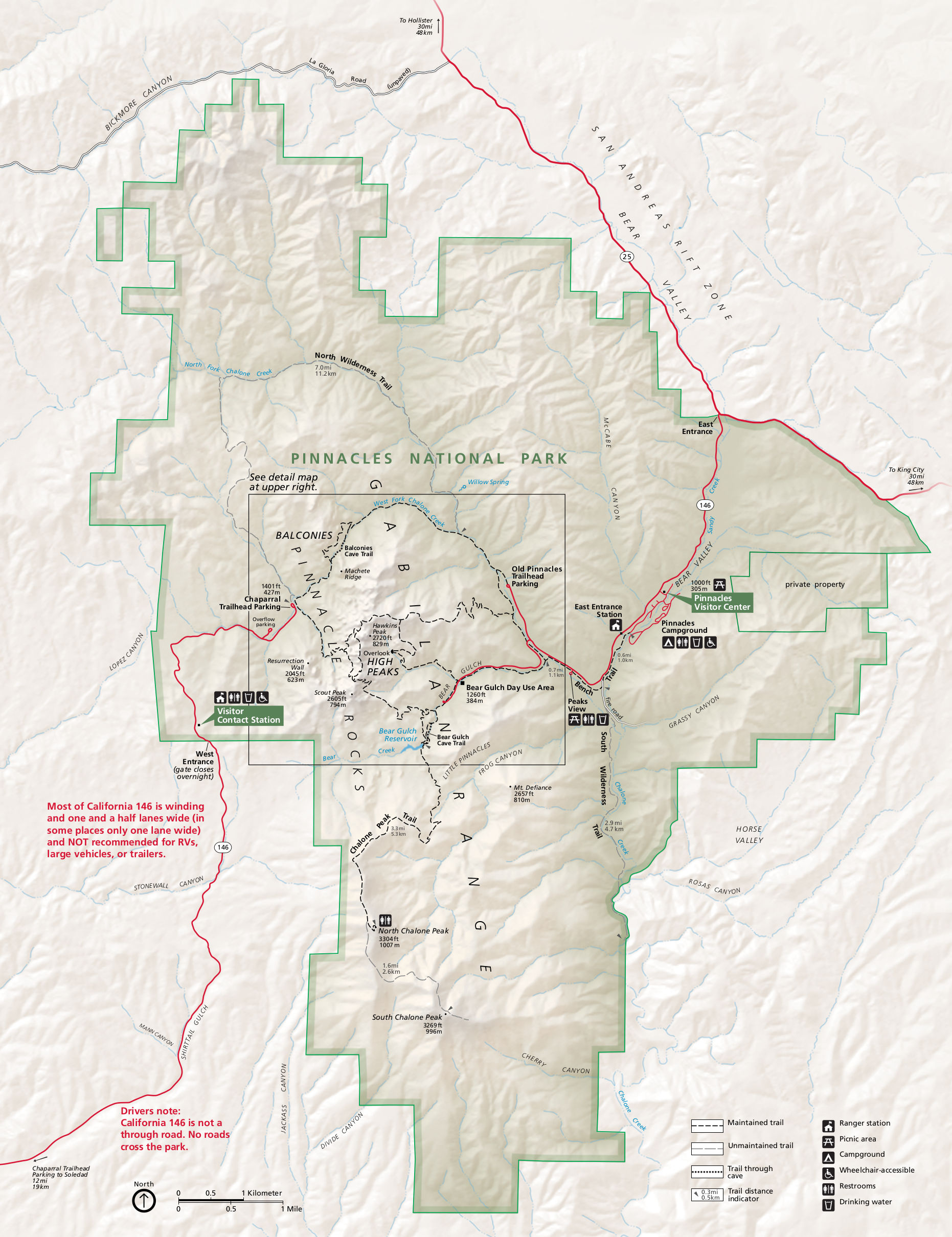
English: Main Pinnacles National Park map, showing roads, hiking trails, campgrounds, visitor centers, and points of interest. |
| Datum | |
| Bron | U.S. National Park Service (http://npmaps.com/wp-content/uploads/pinnacles-map.jpg) |
| Auteur | U.S. National Park Service, restoration/cleanup by Matt Holly |
| Andere versies |
 |
Licentie
| Dit beeld- of mediabestand bevat materiaal gebaseerd op een werk van een National Park Service medewerker, gemaakt als onderdeel van de officiële taken van die persoon. Als een werk van de Amerikaanse federale overheid, bevindt dergelijk werk zich in het publieke domein in de Verenigde Staten. Zie de NPS website en NPS copyright policy voor meer informatie. |
Bestandsgeschiedenis
Klik op een datum/tijd om het bestand te zien zoals het destijds was.
| Datum/tijd | Miniatuur | Afmetingen | Gebruiker | Opmerking | |
|---|---|---|---|---|---|
| huidige versie | 17 mei 2017 03:52 | | 1.862 × 2.420 (600 kB) | RKBot | =={{int:filedesc}}== {{Information |description= {{en|1=Main Pinnacles National Park map, showing roads, hiking trails, campgrounds, visitor centers, and points of interest.}} |date= 2015-08-14 |source= U.S. National Park Service (http://npmaps.com/wp-... |
Bestandsgebruik
Dit bestand wordt op de volgende pagina gebruikt:
Globaal bestandsgebruik
De volgende andere wiki's gebruiken dit bestand:
- Gebruikt op en.wikipedia.org
- Gebruikt op es.wikipedia.org
- Gebruikt op eu.wikipedia.org
- Gebruikt op he.wikipedia.org
- Gebruikt op pl.wikipedia.org
- Gebruikt op tr.wikipedia.org