
Bestand:Rennel map 1799.png

Oorspronkelijk bestand (1.318 × 1.060 pixels, bestandsgrootte: 335 kB, MIME-type: image/png)
| Dit is een bestand van Wikimedia Commons. Onderstaande beschrijving komt van de beschrijving van het bestand daar. |
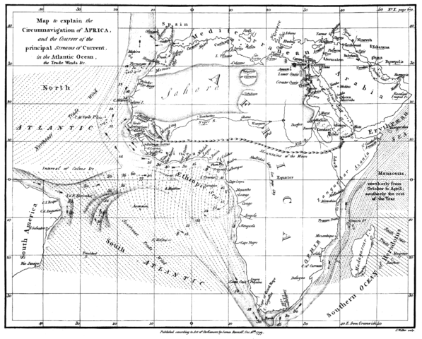
| Beschrijving | Map of the currents in the Atlantic and Indian Ocean | ||||
| Datum | |||||
| Bron | "The geographical system of herodotus ..." by James Rennell, London 01. January 1800 | ||||
| Auteur | James Rennell | ||||
| Toestemming (Hergebruik van dit bestand) |
|
||||
Bestandsgeschiedenis
Klik op een datum/tijd om het bestand te zien zoals het destijds was.
| Datum/tijd | Miniatuur | Afmetingen | Gebruiker | Opmerking | |
|---|---|---|---|---|---|
| huidige versie | 13 feb 2018 17:07 | | 1.318 × 1.060 (335 kB) | Shyamal | Contrast |
| 4 aug 2005 19:28 |  | 1.318 × 1.060 (4,01 MB) | Kl833x9~commonswiki | Map of the currents in the Atlantic and Indian Ocean Created by James Rennell 1799 Source: Copy from Book "The geographical system of herodotus ..." by James Rennell, London 01. January 1800 {{PD}} |
Bestandsgebruik
Dit bestand wordt op de volgende pagina gebruikt:
Globaal bestandsgebruik
De volgende andere wiki's gebruiken dit bestand:
- Gebruikt op ar.wikipedia.org
- Gebruikt op ary.wikipedia.org
- Gebruikt op bn.wikipedia.org
- Gebruikt op br.wikipedia.org
- Gebruikt op ca.wikipedia.org
- Gebruikt op da.wikipedia.org
- Gebruikt op da.wikibooks.org
- Gebruikt op de.wikipedia.org
- Gebruikt op en.wikipedia.org
- Gebruikt op es.wikipedia.org
- Gebruikt op fa.wikipedia.org
- Gebruikt op fa.wikibooks.org
- Gebruikt op hif.wikipedia.org
- Gebruikt op hi.wikipedia.org
- Gebruikt op id.wikipedia.org
- Gebruikt op ja.wikipedia.org
- Gebruikt op mk.wikipedia.org
- Gebruikt op pnb.wikipedia.org
- Gebruikt op ta.wikipedia.org
- Gebruikt op tr.wikipedia.org
- Gebruikt op ur.wikipedia.org
- Gebruikt op www.wikidata.org