
Bestand:Viperisland.jpg

Geen hogere resolutie beschikbaar.
Viperisland.jpg (413 × 343 pixels, bestandsgrootte: 100 kB, MIME-type: image/jpeg)
| Dit is een bestand van Wikimedia Commons. Onderstaande beschrijving komt van de beschrijving van het bestand daar. |
Beschrijving
| Beschrijving |
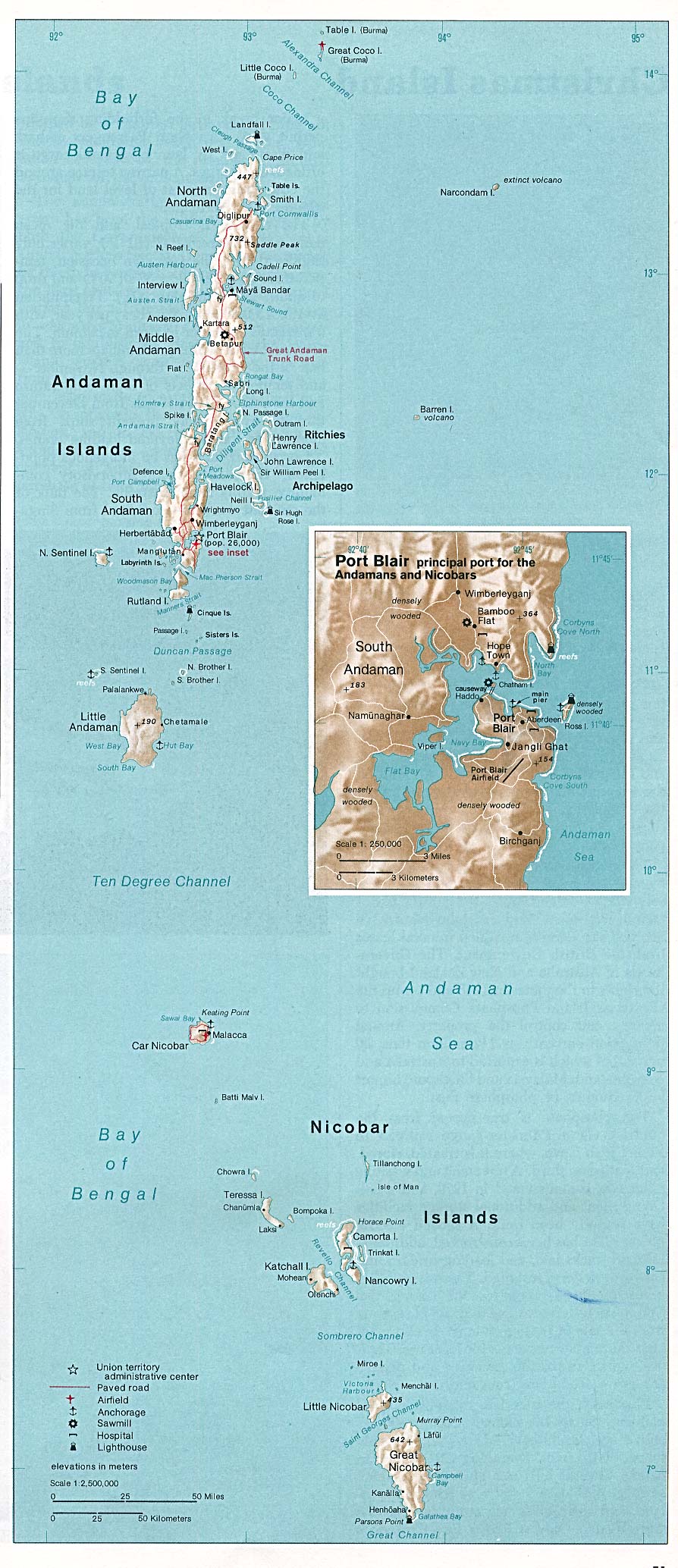
English: Location of Viper Island, Andaman Islands
Deutsch: Lage der Vipern-Insel, Andamanen |
|||||||||
| Datum | ||||||||||
| Bron | http://www.lib.utexas.edu/maps/islands_oceans_poles/andaman_nicobar_76.jpg | |||||||||
| Maker |
Taken from Perry-Castañeda Library (PCL) of the Texas University (Austin), originally from CIA Indian Ocean Atlas |
|||||||||
| Toestemming (Hergebruik van dit bestand) |
It qualifies to the rules stated at http://www.lib.utexas.edu/usage_statement.html | |||||||||
| Geotemporal data | ||||||||||
| Bounding box |
|
|||||||||
| Georeferencing | ||||||||||
| Andere versies | http://commons.wikimedia.org/wiki/Image:Andaman_nicobar_76.jpg | |||||||||
Licentie
| This image is a work of a Central Intelligence Agency employee, taken or made as part of that person's official duties. As a Work of the United States Government, this image or media is in the public domain in the United States.
|

|
Bestandsgeschiedenis
Klik op een datum/tijd om het bestand te zien zoals het destijds was.
| Datum/tijd | Miniatuur | Afmetingen | Gebruiker | Opmerking | |
|---|---|---|---|---|---|
| huidige versie | 14 okt 2008 14:32 | | 413 × 343 (100 kB) | Ulrich Kaden | {{Information |Description={{en|1=Viper Island}} {{de|1=Vipern-Insel}} |Source=http://www.lib.utexas.edu/maps/islands_oceans_poles/andaman_nicobar_76.jpg |Author=CIA / University of Texas |Date=1976 |Permission= |other_versions=http://commons.wikimedia.or |
Bestandsgebruik
Dit bestand wordt op de volgende pagina gebruikt:
Globaal bestandsgebruik
De volgende andere wiki's gebruiken dit bestand:
- Gebruikt op ceb.wikipedia.org
- Gebruikt op de.wikipedia.org
- Gebruikt op sv.wikipedia.org
- Gebruikt op www.wikidata.org