
Bestand:Panama location map.svg

Afmetingen van deze voorvertoning van het type PNG van dit SVG-bestand: 800 × 403 pixels Andere resoluties: 320 × 161 pixels | 640 × 323 pixels | 1.024 × 516 pixels | 1.280 × 645 pixels | 2.560 × 1.290 pixels | 1.246 × 628 pixels.
Oorspronkelijk bestand (SVG-bestand, nominaal 1.246 × 628 pixels, bestandsgrootte: 327 kB)
| Dit is een bestand van Wikimedia Commons. Onderstaande beschrijving komt van de beschrijving van het bestand daar. |
Beschrijving
| Beschrijving |
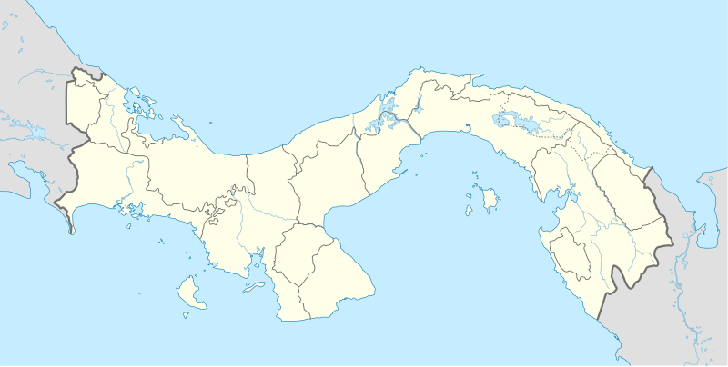
English: Location map of Panama
Equirectangular projection. Geographic limits of the map:
Deutsch: Positionskarte von Panama
Quadratische Plattkarte. Geographische Begrenzung der Karte:
|
| Datum | |
| Bron | Eigen werk |
| Auteur | Alexrk |
| Andere versies |
|


|
Deze kaart is gemaakt of verbeterd in de Duitse Kartenwerkstatt (Map Lab). Je kunt ook zelf kaarten ter verbetering voorstellen.
|
Licentie
Ik, de auteursrechthebbende van dit werk, maak het hierbij onder de volgende licenties beschikbaar:

|
Toestemming wordt verleend voor het kopiëren, verspreiden en/of wijzigen van dit document onder de voorwaarden van de GNU-licentie voor vrije documentatie, versie 1.2 of enige latere versie als gepubliceerd door de Free Software Foundation; zonder Invariant Sections, zonder Front-Cover Texts, en zonder Back-Cover Texts. Een kopie van de licentie is opgenomen in de sectie GNU-licentie voor vrije documentatie. |
Dit bestand is gelicenseerd onder de Creative Commons-licentie Naamsvermelding-Gelijk delen 3.0 Unported
- De gebruiker mag:
- Delen – het werk kopiëren, verspreiden en doorgeven
- Remixen – afgeleide werken maken
- Onder de volgende voorwaarden:
- naamsvermelding – U moet op een gepaste manier aan naamsvermelding doen, een link naar de licentie geven, en aangeven of er wijzigingen in het werk zijn aangebracht. U mag dit op elke redelijke manier doen, maar niet zodanig dat de indruk wordt gewekt dat de licentiegever instemt met uw werk of uw gebruik van zijn werk.
- Gelijk delen – Als u het werk heeft geremixt, veranderd, of erop heeft voortgebouwd, moet u het gewijzigde materiaal verspreiden onder dezelfde licentie als het oorspronkelijke werk, of een daarmee compatibele licentie.
U mag zelf één van de licenties kiezen.
Bestandsgeschiedenis
Klik op een datum/tijd om het bestand te zien zoals het destijds was.
| Datum/tijd | Miniatuur | Afmetingen | Gebruiker | Opmerking | |
|---|---|---|---|---|---|
| huidige versie | 28 dec 2020 18:43 | | 1.246 × 628 (327 kB) | Milenioscuro | new comarca: Naso Tjerdi (created December 4, 2020) + improvements in limits of some provinces |
| 1 jan 2014 19:55 |  | 1.246 × 628 (296 kB) | NordNordWest | + Panama Oeste | |
| 22 jul 2009 18:24 |  | 1.246 × 628 (530 kB) | Alexrk2 | Admingrenzen verbessert | |
| 19 jul 2009 16:18 |  | 1.246 × 628 (528 kB) | Alexrk2 | Admingrenzen korrigiert, +Flüsse | |
| 31 mei 2009 19:27 |  | 1.246 × 628 (347 kB) | Alexrk | Update Admin-Grenzen | |
| 31 mei 2009 19:03 |  | 1.246 × 628 (331 kB) | Alexrk | + Panamakanal | |
| 31 mei 2009 18:42 |  | 1.246 × 628 (330 kB) | Alexrk | Farben korr | |
| 31 mei 2009 17:54 |  | 1.246 × 628 (331 kB) | Alexrk | {{Information |Description={{en|1=Location map of Panama Equirectangular projection. Geographic limits of the map: * N: 10.28° N * S: 6.79° N * W: 83.56° W * O: 76.64° W}} {{de|1=Positionskarte von Panama Quadratische Pla |
Bestandsgebruik
Meer dan 100 pagina's gebruiken dit bestand. De volgende lijst geeft alleen de eerste 100 pagina's weer die dit bestand gebruiken. Er is ook een volledige lijst beschikbaar.
- 24 de Diciembre
- Achutupo
- Agua Buena
- Aguadulce (Panama)
- Ailigandí
- Alanje
- Alcalde Díaz
- Almirante
- Alto de la Estancia
- Alto del Espino
- Ancón (Panama)
- Antón
- Arraiján
- Aserrío de Gariché
- Atalaya (Panama)
- Balboa (Panama)
- Barú
- Berbá
- Bisira
- Boca de Parita
- Bocas del Toro (stad)
- Boquerón (Panama)
- Boquete
- Bugaba
- Burica
- Bágala
- CONCACAF-kampioenschap voetbal onder 17 - 2013
- Caimitillo
- Calobre
- Calzada Larga
- Canoa
- Capellanía
- Capetí
- Capira
- Cartí Sugtupu
- Celmira
- Centennial Bridge
- Chame (Panama)
- Changuinola
- Chepo
- Chichica
- Chigoré
- Chilibre
- Chitré
- Coco Solo
- Coetupo
- Coloncito (Panama)
- Colón (Panama)
- Copa Centroamericana 2011
- Cristóbal (Panama)
- David (Panama)
- David (deelgemeente)
- Divalá
- Dolega
- El Roble (Panama)
- Entradero
- Ernesto Córdoba Campos
- Escobal
- Garachiné
- Gariché
- Guabito
- Gualaca
- Guararé
- Icantí
- Internationale luchthaven Tocumen
- Ipetí
- Jaqué
- Juan Díaz
- Kanir-Dup
- Kankintú
- Kuna de Wargandí
- Kusapin
- La Cabima
- La Chorrera (Panama)
- Las Cumbres
- Mortí
- Ocú
- Olá
- Pacora
- Panama-Stad
- Penonomé (stad)
- Pesé
- Pocrí (Coclé)
- Pocrí (Los Santos)
- Portobelo
- San Miguelito (Panama)
- Santa María de Belén
- Santa Rita Arriba
- Santiago de Veraguas
- Sasardi
- Tocumen
- Tolé
- Tonosí
- Tubualá
- UNCAF Nations Cup 2003
- U (Panama)
- Ustupo
- Vacamonte
- Valle del Risco
- Voetbal in Latijns-Amerika
Meer koppelingen naar dit bestand bekijken.
Globaal bestandsgebruik
De volgende andere wiki's gebruiken dit bestand:
- Gebruikt op af.wikipedia.org
- Gebruikt op als.wikipedia.org
- Gebruikt op an.wikipedia.org
- Gebruikt op ar.wikipedia.org
- Gebruikt op arz.wikipedia.org
- Gebruikt op ast.wikipedia.org
- Ponte de les Amériques
- Canal de Panamá
- Ciudá de Panamá
- Módulu:Mapa de llocalización/datos/Panamá
- Módulu:Mapa de llocalización/datos/Panamá/usu
- Aeropuertu Internacional Enrique Malek
- Aeropuertu Internacional de Tocumen
- Puertu de Balboa
- Terminal Internacional de Manzanillo
- Terminal Internacional de PSA Panamá
- Academia Panameña de la Llingua
- Gebruikt op az.wikipedia.org
- Gebruikt op ba.wikipedia.org
- Gebruikt op be-tarask.wikipedia.org
- Gebruikt op be.wikipedia.org
- Gebruikt op bg.wikipedia.org
- Gebruikt op bn.wikipedia.org
- Gebruikt op bs.wikipedia.org
Globaal gebruik van dit bestand bekijken.