
Bestand:Antietam0600 a.svg

Afmetingen van deze voorvertoning van het type PNG van dit SVG-bestand: 473 × 561 pixels Andere resoluties: 202 × 240 pixels | 405 × 480 pixels | 647 × 768 pixels | 863 × 1.024 pixels | 1.727 × 2.048 pixels.
Oorspronkelijk bestand (SVG-bestand, nominaal 473 × 561 pixels, bestandsgrootte: 2,86 MB)
| Dit is een bestand van Wikimedia Commons. Onderstaande beschrijving komt van de beschrijving van het bestand daar. |
W3C-validity not checked.
Beschrijving
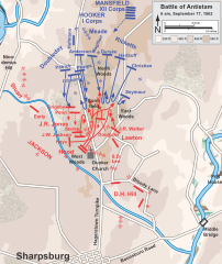
| Beschrijving | Map of the Battle of Antietam of the American Civil War. Drawn in Adobe Illustrator CS5 by Hal Jespersen. Graphic source file is available at http://www.posix.com/CWmaps/ |
| Datum | (UTC) |
| Bron |
Dit bestand is afgeleid van: Antietam0600.png:  |
| Auteur |
|
| Dit is een geretoucheerde foto, wat betekent dat de originele versie digitaal aangepast is. Aanpassingen: Made it into a svg-file. Het origineel kan hier bekeken worden: Antietam0600.png. Aanpassingen gedaan door Citypeek.
|
Licentie
Ik, de auteursrechthebbende van dit werk, maak het hierbij onder de volgende licentie beschikbaar:
Dit bestand is gelicenseerd onder de Creative Commons-licentie Naamsvermelding 3.0 Unported
- De gebruiker mag:
- Delen – het werk kopiëren, verspreiden en doorgeven
- Remixen – afgeleide werken maken
- Onder de volgende voorwaarden:
- naamsvermelding – U moet op een gepaste manier aan naamsvermelding doen, een link naar de licentie geven, en aangeven of er wijzigingen in het werk zijn aangebracht. U mag dit op elke redelijke manier doen, maar niet zodanig dat de indruk wordt gewekt dat de licentiegever instemt met uw werk of uw gebruik van zijn werk.
Oorspronkelijk uploadlogboek
This image is a derivative work of the following images:
- File:Antietam0600.png licensed with Cc-by-3.0
- 2011-09-27T21:24:51Z Hlj 789x935 (338532 Bytes) Provide more exact topographical information. Same license.
- 2011-03-28T19:48:57Z Hlj 794x957 (231811 Bytes) Update to more recent graphical style for rivers and roads. Same license.
- 2010-10-26T01:19:03Z Hlj 794x957 (209156 Bytes) Updated graphics to conform to style used by many other ACW maps, added legend/scale. Drawn in Adobe Illustrator CS5 by Hal Jespersen. Graphic source file is available at http://www.posix.com/CWmaps/ {{cc-by-3.0|Map by Hal Je
- 2007-04-15T09:11:03Z Hellisp 755x922 (241723 Bytes) Map of the Battle of Antietam of the American Civil War, actions starting at 6 a.m. Drawn by Hal Jespersen in Macromedia Freehand. Graphic source file is available at http://www.posix.com/CWmaps/ {{PD-release}} From en.wiki
Uploaded with derivativeFX
Bestandsgeschiedenis
Klik op een datum/tijd om het bestand te zien zoals het destijds was.
| Datum/tijd | Miniatuur | Afmetingen | Gebruiker | Opmerking | |
|---|---|---|---|---|---|
| huidige versie | 8 mei 2013 07:23 | | 473 × 561 (2,86 MB) | Citypeek | == {{int:filedesc}} == {{Information |Description=Map of the Battle of Antietam of the American Civil War. Drawn in Adobe Illustrator CS5 by Hal Jespersen. Graphic source file is available at http://www.posix.com/CWmaps/ |Source={{Derived from|Anti... |
Bestandsgebruik
Dit bestand wordt op de volgende pagina gebruikt:
Globaal bestandsgebruik
De volgende andere wiki's gebruiken dit bestand:
- Gebruikt op de.wikipedia.org