
Bestand:LocationSeychellesOuterIslands.PNG
Geen hogere resolutie beschikbaar.
LocationSeychellesOuterIslands.PNG (250 × 119 pixels, bestandsgrootte: 5 kB, MIME-type: image/png)
| Dit is een bestand van Wikimedia Commons. Onderstaande beschrijving komt van de beschrijving van het bestand daar. |
Beschrijving
| Beschrijving |
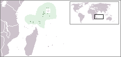
English: Location map of the Outer Seychelles Islands (Coralline Seychelles) coral archipelago of the Seychelles islands and nation.
|
| Datum | |
| Bron | Eigen werk |
| Auteur | Telim tor |
Licentie
| Ik, de auteursrechthebbende van dit werk, geef dit werk vrij in het publieke domein. Dit is wereldwijd van toepassing. In sommige landen is dit wettelijk niet mogelijk; in die gevallen geldt: Ik sta iedereen toe dit werk voor eender welk doel te gebruiken, zonder enige voorwaarden, tenzij zulke voorwaarden door de wet worden voorgeschreven. |
Bestandsgeschiedenis
Klik op een datum/tijd om het bestand te zien zoals het destijds was.
| Datum/tijd | Miniatuur | Afmetingen | Gebruiker | Opmerking | |
|---|---|---|---|---|---|
| huidige versie | 19 apr 2010 13:23 | | 250 × 119 (5 kB) | Telim tor | == {{int:filedesc}} == {{Information |Description=Location of the Outer Islands of Seychelles |Source={{own}} |Date=2010-04-19 |Author=Telim tor |Permission= |other_versions= }} == {{int:license}} == {{PD-self}} [[Category:Maps of Sey |
| 19 apr 2010 13:23 |  | 250 × 119 (5 kB) | Telim tor | == {{int:filedesc}} == {{Information |Description=Location of the Outer Islands of Seychelles |Source={{own}} |Date=2010-04-19 |Author=Telim tor |Permission= |other_versions= }} == {{int:license}} == {{PD-self}} [[Category:Maps of Sey |
Bestandsgebruik
Dit bestand wordt op de volgende pagina gebruikt:
Globaal bestandsgebruik
De volgende andere wiki's gebruiken dit bestand:
- Gebruikt op ru.wikipedia.org