
Bestand:Map of Limpopo with districts labelled (2011).svg

Afmetingen van deze voorvertoning van het type PNG van dit SVG-bestand: 800 × 537 pixels Andere resoluties: 320 × 215 pixels | 640 × 430 pixels | 1.024 × 687 pixels | 1.280 × 859 pixels | 2.560 × 1.719 pixels | 925 × 621 pixels.
Oorspronkelijk bestand (SVG-bestand, nominaal 925 × 621 pixels, bestandsgrootte: 305 kB)
| Dit is een bestand van Wikimedia Commons. Onderstaande beschrijving komt van de beschrijving van het bestand daar. |
.svg)
Beschrijving
| Beschrijving |
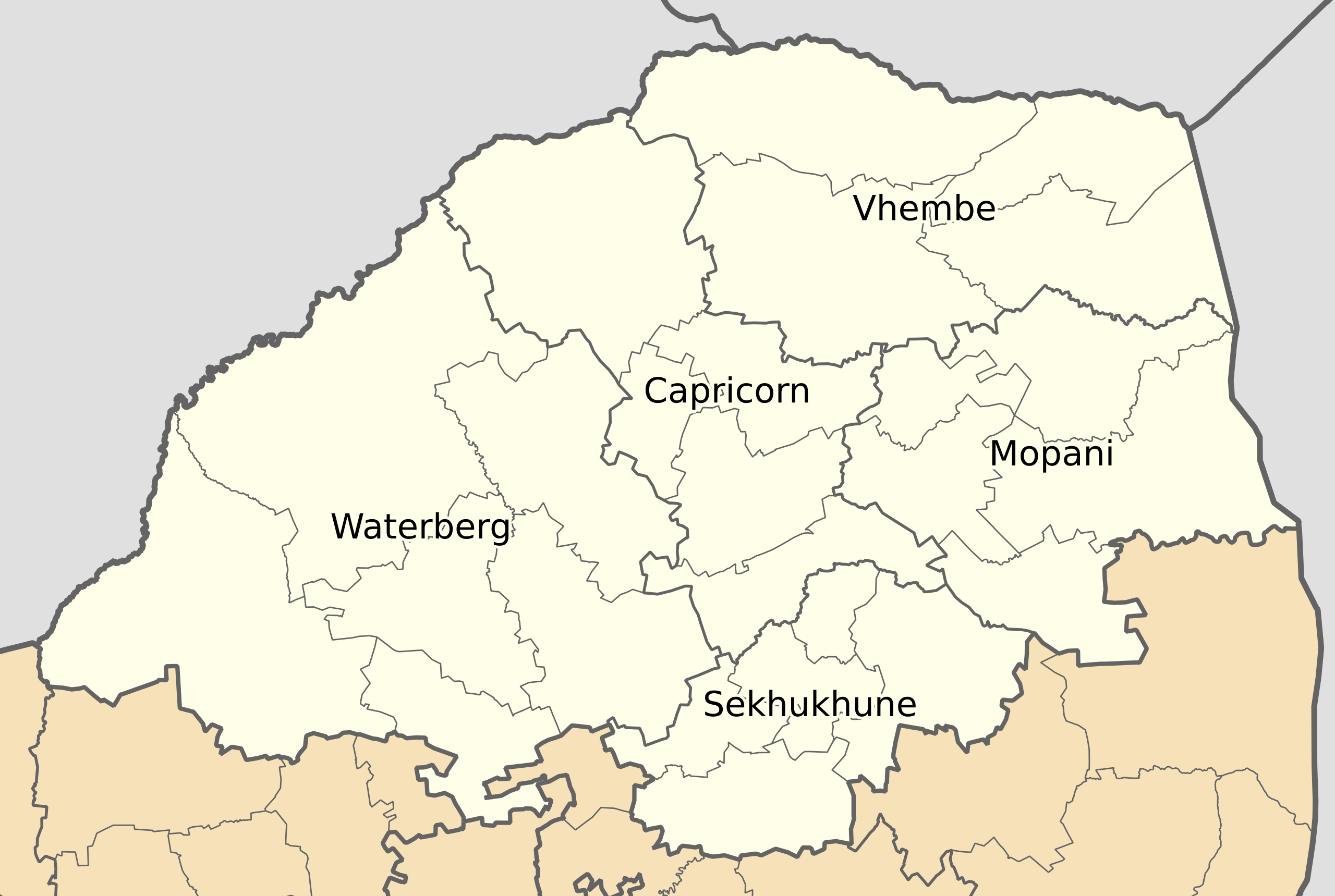
English: Map of municipal boundaries in Limpopo, as they will be after the municipal elections of 18 May 2011, with district and metropolitan municipalities named. |
| Datum | |
| Bron | Eigen werk |
| Auteur | Htonl |
Licentie
Ik, de auteursrechthebbende van dit werk, maak het hierbij onder de volgende licenties beschikbaar:

|
Toestemming wordt verleend voor het kopiëren, verspreiden en/of wijzigen van dit document onder de voorwaarden van de GNU-licentie voor vrije documentatie, versie 1.2 of enige latere versie als gepubliceerd door de Free Software Foundation; zonder Invariant Sections, zonder Front-Cover Texts, en zonder Back-Cover Texts. Een kopie van de licentie is opgenomen in de sectie GNU-licentie voor vrije documentatie. |
This file is licensed under the Creative Commons Attribution-Share Alike 4.0 International, 3.0 Unported, 2.5 Generic, 2.0 Generic and 1.0 Generic license.
- De gebruiker mag:
- Delen – het werk kopiëren, verspreiden en doorgeven
- Remixen – afgeleide werken maken
- Onder de volgende voorwaarden:
- naamsvermelding – U moet op een gepaste manier aan naamsvermelding doen, een link naar de licentie geven, en aangeven of er wijzigingen in het werk zijn aangebracht. U mag dit op elke redelijke manier doen, maar niet zodanig dat de indruk wordt gewekt dat de licentiegever instemt met uw werk of uw gebruik van zijn werk.
- Gelijk delen – Als u het werk heeft geremixt, veranderd, of erop heeft voortgebouwd, moet u het gewijzigde materiaal verspreiden onder dezelfde licentie als het oorspronkelijke werk, of een daarmee compatibele licentie.
U mag zelf één van de licenties kiezen.
Bestandsgeschiedenis
Klik op een datum/tijd om het bestand te zien zoals het destijds was.
| Datum/tijd | Miniatuur | Afmetingen | Gebruiker | Opmerking | |
|---|---|---|---|---|---|
| huidige versie | 14 mei 2011 04:33 | | 925 × 621 (305 kB) | Htonl | svg code tweak |
| 14 mei 2011 02:47 |  | 925 × 621 (305 kB) | Htonl | == Summary == {{Information |Description ={{en|1=Map of municipal boundaries in w:Limpopo, as they will be after the municipal elections of 18 May 2011, with district and metropolitan municipalities nam |
Bestandsgebruik
Geen enkele pagina gebruikt dit bestand.
Globaal bestandsgebruik
De volgende andere wiki's gebruiken dit bestand:
- Gebruikt op af.wikipedia.org
- Gebruikt op en.wikipedia.org
- Gebruikt op hu.wikipedia.org
- Gebruikt op hy.wikipedia.org
- Gebruikt op pl.wikipedia.org
- Gebruikt op sh.wikipedia.org
.svg)