
Bestand:Map of Virginia highlighting King William County.svg

Afmetingen van deze voorvertoning van het type PNG van dit SVG-bestand: 800 × 347 pixels Andere resoluties: 320 × 139 pixels | 640 × 278 pixels | 1.024 × 444 pixels | 1.280 × 555 pixels | 2.560 × 1.110 pixels | 7.486 × 3.247 pixels.
Oorspronkelijk bestand (SVG-bestand, nominaal 7.486 × 3.247 pixels, bestandsgrootte: 223 kB)
| Dit is een bestand van Wikimedia Commons. Onderstaande beschrijving komt van de beschrijving van het bestand daar. |
Beschrijving
| Beschrijving |
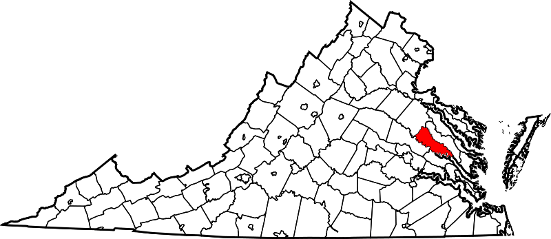
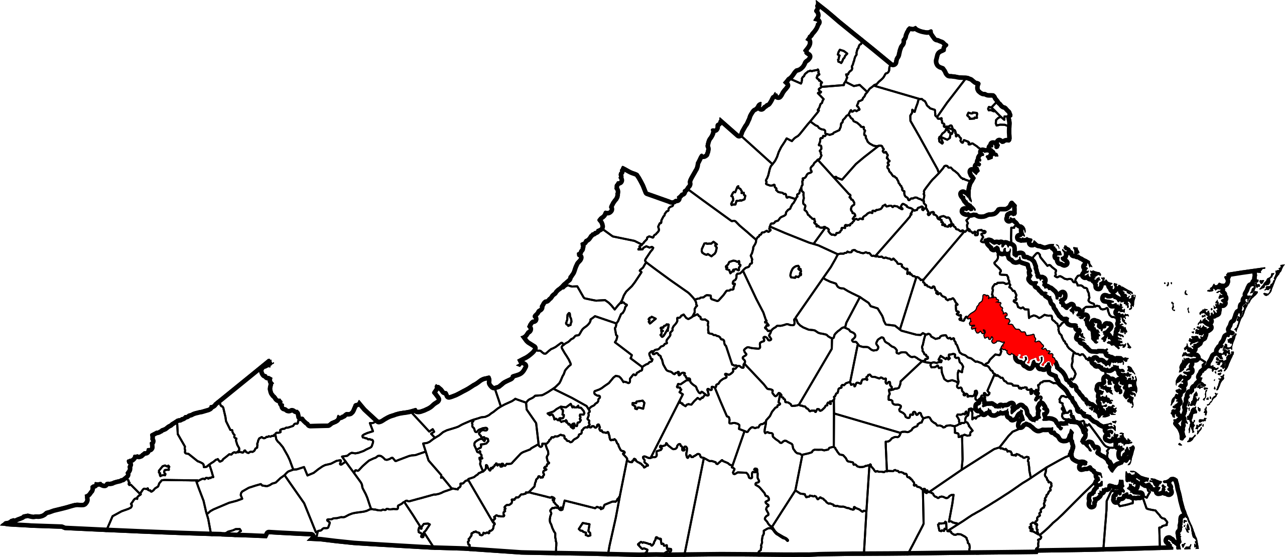
English: This is a locator map showing King William County in Virginia. For more information, see Commons:United States county locator maps. |
| Datum | |
| Bron |
Eigen werk: English: The maps use data from nationalatlas.gov, specifically countyp020.tar.gz on the Raw Data Download page. The maps also use state outline data from statesp020.tar.gz. The Florida maps use hydrogm020.tar.gz to display Lake Okeechobee. |
| Auteur | David Benbennick |
| SVG ontwikkeling | Deze niet W3C-deugdelijke kaart is gemaakt met een onbekende SVG-editor |
Licentie
| Ik, de auteursrechthebbende van dit werk, geef dit werk vrij in het publieke domein. Dit is wereldwijd van toepassing. In sommige landen is dit wettelijk niet mogelijk; in die gevallen geldt: Ik sta iedereen toe dit werk voor eender welk doel te gebruiken, zonder enige voorwaarden, tenzij zulke voorwaarden door de wet worden voorgeschreven. |
Bestandsgeschiedenis
Klik op een datum/tijd om het bestand te zien zoals het destijds was.
| Datum/tijd | Miniatuur | Afmetingen | Gebruiker | Opmerking | |
|---|---|---|---|---|---|
| huidige versie | 12 feb 2006 19:48 | | 7.486 × 3.247 (223 kB) | David Benbennick | {{subst:User:Dbenbenn/clm|county=King William County|state=Virginia|type=county}} |
Bestandsgebruik
Dit bestand wordt op de volgende pagina gebruikt:
Globaal bestandsgebruik
De volgende andere wiki's gebruiken dit bestand:
- Gebruikt op ar.wikipedia.org
- Gebruikt op bpy.wikipedia.org
- Gebruikt op ca.wikipedia.org
- Gebruikt op cdo.wikipedia.org
- Gebruikt op ceb.wikipedia.org
- Gebruikt op ce.wikipedia.org
- Gebruikt op cy.wikipedia.org
- Gebruikt op de.wikipedia.org
- Gebruikt op en.wikipedia.org
- List of cities and counties in Virginia
- West Point, Virginia
- Pamunkey Indian Reservation
- Pamunkey River
- Mattaponi
- King William, Virginia
- King William County, Virginia
- Template:King William County, Virginia
- Sandy Point State Forest
- Zoar State Forest
- Aylett, Virginia
- Beulahville, Virginia
- Calno, Virginia
- Chericoke, Virginia
- Cohoke, Virginia
- Corinth Fork, Virginia
- Duane, Virginia
- Duane Fork, Virginia
- Elsing Green, Virginia
- Enfield, Virginia
- Epworth, Virginia
- Etna Mills, Virginia
- Globe, Virginia
- Horseshoe, Virginia
- Keith, Virginia
- Lanesville, Virginia
- Mangohick, Virginia
- Manquin, Virginia
- Midway, King William County, Virginia
- Port Richmond, Virginia
- Romancoke, Virginia
- Rosespout, Virginia
- Rumford, Virginia
- Tuck Fork, Virginia
Globaal gebruik van dit bestand bekijken.