
Bestand:Morayfirthmap.png

Grootte van deze voorvertoning: 597 × 600 pixels. Andere resoluties: 239 × 240 pixels | 478 × 480 pixels | 995 × 1.000 pixels.
Oorspronkelijk bestand (995 × 1.000 pixels, bestandsgrootte: 280 kB, MIME-type: image/png)
| Dit is een bestand van Wikimedia Commons. Onderstaande beschrijving komt van de beschrijving van het bestand daar. |
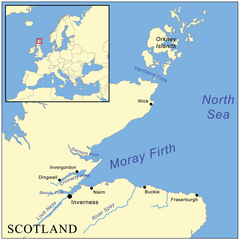
| Beschrijving | This is a map of the Moray Firth including a small locator map, based on Digital Chart of the World data. |
| Datum | |
| Bron | Eigen werk |
| Auteur | Kmusser |
Ik, de auteursrechthebbende van dit werk, maak het hierbij onder de volgende licentie beschikbaar:
Dit bestand is gelicenseerd onder de Creative Commons-licentie Naamsvermelding-Gelijk delen 2.5 Unported
- De gebruiker mag:
- Delen – het werk kopiëren, verspreiden en doorgeven
- Remixen – afgeleide werken maken
- Onder de volgende voorwaarden:
- naamsvermelding – U moet op een gepaste manier aan naamsvermelding doen, een link naar de licentie geven, en aangeven of er wijzigingen in het werk zijn aangebracht. U mag dit op elke redelijke manier doen, maar niet zodanig dat de indruk wordt gewekt dat de licentiegever instemt met uw werk of uw gebruik van zijn werk.
- Gelijk delen – Als u het werk heeft geremixt, veranderd, of erop heeft voortgebouwd, moet u het gewijzigde materiaal verspreiden onder dezelfde licentie als het oorspronkelijke werk, of een daarmee compatibele licentie.
Bestandsgeschiedenis
Klik op een datum/tijd om het bestand te zien zoals het destijds was.
| Datum/tijd | Miniatuur | Afmetingen | Gebruiker | Opmerking | |
|---|---|---|---|---|---|
| huidige versie | 4 jul 2012 11:47 | | 995 × 1.000 (280 kB) | Dricherby | sp Dornoch (was "Dornach"). |
| 22 mei 2007 18:11 |  | 995 × 1.000 (317 kB) | Kmusser | fix montenegro boundary | |
| 22 mei 2007 18:01 |  | 995 × 1.000 (317 kB) | Kmusser | {{Information |Description=This is a map of the Moray Firth including a small locator map, based on Digital Chart of the World data. |Source=self-made |Date= May 22, 2007 |Author= User:Kmusser |
Bestandsgebruik
Dit bestand wordt op de volgende pagina gebruikt:
Globaal bestandsgebruik
De volgende andere wiki's gebruiken dit bestand:
- Gebruikt op br.wikipedia.org
- Gebruikt op de.wikipedia.org
- Gebruikt op en.wikipedia.org
- Gebruikt op es.wikipedia.org
- Gebruikt op fi.wikipedia.org
- Gebruikt op fr.wikipedia.org
- Gebruikt op gd.wikipedia.org
- Gebruikt op ia.wikipedia.org
- Gebruikt op it.wikipedia.org
- Gebruikt op ja.wikipedia.org
- Gebruikt op nn.wikipedia.org
- Gebruikt op no.wikipedia.org
- Gebruikt op pl.wikipedia.org
- Gebruikt op ru.wikipedia.org
- Gebruikt op sco.wikipedia.org
- Gebruikt op vi.wikipedia.org