
Bestand:Overland Campaign May 29-30.png
Grootte van deze voorvertoning: 497 × 599 pixels. Andere resoluties: 199 × 240 pixels | 398 × 480 pixels | 637 × 768 pixels | 1.186 × 1.430 pixels.
Oorspronkelijk bestand (1.186 × 1.430 pixels, bestandsgrootte: 374 kB, MIME-type: image/png)
| Dit is een bestand van Wikimedia Commons. Onderstaande beschrijving komt van de beschrijving van het bestand daar. |
| Beschrijving |
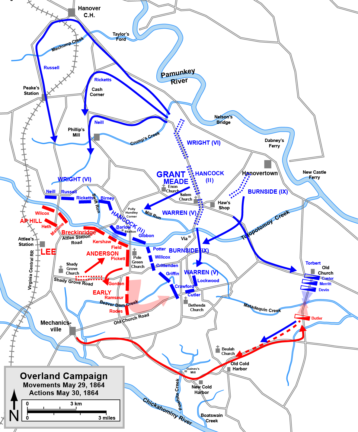
English: One of a series of maps of the Overland Campaign of the American Civil War, showing the movements that led to the battles of Totopotomoy Creek (Bethesda Church) and Old Church. Drawn in Adobe Illustrator CS5 by Hal Jespersen. Graphic source file is available at http://www.posix.com/CWmaps/
Dit bestand is gelicenseerd onder de Creative Commons-licentie Naamsvermelding 3.0 Unported Naamsvermelding: Map by Hal Jespersen, www.posix.com/CW
|
| Bron | Eigen werk |
| Auteur | Hlj |
Bestandsgeschiedenis
Klik op een datum/tijd om het bestand te zien zoals het destijds was.
| Datum/tijd | Miniatuur | Afmetingen | Gebruiker | Opmerking | |
|---|---|---|---|---|---|
| huidige versie | 17 mrt 2011 22:17 | | 1.186 × 1.430 (374 kB) | Hlj | Minor graphical changes to conform to new ACW map style for roads and rivers. Same license. |
| 21 feb 2011 19:47 |  | 1.186 × 1.430 (278 kB) | Hlj | Minor updates to clarify the movements and actions of the Battle of Old Church (Matadequin Creek). Same license. | |
| 18 feb 2011 22:30 |  | 1.186 × 1.430 (268 kB) | Hlj | {{Information |Description ={{en|1=One of a series of maps of the Overland Campaign of the American Civil War, showing the movements that led to the battles of Totopotomoy Creek (Bethesda Church) and |
Bestandsgebruik
Dit bestand wordt op de volgende 3 pagina's gebruikt:
Globaal bestandsgebruik
De volgende andere wiki's gebruiken dit bestand:
- Gebruikt op en.wikipedia.org
- Gebruikt op fr.wikipedia.org
- Gebruikt op ja.wikipedia.org
- Gebruikt op ru.wikipedia.org