
Bestand:Position of Waikato Region.png
Geen hogere resolutie beschikbaar.
Position_of_Waikato_Region.png (405 × 590 pixels, bestandsgrootte: 7 kB, MIME-type: image/png)
| Dit is een bestand van Wikimedia Commons. Onderstaande beschrijving komt van de beschrijving van het bestand daar. |

|
Deze kaartafbeelding zou opnieuw moeten worden aangemaakt als een SVG-bestand door vectorafbeeldingen te gebruiken. Dit heeft een aantal voordelen; zie Commons:Media for cleanup voor meer informatie. Als er een SVG-formaat van deze afbeelding bestaat, dan deze graag uploaden. Nadat u dit heeft gedaan, gelieve dit sjabloon te vervangen door het sjabloon {{vector version available|nieuwe bestandsnaam.svg}} op deze afbeeldingspagina.
|
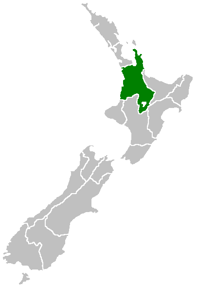
Region of New Zealand, position on the map (source:English Wiki)
| |
Dit bestand is door Furius op Wikimedia Commons, in het publieke domein geplaatst. Dit is wereldwijd van toepassing. In sommige landen is dit niet mogelijk; in die gevallen geldt: |
Bestandsgeschiedenis
Klik op een datum/tijd om het bestand te zien zoals het destijds was.
| Datum/tijd | Miniatuur | Afmetingen | Gebruiker | Opmerking | |
|---|---|---|---|---|---|
| huidige versie | 27 apr 2005 09:41 | | 405 × 590 (7 kB) | Domie~commonswiki | Region of New Zealand, position on the map (source:English Wiki) {{PD}} Category:Maps of New Zealand |
Bestandsgebruik
Geen enkele pagina gebruikt dit bestand.
Globaal bestandsgebruik
De volgende andere wiki's gebruiken dit bestand:
- Gebruikt op en.wikipedia.org
- Mamaku Ranges
- Cape Colville
- Motukawao Islands
- Coromandel Range
- Slipper Island
- Lake Maraetai
- Lake Arapuni
- Lake Waikare
- Mangateparu
- Māhoenui
- Ōhakuri Dam
- Template:Waikato-geo-stub
- Huntly Power Station
- Lady Knox Geyser
- Horseshoe Lake (New Zealand)
- Lake Rotopounamu
- Awakino
- Kārewa / Gannet Island
- Waihi Village
- Hauauru ma raki
- Te Huka Power Station
- Portal:Monarchy
- Te Rapa cogeneration
- Te Mihi Power Station
- Wairakei Power Station
- Te Uku Wind Farm
- Aratiatia Power Station
- Ohaaki Power Station
- Poihipi Power Station
- Rotokawa Power Station
- Horahora Power Station
- Karāpiro Power Station
- Nga Awa Purua Power Station
- Madonna Falls
- Ben Lomond (Waikato)
- Tongariro Power Scheme
- Atiamuri Power Station
- Maraetai Power Station
- Arapuni Power Station
- Meremere Power Station
- Whakamaru Dam
- Wairere Falls
- Seabird Coast
- Ngatamariki Power Station
- Non-sovereign monarchy
- Whitianga Festival of Speed
- List of localities in Waikato
- Waikato County
- Hamilton Town Belt
- Grandview Heights, New Zealand
Globaal gebruik van dit bestand bekijken.