
Bestand:ScotlandStirling.png
Geen hogere resolutie beschikbaar.
ScotlandStirling.png (200 × 230 pixels, bestandsgrootte: 3 kB, MIME-type: image/png)
| Dit is een bestand van Wikimedia Commons. Onderstaande beschrijving komt van de beschrijving van het bestand daar. |
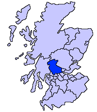
Stirling unitary council
Slightly edited version of a map drawn by Morwen

|
Toestemming wordt verleend voor het kopiëren, verspreiden en/of wijzigen van dit document onder de voorwaarden van de GNU-licentie voor vrije documentatie, versie 1.2 of enige latere versie als gepubliceerd door de Free Software Foundation; zonder Invariant Sections, zonder Front-Cover Texts, en zonder Back-Cover Texts. Een kopie van de licentie is opgenomen in de sectie GNU-licentie voor vrije documentatie. |
| Dit bestand is gelicenseerd onder de Creative Commons-licentie Naamsvermelding-Gelijk delen 3.0 Unported | ||
| ||
| Deze licentietag is toegevoegd aan dit bestand in verband met de GFDL licentie-update. |
Bestandsgeschiedenis
Klik op een datum/tijd om het bestand te zien zoals het destijds was.
| Datum/tijd | Miniatuur | Afmetingen | Gebruiker | Opmerking | |
|---|---|---|---|---|---|
| huidige versie | 22 feb 2009 06:04 | | 200 × 230 (3 kB) | Mahahahaneapneap | Compressed |
| 17 mei 2005 23:44 |  | 200 × 230 (4 kB) | Voyager | Stirling unitary council Slightly edited version of a map drawn by Morwen {{GFDL}} Category:Maps of Scottish unitary councils |
Bestandsgebruik
Geen enkele pagina gebruikt dit bestand.
Globaal bestandsgebruik
De volgende andere wiki's gebruiken dit bestand:
- Gebruikt op be.wikipedia.org
- Gebruikt op bg.wikipedia.org
- Gebruikt op cs.wikipedia.org
- Gebruikt op cy.wikipedia.org
- Gebruikt op de.wikipedia.org
- Gebruikt op en.wikipedia.org
- Gebruikt op eo.wikipedia.org
- Gebruikt op eu.wikipedia.org
- Stirling
- Lankide:Euskaldunaa
- Dunblane
- Txantiloi:Stirling
- Bannockburn
- Bridge of Allan
- Callander
- Doune
- Aberfoyle (Stirling)
- Balfron
- Balmaha
- Balquhidder
- Wikiproiektu:Irlanda, Gales eta Eskoziako udalerriak
- Blairlogie
- Blanefield
- Buchlyvie
- Cambusbarron
- Cambuskenneth
- Cowie (Stirling)
- Crianlarich
- Croftamie
- Deanston
- Drymen
- Fallin (Stirling)
- Fintry
- Gargunnock
- Gartmore
- Hillfoots Villages
- Killearn
- Killin
- Kinlochard
- Kippen
- Lochearnhead
- Milton of Buchanan
- Plean
- Port of Menteith
- Strathblane
- Strathyre
- Thornhill (Stirling)
- Tyndrum
- Ardchullarie More
Globaal gebruik van dit bestand bekijken.