
Bestand:Sulawesi Locator Topography.png
Grootte van deze voorvertoning: 642 × 599 pixels. Andere resoluties: 257 × 240 pixels | 514 × 480 pixels | 823 × 768 pixels | 1.097 × 1.024 pixels | 1.991 × 1.858 pixels.
Oorspronkelijk bestand (1.991 × 1.858 pixels, bestandsgrootte: 1,88 MB, MIME-type: image/png)
| Dit is een bestand van Wikimedia Commons. Onderstaande beschrijving komt van de beschrijving van het bestand daar. |
Beschrijving
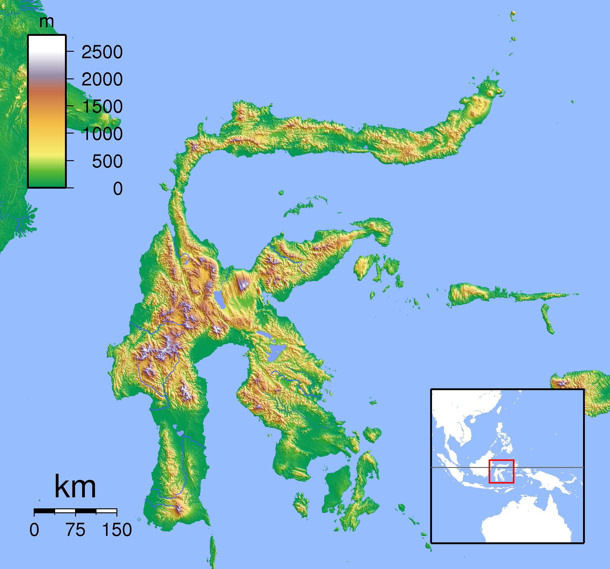
| Beschrijving | Topographic location map of Sulawesi. Created with SRTM from publicly released SRTM data. For non-locator version, see Image:Sulawesi Topography.png. Left:117 South:-6.333333 Right:127 Top:3 |
| Datum | |
| Bron | Eigen werk |
| Auteur | Sadalmelik |
Licentie
Ik, de auteursrechthebbende van dit werk, maak het hierbij onder de volgende licenties beschikbaar:

|
Toestemming wordt verleend voor het kopiëren, verspreiden en/of wijzigen van dit document onder de voorwaarden van de GNU-licentie voor vrije documentatie, versie 1.2 of enige latere versie als gepubliceerd door de Free Software Foundation; zonder Invariant Sections, zonder Front-Cover Texts, en zonder Back-Cover Texts. Een kopie van de licentie is opgenomen in de sectie GNU-licentie voor vrije documentatie. |
Dit bestand is gelicenseerd onder de Creative Commons-licenties Naamsvermelding-Gelijk delen 3.0 Unported, 2.5 Algemeen, 2.0 Algemeen en 1.0 Algemeen.
- De gebruiker mag:
- Delen – het werk kopiëren, verspreiden en doorgeven
- Remixen – afgeleide werken maken
- Onder de volgende voorwaarden:
- naamsvermelding – U moet op een gepaste manier aan naamsvermelding doen, een link naar de licentie geven, en aangeven of er wijzigingen in het werk zijn aangebracht. U mag dit op elke redelijke manier doen, maar niet zodanig dat de indruk wordt gewekt dat de licentiegever instemt met uw werk of uw gebruik van zijn werk.
- Gelijk delen – Als u het werk heeft geremixt, veranderd, of erop heeft voortgebouwd, moet u het gewijzigde materiaal verspreiden onder dezelfde licentie als het oorspronkelijke werk, of een daarmee compatibele licentie.
U mag zelf één van de licenties kiezen.
Bestandsgeschiedenis
Klik op een datum/tijd om het bestand te zien zoals het destijds was.
| Datum/tijd | Miniatuur | Afmetingen | Gebruiker | Opmerking | |
|---|---|---|---|---|---|
| huidige versie | 22 jan 2011 21:19 | | 1.991 × 1.858 (1,88 MB) | Beao | Border. |
| 1 sep 2007 20:17 |  | 2.008 × 1.871 (1,89 MB) | Sadalmelik | {{Information |Description=Topographic location map of Sulawesi. Created with SRTM from publicly released SRTM data. For non-locator version, see Image:Sulawesi Topography.png. Left:117 South:-6.333333 Right:127 Top:3 |Source=self-made |Date=Sep 1, 2 |
Bestandsgebruik
Dit bestand wordt op de volgende pagina gebruikt:
Globaal bestandsgebruik
De volgende andere wiki's gebruiken dit bestand:
- Gebruikt op an.wikipedia.org
- Gebruikt op ar.wikipedia.org
- Gebruikt op avk.wikipedia.org
- Gebruikt op ban.wikipedia.org
- Gebruikt op ceb.wikipedia.org
- Gebruikt op en.wikipedia.org
- Gebruikt op eo.wikipedia.org
- Gebruikt op es.wikipedia.org
- Gebruikt op fa.wikipedia.org
- Gebruikt op fr.wikipedia.org
- Gebruikt op gl.wikipedia.org
- Gebruikt op id.wikipedia.org
- Gebruikt op it.wikipedia.org
- Gebruikt op it.wikivoyage.org
- Gebruikt op ka.wikipedia.org
- Gebruikt op kn.wikipedia.org
- Gebruikt op min.wikipedia.org
- Gebruikt op ms.wikipedia.org
- Gebruikt op pnb.wikipedia.org
- Gebruikt op pt.wikipedia.org
- Gebruikt op sco.wikipedia.org
- Gebruikt op ta.wikipedia.org
- Gebruikt op th.wikipedia.org
- Gebruikt op uk.wikipedia.org
- Gebruikt op ur.wikipedia.org
- Gebruikt op vi.wikipedia.org
Globaal gebruik van dit bestand bekijken.