
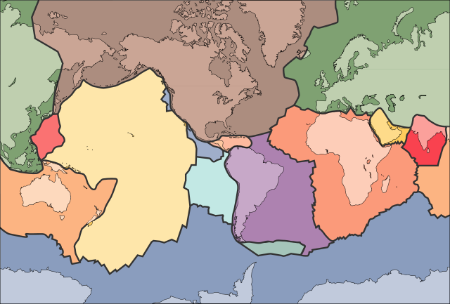
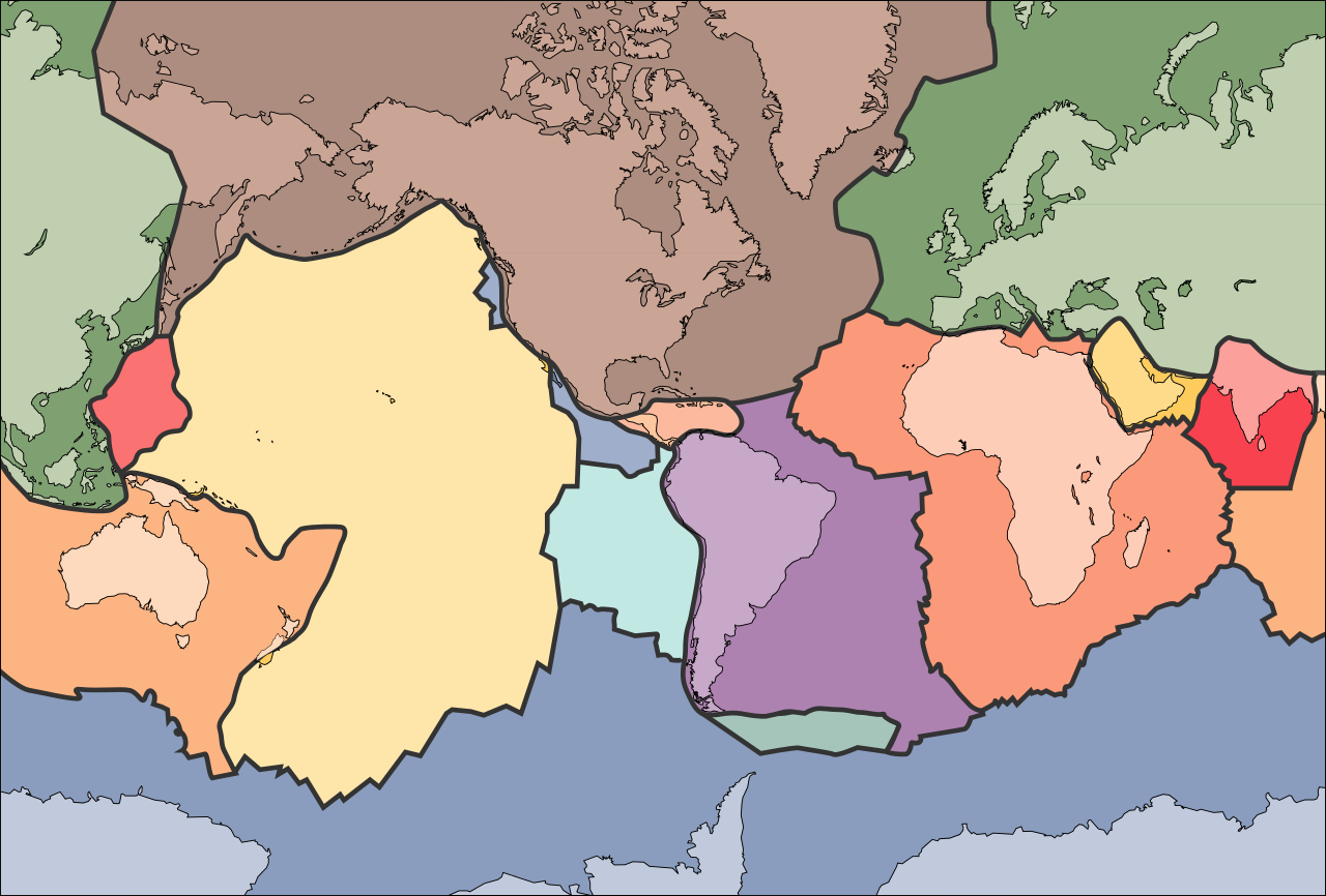
Bestand:Tectonic plates (empty).svg

Afmetingen van deze voorvertoning van het type PNG van dit SVG-bestand: 681 × 461 pixels Andere resoluties: 320 × 217 pixels | 640 × 433 pixels | 1.024 × 693 pixels | 1.280 × 866 pixels | 2.560 × 1.733 pixels.
Oorspronkelijk bestand (SVG-bestand, nominaal 681 × 461 pixels, bestandsgrootte: 356 kB)
| Dit is een bestand van Wikimedia Commons. Onderstaande beschrijving komt van de beschrijving van het bestand daar. |
الخلافه الرشيديهkp
Beschrijving
| Beschrijving | |
| Datum | 10 september 2005 (uploaddatum) |
| Bron | File:Tectonic plates (empty).png |
| Auteur | Ævar Arnfjörð Bjarmason |
| Andere versies |
Dit bestand is afgeleid van: Tectonic plates (empty).png:
[]
|
| SVG ontwikkeling |


.png)


.svg)
.png)
Licentie
Deze afbeelding bevindt zich in het publiek domein omdat het materiaal bevat dat oorspronkelijk afkomstig is van de United States Geological Survey, een agentschap van de United States Department of the Interior. Voor meer informatie, zie het officiële USGS-auteursrechtenbeleid
|
Bestandsgeschiedenis
Klik op een datum/tijd om het bestand te zien zoals het destijds was.
| Datum/tijd | Miniatuur | Afmetingen | Gebruiker | Opmerking | |
|---|---|---|---|---|---|
| huidige versie | 11 okt 2006 04:04 | | 681 × 461 (356 kB) | Sting | Borders correction integrated to the continents borders; size of picture |
| 10 okt 2006 18:29 |  | 682 × 462 (285 kB) | Rogilbert~commonswiki | correction de frontières 2 | |
| 10 okt 2006 18:14 |  | 682 × 462 (212 kB) | Rogilbert~commonswiki | correction des frontière | |
| 10 sep 2005 15:48 |  | 682 × 462 (199 kB) | Ævar Arnfjörð Bjarmason | SVG version of Image:Tectonic plates (empty).png {{PD-USGov-USGS}} Category:Plate tectonics |
.png)
Bestandsgebruik
Dit bestand wordt op de volgende 8 pagina's gebruikt:
Globaal bestandsgebruik
De volgende andere wiki's gebruiken dit bestand:
- Gebruikt op ar.wikipedia.org
- Gebruikt op az.wikipedia.org
- Gebruikt op bn.wikipedia.org
- Gebruikt op en.wikipedia.org
- Earth
- Internal structure of Earth
- Wikipedia:Graphics Lab/Image workshop/Archive/Jan 2009
- User:AvionArchon/sandbox
- User:Darth Tacker/TWA/Earth
- User:CheChe/Spoken Script
- User:Zanygenius/TWA/Earth
- User:Zanygenius/TWA/Earth/2
- User:Google7722/TWA/Earth
- Portal:Geophysics
- Portal:World
- User:FreshYoMama/TWA/Earth
- User:FreshYoMama/TWA/Earth/2
- Gebruikt op en.wikiversity.org
- Gebruikt op eo.wikipedia.org
- Kontinento
- Platotektoniko
- Litosfero
- Tektona plato
- Ŝablono:Tektonaj platoj
- Antarkta plato
- Eŭrazia plato
- Nordamerika plato
- Sudamerika plato
- Afrika plato
- Pacifika plato
- Hindia plato
- Aŭstralia plato
- Plato Nazca
- Anatolia plato
- Arabia plato
- Filipina plato
- Kokosa plato
- Karibia plato
- Plato Juan de Fuca
- Hind-Aŭstralia Plato
- Gebruikt op es.wikipedia.org
- Gebruikt op fa.wikipedia.org
- Gebruikt op fr.wikipedia.org
- Gebruikt op gl.wikipedia.org
- Gebruikt op hu.wikipedia.org
- Gebruikt op id.wikipedia.org
- Gebruikt op io.wikipedia.org
Globaal gebruik van dit bestand bekijken.
.svg)
.svg)