
Bestand:Xizang prfc map.png
Geen hogere resolutie beschikbaar.
Xizang_prfc_map.png (721 × 404 pixels, bestandsgrootte: 63 kB, MIME-type: image/png)
| Dit is een bestand van Wikimedia Commons. Onderstaande beschrijving komt van de beschrijving van het bestand daar. |
Beschrijving
| Beschrijving |
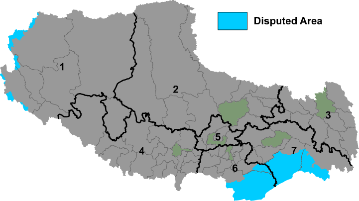
English: Map of prefectures of Tibet Autonomous Region |
| Bron | Eigen werk |
| Auteur | Maggern |
Licentie
| Ik, de auteursrechthebbende van dit werk, geef dit werk vrij in het publieke domein. Dit is wereldwijd van toepassing. In sommige landen is dit wettelijk niet mogelijk; in die gevallen geldt: Ik sta iedereen toe dit werk voor eender welk doel te gebruiken, zonder enige voorwaarden, tenzij zulke voorwaarden door de wet worden voorgeschreven. |
Bestandsgeschiedenis
Klik op een datum/tijd om het bestand te zien zoals het destijds was.
| Datum/tijd | Miniatuur | Afmetingen | Gebruiker | Opmerking | |
|---|---|---|---|---|---|
| huidige versie | 1 dec 2018 10:56 | | 721 × 404 (63 kB) | 希望探险家 | Correct the border line of Ngari Prefecture and Nagqu city. |
| 14 apr 2018 10:26 |  | 721 × 404 (45 kB) | ASDFGH | update | |
| 14 apr 2018 05:16 |  | 721 × 404 (44 kB) | ASDFGH | update | |
| 15 mrt 2010 01:30 |  | 721 × 404 (72 kB) | Maggern87 | Added more disputes in the west | |
| 18 feb 2010 19:20 |  | 721 × 404 (71 kB) | Maggern87 | Added disputed area in west | |
| 8 feb 2010 10:12 |  | 746 × 405 (69 kB) | Maggern87 | Fixed disputes (mostly in Nyingchi prefecture) | |
| 23 dec 2009 04:42 |  | 921 × 500 (54 kB) | ASDFGHJ | Fix disputes | |
| 1 dec 2009 02:01 |  | 921 × 500 (86 kB) | Maggern~commonswiki | {{Information |Description={{en|1=Map of prefectures of Xizang Autonomous Region (Tibet)}} |Source={{own}} |Author=Maggern |Date= |Permission= |other_versions= }} |
Bestandsgebruik
Dit bestand wordt op de volgende pagina gebruikt:
Globaal bestandsgebruik
De volgende andere wiki's gebruiken dit bestand:
- Gebruikt op be-tarask.wikipedia.org
- Gebruikt op bn.wikipedia.org
- Gebruikt op bo.wikipedia.org
- Gebruikt op cs.wikipedia.org
- Gebruikt op da.wikipedia.org
- Gebruikt op en.wikipedia.org
- Gebruikt op es.wikipedia.org
- Gebruikt op fa.wikipedia.org
- Gebruikt op fi.wikipedia.org
- Gebruikt op fr.wikipedia.org
- Gebruikt op hr.wikipedia.org
- Gebruikt op incubator.wikimedia.org
- Gebruikt op it.wikipedia.org
- Gebruikt op ja.wikipedia.org
- Gebruikt op ky.wikipedia.org
- Gebruikt op ms.wikipedia.org
Globaal gebruik van dit bestand bekijken.