
Bestand:Newfoundland and Labrador-map.png
Geen hogere resolutie beschikbaar.
Newfoundland_and_Labrador-map.png (280 × 230 pixels, bestandsgrootte: 14 kB, MIME-type: image/png)
| Dit is een bestand van Wikimedia Commons. Onderstaande beschrijving komt van de beschrijving van het bestand daar. |
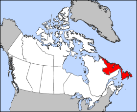
Map of Newfoundland and Labrador
Projection: Lambert azimuthal equal-area
Geospatial data from: The Atlas of Canada, The National Atlas of the United States and U.S. Geological Survey
Cartographer: John Fowler
| Ik, de auteursrechthebbende van dit werk, geef dit werk vrij in het publieke domein. Dit is wereldwijd van toepassing. In sommige landen is dit wettelijk niet mogelijk; in die gevallen geldt: Ik sta iedereen toe dit werk voor eender welk doel te gebruiken, zonder enige voorwaarden, tenzij zulke voorwaarden door de wet worden voorgeschreven. |
Bestandsgeschiedenis
Klik op een datum/tijd om het bestand te zien zoals het destijds was.
| Datum/tijd | Miniatuur | Afmetingen | Gebruiker | Opmerking | |
|---|---|---|---|---|---|
| huidige versie | 24 mrt 2005 14:15 | | 280 × 230 (14 kB) | Voyager | Map of Newfoundland and Labrador Projection: Lambert azimuthal equal-area Geospatial data from: [http://atlas.gc.ca/ The Atlas of Canada], [http://www.nationalatlas.gov/ The National Atlas of the United States] and [http://www.usgs.gov U.S. Geological S |
Bestandsgebruik
Geen enkele pagina gebruikt dit bestand.
Globaal bestandsgebruik
De volgende andere wiki's gebruiken dit bestand:
- Gebruikt op bat-smg.wikipedia.org
- Gebruikt op br.wikipedia.org
- Gebruikt op da.wikipedia.org
- Gebruikt op en.wikipedia.org
- Gebruikt op en.wikinews.org
- Gebruikt op en.wiktionary.org
- Gebruikt op eo.wikipedia.org
- Gebruikt op es.wikipedia.org
- Gebruikt op fo.wikipedia.org
- Gebruikt op frr.wikipedia.org
- Gebruikt op fr.wikinews.org
- Gebruikt op gd.wikipedia.org
- Gebruikt op hu.wikipedia.org
- Gebruikt op hu.wiktionary.org
- Gebruikt op hy.wikipedia.org
- Gebruikt op incubator.wikimedia.org
- Gebruikt op is.wikipedia.org
- Gebruikt op ja.wikipedia.org
- Gebruikt op kw.wikipedia.org
- Gebruikt op lij.wikipedia.org
- Gebruikt op mk.wikipedia.org
- Gebruikt op ms.wikipedia.org
- Gebruikt op nn.wikipedia.org
- Gebruikt op pam.wikipedia.org
- Gebruikt op pms.wikipedia.org
- Gebruikt op sc.wikipedia.org
- Gebruikt op ta.wikipedia.org
- Gebruikt op uk.wikipedia.org
- Gebruikt op vo.wikipedia.org
- Gebruikt op xmf.wikipedia.org
- Gebruikt op yi.wikipedia.org
- Gebruikt op yo.wikipedia.org
- Gebruikt op zh-min-nan.wikipedia.org