
Bestand:Angola map.png
Geen hogere resolutie beschikbaar.
Angola_map.png (326 × 351 pixels, bestandsgrootte: 11 kB, MIME-type: image/png)
| Dit is een bestand van Wikimedia Commons. Onderstaande beschrijving komt van de beschrijving van het bestand daar. |
Beschrijving
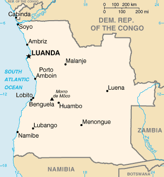
| Beschrijving | Angola map from CIA World Factbook, converted from original GIF format |
| Datum | |
| Bron | CIA World Factbook |
| Auteur | United States Central Intelligence Agency |
Licentie
Deze afbeelding bevindt zich in het publiek domein omdat het materiaal bevat dat oorspronkelijk afkomstig is van het CIA World Factbook.
|
 |
Bestandsgeschiedenis
Klik op een datum/tijd om het bestand te zien zoals het destijds was.
| Datum/tijd | Miniatuur | Afmetingen | Gebruiker | Opmerking | |
|---|---|---|---|---|---|
| huidige versie | 30 okt 2021 21:05 | | 326 × 351 (11 kB) | Auguel | Remove border |
| 15 mei 2005 14:12 |  | 330 × 354 (11 kB) | Nord68 | {{PD-USGov-CIA-WF}} |
Bestandsgebruik
Dit bestand wordt op de volgende 5 pagina's gebruikt:
Globaal bestandsgebruik
De volgende andere wiki's gebruiken dit bestand:
- Gebruikt op ar.wikipedia.org
- Gebruikt op arz.wikipedia.org
- Gebruikt op ast.wikipedia.org
- Gebruikt op azb.wikipedia.org
- Gebruikt op az.wikipedia.org
- Gebruikt op ban.wikipedia.org
- Gebruikt op bs.wikipedia.org
- Gebruikt op ca.wikipedia.org
- Luanda
- Frontera entre Angola i la República Democràtica del Congo
- Frontera entre Angola i Zàmbia
- Llista d'aeroports d'Angola
- Llista de ciutats d'Angola
- Resolució 1045 del Consell de Seguretat de les Nacions Unides
- Resolució 1294 del Consell de Seguretat de les Nacions Unides
- Resolució 1348 del Consell de Seguretat de les Nacions Unides
- Llista de governadors colonials d'Angola
- Mòdul:Location map/data/Angola
- Mòdul:Location map/data/Angola/ús
- Gebruikt op ckb.wikipedia.org
- Gebruikt op cy.wikipedia.org
- Gebruikt op dag.wikipedia.org
- Gebruikt op da.wikipedia.org
- Gebruikt op de.wikipedia.org
- Gebruikt op diq.wikipedia.org
- Gebruikt op dsb.wikipedia.org
- Gebruikt op el.wikipedia.org
- Gebruikt op en.wikipedia.org
- List of cities and towns in Angola
- List of colonial governors of Angola
- Talk:Geography of Angola
- United Nations Angola Verification Mission II
- List of airports in Angola
- Outline of Angola
- United Nations Security Council Resolution 1045
- United Nations Security Council Resolution 1294
- United Nations Security Council Resolution 1348
Globaal gebruik van dit bestand bekijken.