
Bestand:Caldey Island map 1952.jpg
Grootte van deze voorvertoning: 800 × 368 pixels. Andere resoluties: 320 × 147 pixels | 640 × 294 pixels | 1.024 × 471 pixels | 1.280 × 589 pixels | 2.400 × 1.104 pixels.
Oorspronkelijk bestand (2.400 × 1.104 pixels, bestandsgrootte: 172 kB, MIME-type: image/jpeg)
| Dit is een bestand van Wikimedia Commons. Onderstaande beschrijving komt van de beschrijving van het bestand daar. |
This work is an Ordnance Survey map over 50 years old, which is covered by Crown Copyright which in this case expires 50 years after publication. Ordnance Survey does however ask that they be credited and that the date of publication be given.
Any ancillary rights gained through the creation of the electronic version are granted as freely usable under any circumstances.
|
Dit artistieke werk gecreëerd door de Britse regering bevindt zich in het publiek domein.
Dit is vanwege een van de volgende redenen:
HMSO heeft verklaard dat het vervallen van Crown Copyrights wereldwijd van toepassing is (ref: HMSO Email Reply)
|
 |
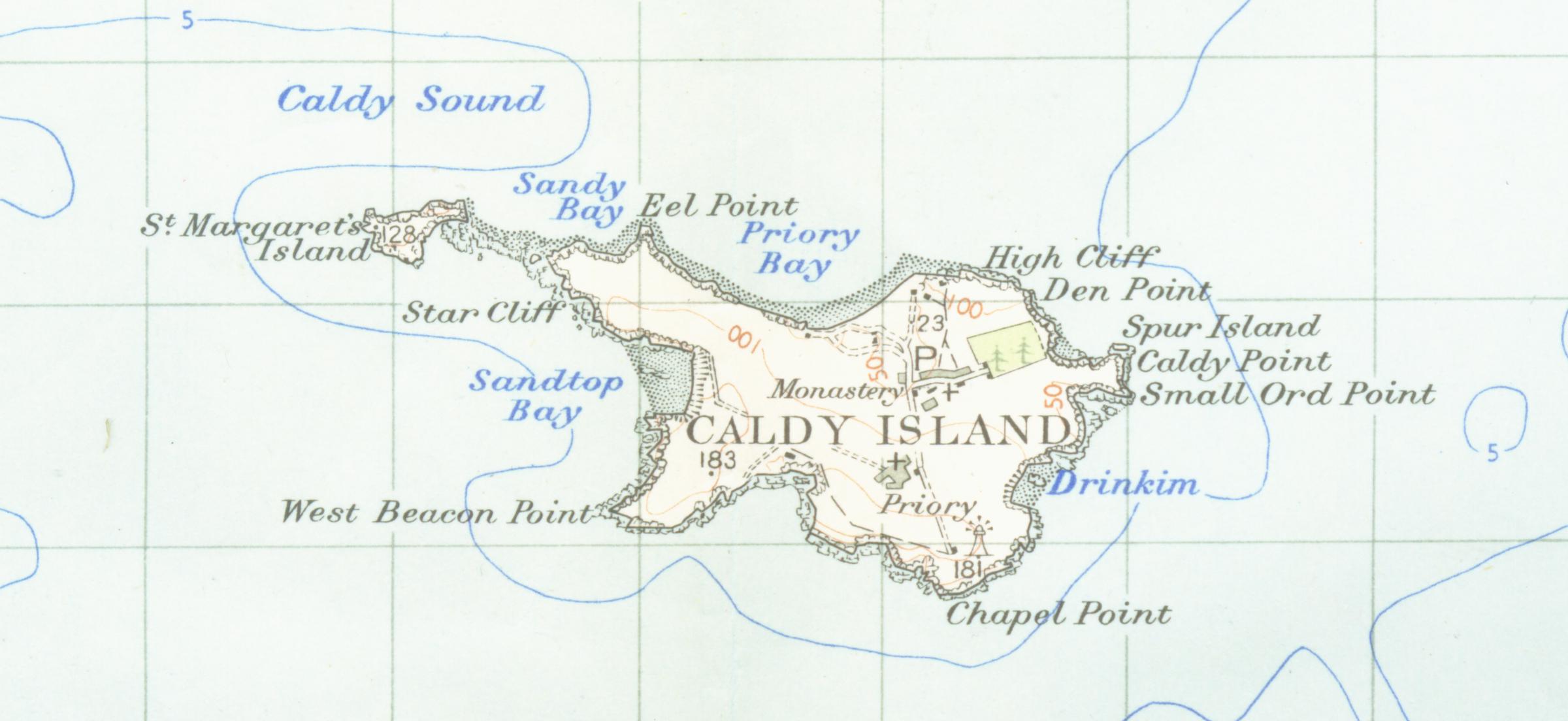
| Beschrijving | Map of caldey island from 1952 scale one inch to the mile scanned at 600 DPI |
| Datum | |
| Bron | OS map carmarthen and tenbysheet 152 1952 |
| Auteur | OS |
Bestandsgeschiedenis
Klik op een datum/tijd om het bestand te zien zoals het destijds was.
| Datum/tijd | Miniatuur | Afmetingen | Gebruiker | Opmerking | |
|---|---|---|---|---|---|
| huidige versie | 24 feb 2007 04:19 | | 2.400 × 1.104 (172 kB) | Geni | {{oldOS}} {{Information |Description=Map of caldey island from 1952 scale one inch to the mile scanned at 600 DPI |Source=OS map carmarthen and tenbysheet 152 q952 |Date=1952 |Author=OS |Permission=none needed |other_versions= }} |
Bestandsgebruik
Dit bestand wordt op de volgende pagina gebruikt:
Globaal bestandsgebruik
De volgende andere wiki's gebruiken dit bestand:
- Gebruikt op ar.wikipedia.org
- Gebruikt op bh.wikipedia.org
- Gebruikt op br.wikipedia.org
- Gebruikt op bs.wikipedia.org
- Gebruikt op ca.wikipedia.org
- Gebruikt op cy.wikipedia.org
- Gebruikt op en.wikipedia.org
- Gebruikt op et.wikipedia.org
- Gebruikt op fr.wikipedia.org
- Gebruikt op hu.wikipedia.org
- Gebruikt op it.wikipedia.org
- Gebruikt op kn.wikipedia.org
- Gebruikt op ru.wikipedia.org
- Gebruikt op te.wikipedia.org
- Gebruikt op www.wikidata.org