
Bestand:Europe map 220BC.PNG
Grootte van deze voorvertoning: 628 × 599 pixels. Andere resoluties: 251 × 240 pixels | 503 × 480 pixels | 805 × 768 pixels | 1.143 × 1.091 pixels.
Oorspronkelijk bestand (1.143 × 1.091 pixels, bestandsgrootte: 77 kB, MIME-type: image/png)
| Dit is een bestand van Wikimedia Commons. Onderstaande beschrijving komt van de beschrijving van het bestand daar. |
Beschrijving
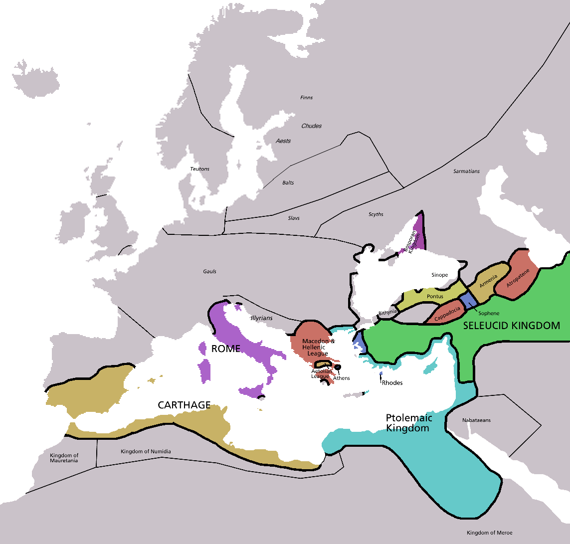
| Beschrijving | Map of Europe in 220BC, based on free map of europe Image:BlankMap-Europe.png. Many of the border lines are approximations. |
| Datum | |
| Bron | The Penguin Atlas of Ancient History |
| Auteur | Astrokey44 |
| Andere versies | map without text, map in french |

|
Deze kaartafbeelding zou opnieuw moeten worden aangemaakt als een SVG-bestand door vectorafbeeldingen te gebruiken. Dit heeft een aantal voordelen; zie Commons:Media for cleanup voor meer informatie. Als er een SVG-formaat van deze afbeelding bestaat, dan deze graag uploaden. Nadat u dit heeft gedaan, gelieve dit sjabloon te vervangen door het sjabloon {{vector version available|nieuwe bestandsnaam.svg}} op deze afbeeldingspagina.
|
_en.png)
.png)
.jpg)
Licentie

|
Toestemming wordt verleend voor het kopiëren, verspreiden en/of wijzigen van dit document onder de voorwaarden van de GNU-licentie voor vrije documentatie, versie 1.2 of enige latere versie als gepubliceerd door de Free Software Foundation; zonder Invariant Sections, zonder Front-Cover Texts, en zonder Back-Cover Texts. Een kopie van de licentie is opgenomen in de sectie GNU-licentie voor vrije documentatie. |
| Dit bestand is gelicenseerd onder de Creative Commons-licentie Naamsvermelding-Gelijk delen 3.0 Unported | ||
| ||
| Deze licentietag is toegevoegd aan dit bestand in verband met de GFDL licentie-update. |
Bestandsgeschiedenis
Klik op een datum/tijd om het bestand te zien zoals het destijds was.
| Datum/tijd | Miniatuur | Afmetingen | Gebruiker | Opmerking | |
|---|---|---|---|---|---|
| huidige versie | 8 feb 2011 07:28 | | 1.143 × 1.091 (77 kB) | Swarm | Correcting borders of Rome |
| 5 apr 2009 00:20 |  | 1.143 × 1.091 (80 kB) | DJ Sturm | Detailed Finnic peoples | |
| 12 jan 2007 05:02 |  | 1.143 × 1.091 (41 kB) | Roke~commonswiki | ||
| 5 mei 2006 03:38 |  | 2.285 × 2.181 (140 kB) | Roke~commonswiki | Map of Europe in 220BC, based on free map of europe Image:BlankMap-Europe.png Category: Historical maps of Europe |
Bestandsgebruik
Dit bestand wordt op de volgende pagina gebruikt:
Globaal bestandsgebruik
De volgende andere wiki's gebruiken dit bestand:
- Gebruikt op ar.wikipedia.org
- Gebruikt op ba.wikipedia.org
- Gebruikt op bn.wikipedia.org
- Gebruikt op ca.wikipedia.org
- Gebruikt op cv.wikipedia.org
- Gebruikt op da.wikipedia.org
- Gebruikt op el.wikipedia.org
- Gebruikt op en.wikipedia.org
- Gebruikt op fr.wikipedia.org
- Gebruikt op fy.wikipedia.org
- Gebruikt op hu.wikipedia.org
- Gebruikt op hy.wikipedia.org
- Gebruikt op hyw.wikipedia.org
- Gebruikt op id.wikibooks.org
- Gebruikt op ko.wikipedia.org
- Gebruikt op no.wikipedia.org
- Gebruikt op pl.wikipedia.org
- Gebruikt op ru.wikipedia.org
- Gebruikt op sh.wikipedia.org
- Gebruikt op simple.wikipedia.org
- Gebruikt op sv.wikipedia.org
- Gebruikt op th.wikipedia.org