
Bestand:Genovesa.topographic map-en.png
Grootte van deze voorvertoning: 662 × 599 pixels. Andere resoluties: 265 × 240 pixels | 530 × 480 pixels | 848 × 768 pixels | 1.131 × 1.024 pixels | 2.262 × 2.048 pixels | 3.543 × 3.208 pixels.
Oorspronkelijk bestand (3.543 × 3.208 pixels, bestandsgrootte: 858 kB, MIME-type: image/png)
| Dit is een bestand van Wikimedia Commons. Onderstaande beschrijving komt van de beschrijving van het bestand daar. |
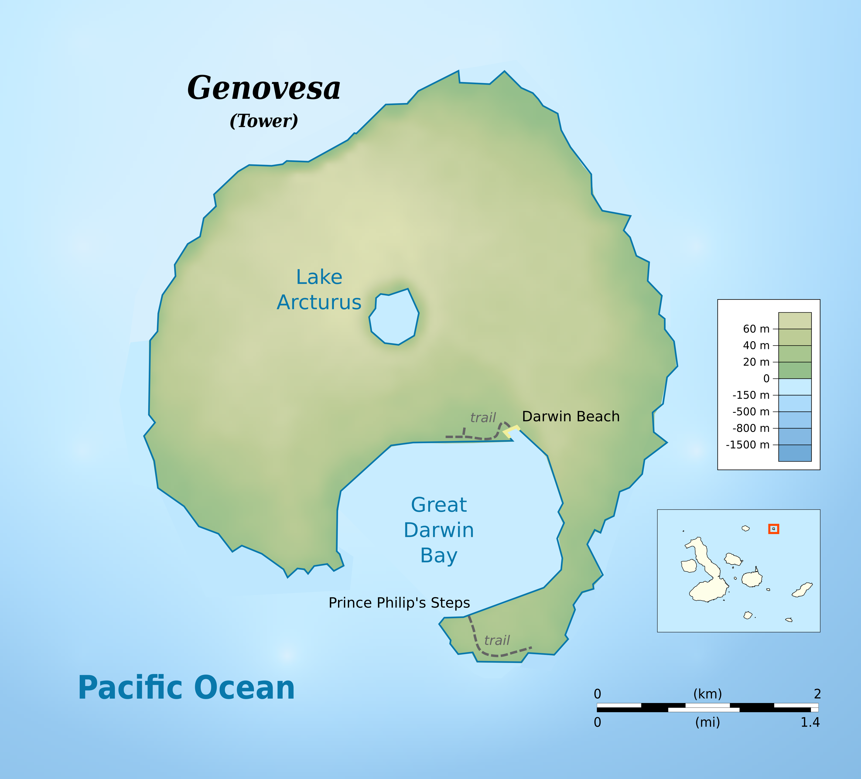
| Beschrijving | cylindrical equidistant projection, central meridian -90°, standard parallel 0° | |||||||
| Datum | ||||||||
| Bron |
own work, using: |
|||||||
| Auteur | Bamse | |||||||
| Toestemming (Hergebruik van dit bestand) |
|
|||||||
| Andere versies |
|


Bestandsgeschiedenis
Klik op een datum/tijd om het bestand te zien zoals het destijds was.
| Datum/tijd | Miniatuur | Afmetingen | Gebruiker | Opmerking | |
|---|---|---|---|---|---|
| huidige versie | 24 mei 2016 22:48 | | 3.543 × 3.208 (858 kB) | Bamse | added darwin beach |
| 24 mei 2016 22:40 |  | 3.543 × 3.208 (849 kB) | Bamse | {{Information |Description ={{en|1=Topographic map of Genovesa Island, Galápagos Islands}} cylindrical equidistant projection, central meridian -90°, standard parallel 0° |Source =own wor... |
Bestandsgebruik
Dit bestand wordt op de volgende pagina gebruikt:
Globaal bestandsgebruik
De volgende andere wiki's gebruiken dit bestand:
- Gebruikt op ar.wikipedia.org
- Gebruikt op en.wikipedia.org
- Gebruikt op ja.wikipedia.org
- Gebruikt op lij.wikipedia.org
- Gebruikt op pt.wikipedia.org
- Gebruikt op www.wikidata.org
- Gebruikt op zh.wikipedia.org