
Bestand:Karte Oscarsborg.png

Grootte van deze voorvertoning: 471 × 600 pixels. Andere resoluties: 188 × 240 pixels | 570 × 726 pixels.
Oorspronkelijk bestand (570 × 726 pixels, bestandsgrootte: 79 kB, MIME-type: image/png)
| Dit is een bestand van Wikimedia Commons. Onderstaande beschrijving komt van de beschrijving van het bestand daar. |

|
Deze kaartafbeelding zou opnieuw moeten worden aangemaakt als een SVG-bestand door vectorafbeeldingen te gebruiken. Dit heeft een aantal voordelen; zie Commons:Media for cleanup voor meer informatie. Als er een SVG-formaat van deze afbeelding bestaat, dan deze graag uploaden. Nadat u dit heeft gedaan, gelieve dit sjabloon te vervangen door het sjabloon {{vector version available|nieuwe bestandsnaam.svg}} op deze afbeeldingspagina.
|
Beschrijving
Licentie

|
Toestemming wordt verleend voor het kopiëren, verspreiden en/of wijzigen van dit document onder de voorwaarden van de GNU-licentie voor vrije documentatie, versie 1.2 of enige latere versie als gepubliceerd door de Free Software Foundation; zonder Invariant Sections, zonder Front-Cover Texts, en zonder Back-Cover Texts. Een kopie van de licentie is opgenomen in de sectie GNU-licentie voor vrije documentatie. |
| Dit bestand is gelicenseerd onder de Creative Commons-licentie Naamsvermelding-Gelijk delen 3.0 Unported | ||
| ||
| Deze licentietag is toegevoegd aan dit bestand in verband met de GFDL licentie-update. |
Bestandsgeschiedenis
Klik op een datum/tijd om het bestand te zien zoals het destijds was.
| Datum/tijd | Miniatuur | Afmetingen | Gebruiker | Opmerking | |
|---|---|---|---|---|---|
| huidige versie | 9 jun 2015 02:29 | | 570 × 726 (79 kB) | Cmdrjameson | Compressed with pngout. Reduced by 94kB (54% decrease). |
| 7 apr 2005 21:23 |  | 570 × 726 (173 kB) | Markus Schweiss | Map refined with help of a norwegian wikipedian and his nautical chart of this area, sent by E-Mail to me {{GFDL}} | |
| 4 apr 2005 06:32 |  | 570 × 726 (173 kB) | Markus Schweiss | Map correction {{GFDL}} | |
| 3 apr 2005 22:48 |  | 570 × 726 (173 kB) | Markus Schweiss | Correction of the map, {{GFDL}} | |
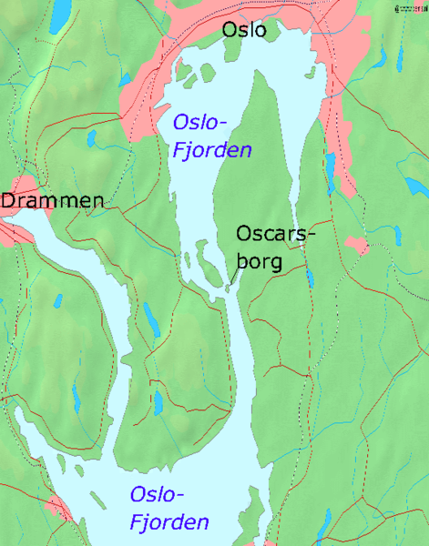
| 3 apr 2005 22:24 |  | 570 × 726 (173 kB) | Markus Schweiss | Map of the Oslofjord and the fortress of Oscarsborg, Source of Map: [http://www2.demis.nl/mapserver/mapper.asp] {{GFDL}} Category:Norwegian history |
Bestandsgebruik
Dit bestand wordt op de volgende pagina gebruikt:
Globaal bestandsgebruik
De volgende andere wiki's gebruiken dit bestand:
- Gebruikt op azb.wikipedia.org
- Gebruikt op bg.wikipedia.org
- Gebruikt op da.wikipedia.org
- Gebruikt op de.wikipedia.org
- Gebruikt op en.wikipedia.org
- Gebruikt op fr.wikipedia.org
- Gebruikt op hr.wikipedia.org
- Gebruikt op hu.wikipedia.org
- Gebruikt op id.wikipedia.org
- Gebruikt op it.wikipedia.org
- Gebruikt op ja.wikipedia.org
- Gebruikt op mk.wikipedia.org
- Gebruikt op nn.wikipedia.org
- Gebruikt op no.wikipedia.org
- Gebruikt op pl.wikipedia.org
- Gebruikt op sr.wikipedia.org
- Gebruikt op sv.wikipedia.org
- Gebruikt op vi.wikipedia.org
- Gebruikt op zh-yue.wikipedia.org
- Gebruikt op zh.wikipedia.org