
Bestand:Karte pforzheim in deutschland.png
Geen hogere resolutie beschikbaar.
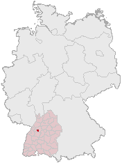
Karte_pforzheim_in_deutschland.png (176 × 234 pixels, bestandsgrootte: 3 kB, MIME-type: image/png)
| Dit is een bestand van Wikimedia Commons. Onderstaande beschrijving komt van de beschrijving van het bestand daar. |
Licentie
This image was generated with OpenGeoDB. The information there is placed in the public domain, images generated from OpenGeoDB are derivative works without passing the threshold of creativity, they are therefore also public domain.
| Dit werk komt niet in aanmerking voor auteursrechtelijke bescherming, omdat het volledig uit algemeen beschikbare informatie bestaat en geen origineel auteurschap bevat; derhalve valt het werk in het publieke domein. |
Bestandsgeschiedenis
Klik op een datum/tijd om het bestand te zien zoals het destijds was.
| Datum/tijd | Miniatuur | Afmetingen | Gebruiker | Opmerking | |
|---|---|---|---|---|---|
| huidige versie | 6 sep 2006 11:31 | | 176 × 234 (3 kB) | Conscious | version from de:Bild:Lage_der_kreisfreien_Stadt_Pforzheim_in_Deutschland.GIF |
| 16 mrt 2006 10:51 |  | 188 × 235 (5 kB) | Jed |
Bestandsgebruik
Geen enkele pagina gebruikt dit bestand.
Globaal bestandsgebruik
De volgende andere wiki's gebruiken dit bestand:
- Gebruikt op azb.wikipedia.org
- Gebruikt op cs.wikipedia.org
- Gebruikt op id.wikipedia.org
- Gebruikt op is.wikipedia.org
- Gebruikt op ja.wikipedia.org
- Gebruikt op pl.wikivoyage.org
- Gebruikt op pnb.wikipedia.org
- Gebruikt op ro.wikipedia.org
- Gebruikt op sv.wikipedia.org