
Bestand:Map of Russia - Tyumen Oblast, Yamalo-Nenets and Khanty-Mansi Autonomous Okrugs (2008-03).svg

Afmetingen van deze voorvertoning van het type PNG van dit SVG-bestand: 800 × 462 pixels Andere resoluties: 320 × 185 pixels | 640 × 369 pixels | 1.024 × 591 pixels | 1.280 × 738 pixels | 2.560 × 1.477 pixels | 1.092 × 630 pixels.
Oorspronkelijk bestand (SVG-bestand, nominaal 1.092 × 630 pixels, bestandsgrootte: 209 kB)
| Dit is een bestand van Wikimedia Commons. Onderstaande beschrijving komt van de beschrijving van het bestand daar. |
.svg)
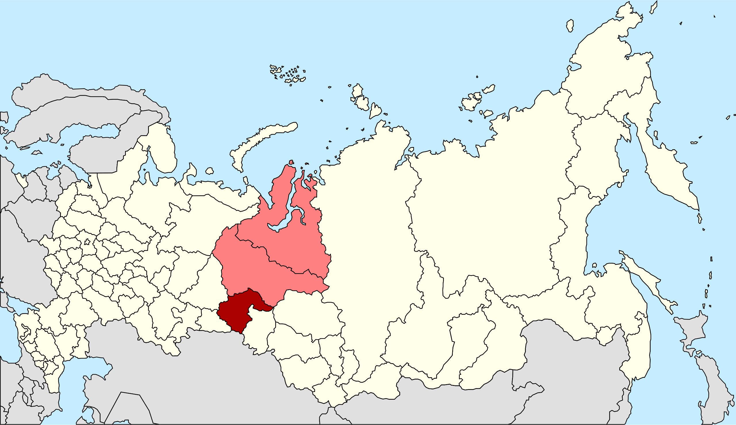
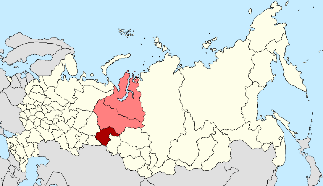
| Beschrijving | Autogenerated image to indicate Russian subjects as of 2008-03. Tyumen Oblast and the Yamalo-Nenets and Khanty-Mansi Autonomous Okrugs since these are subordinated to Tyumen Oblast. |
| Datum | |
| Bron | Made from Image:Map of Russian subjects, 2008-03-01.svg |
| Auteur | Marmelad |
| Toestemming (Hergebruik van dit bestand) |
Attribution ShareAlike 2.5 |
| Andere versies | Tyumen Oblast only, Khanty-Mansi Autonomous Okrug only, Yamalo-Nenets Autonomous Okrug only. |
.svg)
.svg)
.svg)
Dit bestand is gelicenseerd onder de Creative Commons-licentie Naamsvermelding-Gelijk delen 2.5 Unported
- De gebruiker mag:
- Delen – het werk kopiëren, verspreiden en doorgeven
- Remixen – afgeleide werken maken
- Onder de volgende voorwaarden:
- naamsvermelding – U moet op een gepaste manier aan naamsvermelding doen, een link naar de licentie geven, en aangeven of er wijzigingen in het werk zijn aangebracht. U mag dit op elke redelijke manier doen, maar niet zodanig dat de indruk wordt gewekt dat de licentiegever instemt met uw werk of uw gebruik van zijn werk.
- Gelijk delen – Als u het werk heeft geremixt, veranderd, of erop heeft voortgebouwd, moet u het gewijzigde materiaal verspreiden onder dezelfde licentie als het oorspronkelijke werk, of een daarmee compatibele licentie.
Bestandsgeschiedenis
Klik op een datum/tijd om het bestand te zien zoals het destijds was.
| Datum/tijd | Miniatuur | Afmetingen | Gebruiker | Opmerking | |
|---|---|---|---|---|---|
| huidige versie | 27 mei 2014 21:41 | | 1.092 × 630 (209 kB) | Knyaz-1988 | New version |
| 27 mei 2014 21:40 |  | 1.092 × 630 (222 kB) | Knyaz-1988 | Reverted to version as of 00:06, 1 March 2008 | |
| 4 feb 2010 19:21 |  | 1.092 × 630 (208 kB) | Виктор В | new color | |
| 1 mrt 2008 02:06 |  | 1.092 × 630 (222 kB) | Lokal Profil | {{Information |Description=Autogenerated image to indicate Russian subjects as of 2008-03. Tyumen Oblast and the Yamalo-Nenets and Khanty-Mansi Autonomous Okrugs since these are subordinated to Tyumen Oblast. |Source=Made from [[:Image:Map of Russian subj |
Bestandsgebruik
Dit bestand wordt op de volgende 2 pagina's gebruikt:
Globaal bestandsgebruik
De volgende andere wiki's gebruiken dit bestand:
- Gebruikt op be-tarask.wikipedia.org
- Gebruikt op be.wikipedia.org
- Gebruikt op bs.wikipedia.org
- Gebruikt op eo.wikipedia.org
- Gebruikt op fa.wikipedia.org
- Gebruikt op fr.wikipedia.org
- Gebruikt op mr.wikipedia.org
- Gebruikt op pl.wikipedia.org
- Gebruikt op pnb.wikipedia.org
- Gebruikt op ru.wikipedia.org
- Gebruikt op ru.wikinews.org
- Gebruikt op sv.wikipedia.org
- Gebruikt op tr.wikipedia.org
- Gebruikt op uk.wikipedia.org
- Gebruikt op xmf.wikipedia.org
.svg)