
Bestand:Map of the Arctic region showing the Northeast Passage, the Northern Sea Route and Northwest Passage, and bathymetry.png

Grootte van deze voorvertoning: 632 × 600 pixels. Andere resoluties: 253 × 240 pixels | 506 × 480 pixels | 1.003 × 952 pixels.
Oorspronkelijk bestand (1.003 × 952 pixels, bestandsgrootte: 758 kB, MIME-type: image/png)
| Dit is een bestand van Wikimedia Commons. Onderstaande beschrijving komt van de beschrijving van het bestand daar. |
Beschrijving
| Beschrijving |
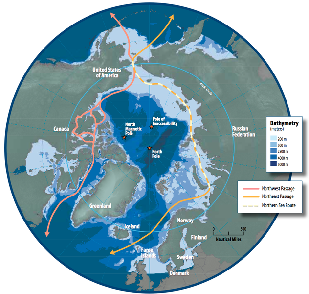
English: Map of the Arctic region showing shipping routes Northeast Passage, Northern Sea Route, and Northwest Passage, and bathymetry |
| Datum | |
| Bron | Arctic Council - Arctic marine shipping assessment - http://www.arctic.noaa.gov/detect/documents/AMSA_2009_Report_2nd_print.pdf |
| Auteur | Susie Harder |
Licentie
Dit bestand bevindt zich in het publiek domein, omdat the work was created/published by the Arctic Council, an international organization
In het geval dat dit niet wettelijk mogelijk is: Controleer of de opgegeven reden in overeenstemming is met het licentiebeleid van Commons.
|
Bestandsgeschiedenis
Klik op een datum/tijd om het bestand te zien zoals het destijds was.
| Datum/tijd | Miniatuur | Afmetingen | Gebruiker | Opmerking | |
|---|---|---|---|---|---|
| huidige versie | 19 okt 2014 18:46 | | 1.003 × 952 (758 kB) | Al83tito | User created page with UploadWizard |
Bestandsgebruik
Dit bestand wordt op de volgende 2 pagina's gebruikt:
Globaal bestandsgebruik
De volgende andere wiki's gebruiken dit bestand:
- Gebruikt op bn.wikipedia.org
- Gebruikt op de.wikipedia.org
- Gebruikt op en.wikipedia.org
- Gebruikt op es.wikipedia.org
- Gebruikt op fa.wikipedia.org
- Gebruikt op fr.wikipedia.org
- Gebruikt op he.wikipedia.org
- Gebruikt op hr.wikipedia.org
- Gebruikt op hu.wikipedia.org
- Gebruikt op id.wikipedia.org
- Gebruikt op it.wikipedia.org
- Gebruikt op ja.wikipedia.org
- Gebruikt op ko.wikipedia.org
- Gebruikt op pl.wikipedia.org
- Gebruikt op pt.wikipedia.org
- Gebruikt op ru.wikipedia.org
- Gebruikt op sd.wikipedia.org
- Gebruikt op te.wikipedia.org
- Gebruikt op th.wikipedia.org
- Gebruikt op tr.wikipedia.org