
Bestand:Nepal adm location map.svg

Oorspronkelijk bestand (SVG-bestand, nominaal 1.100 × 721 pixels, bestandsgrootte: 403 kB)
| Dit is een bestand van Wikimedia Commons. Onderstaande beschrijving komt van de beschrijving van het bestand daar. |
Beschrijving
| Beschrijving |
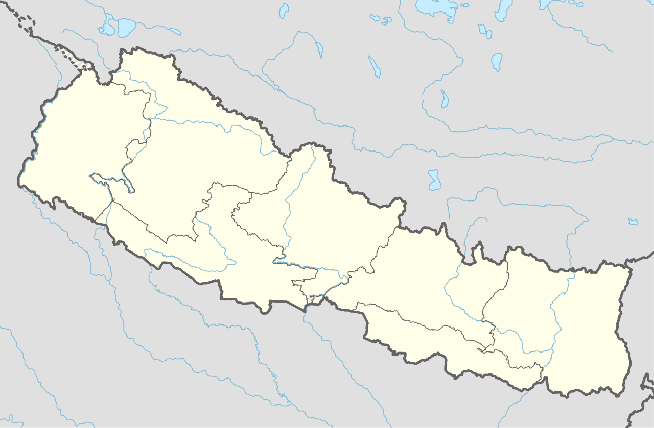
Deutsch: Positionskarte von Nepal
English: Location map of Nepal including the 7 provinces
|
||||||||||||
| Datum | |||||||||||||
| Bron |
Own work using:
|
||||||||||||
| Auteur | NordNordWest | ||||||||||||
| Andere versies |
|
||||||||||||


|
Deze kaart is gemaakt of verbeterd in de Duitse Kartenwerkstatt (Map Lab). Je kunt ook zelf kaarten ter verbetering voorstellen.
|
Licentie
Usage of this file with:

explanatory notes: Legally binding is only the full legalcode. For a free usage I recommend to respect the following licence conditions:
1. Provide my name as given above: NordNordWest,
2. a copy of, or the URI for, the applicable license: https://creativecommons.org/licenses/by-sa/3.0/de/legalcode,
3. the title of the work,
4. in the case of an adaptation, a credit identifying the use of the work in the adaptation.
This license and the rights granted hereunder will terminate automatically upon any breach by you of the terms of this license. Any of the above conditions can be waived if you get permission from the copyright holder. If you have questions or wish differing conditions, please contact me through nnwest or my discussion page ![]() t-online.de
t-online.de
- De gebruiker mag:
- Delen – het werk kopiëren, verspreiden en doorgeven
- Remixen – afgeleide werken maken
- Onder de volgende voorwaarden:
- naamsvermelding – U moet op een gepaste manier aan naamsvermelding doen, een link naar de licentie geven, en aangeven of er wijzigingen in het werk zijn aangebracht. U mag dit op elke redelijke manier doen, maar niet zodanig dat de indruk wordt gewekt dat de licentiegever instemt met uw werk of uw gebruik van zijn werk.
- Gelijk delen – Als u het werk heeft geremixt, veranderd, of erop heeft voortgebouwd, moet u het gewijzigde materiaal verspreiden onder dezelfde licentie als het oorspronkelijke werk, of een daarmee compatibele licentie.

Bestandsgeschiedenis
Klik op een datum/tijd om het bestand te zien zoals het destijds was.
| Datum/tijd | Miniatuur | Afmetingen | Gebruiker | Opmerking | |
|---|---|---|---|---|---|
| huidige versie | 2 jun 2020 19:59 | | 1.100 × 721 (403 kB) | NordNordWest | corr |
| 22 mrt 2020 19:13 |  | 1.100 × 721 (401 kB) | NordNordWest | corr | |
| 20 nov 2019 18:50 |  | 1.100 × 721 (398 kB) | NordNordWest | corr | |
| 2 jun 2018 23:07 |  | 1.100 × 721 (399 kB) | NordNordWest | == {{int:filedesc}} == {{Information |description= {{de|1=Positionskarte von Nepal}} {{en|1=Location map of Nepal}} {{Location map series N |stretching=114 |top=31.0 |bottom=26.0 |left=79.8 |right=88.5 }} |source={{Own using}} * United States National Imagery and Mapping Agency data |date=2018-06-02 |author={{U|NordNordWest}} |permission= |other_versions= }} {{Kartenwerkstatt}} == {{int:license-header}} == {{User:NordNordWest/LicenceMap}} Category:Location maps of Asia (series N) [[Cate... |
Bestandsgebruik
Meer dan 100 pagina's gebruiken dit bestand. De volgende lijst geeft alleen de eerste 100 pagina's weer die dit bestand gebruiken. Er is ook een volledige lijst beschikbaar.
- Amchok
- Baglung (stad)
- Bajho
- Barbote
- Beni (Nepal)
- Bhaktapur (stad)
- Bharatpur (Nepal)
- Bhimdatta
- Bhojpur (stad)
- Bhuli (Nepal)
- Bidur
- Biratnagar
- Birganj
- Chainpur
- Chame (Nepal)
- Chameta
- Chandragadhi
- Charikot
- Chautara
- Chisapani (Mechi)
- Chulachuli
- Dadeldhura (plaats)
- Dailekh (plaats)
- Damak (Nepal)
- Danabari
- Dhading Besi
- Dhangadhi
- Dhankuta (stad)
- Dhunche
- Dhuseni
- Diktel
- Dipayal
- Dulikhel
- Dunai
- Ebhang
- Ektappa
- Erautar
- Gajurmukhi
- Gaur (Nepal)
- Goduk
- Gorkha (stad)
- Gorkhe
- Gularia
- Hetauda
- Ilam (Nepal)
- Jaleshwor
- Janakpur (stad)
- Jirmale
- Jitpur
- Jogmai
- Jomsom
- Kalaiya
- Kamalamai
- Kanakpatti
- Kanyam
- Kathmandu (stad)
- Khalanga
- Khandbari
- Kolbung
- Laxmipura
- Liwang
- Luchthaven Lukla
- Lumbe
- Lumbini (plaats)
- Mabu
- Mahamai
- Maimajhuwa
- Maipokhari
- Malangwa
- Mangalbare
- Mangalsen
- Manma
- Martadi
- Musikot Khalanga
- Namsaling
- Naya Bazar
- Nepalgunj
- Okhaldhunga (stad)
- Panchakanya
- Pashupatinagar
- Patan (Nepal)
- Phakphok
- Phikal Bazar
- Phuyatappa
- Pokhara (stad)
- Puwamajwa
- Pyang
- Pyuthan (stad)
- Rajbiraj
- Ramechhap (stad)
- Sakfara
- Salyan (stad in Nepal)
- Sandhikharka
- Siddharthanagar
- Simikot
- Siraha (stad)
- Tamghas
- Tansen
- Taulihawa
- Thamel
Meer koppelingen naar dit bestand bekijken.
Globaal bestandsgebruik
De volgende andere wiki's gebruiken dit bestand:
- Gebruikt op ab.wikipedia.org
- Gebruikt op af.wikipedia.org
- Gebruikt op an.wikipedia.org
- Gebruikt op azb.wikipedia.org
- Gebruikt op az.wikipedia.org
- Gebruikt op ban.wikipedia.org
- Gebruikt op bcl.wikipedia.org
- Gebruikt op be.wikipedia.org
- Gebruikt op bg.wikipedia.org
- Gebruikt op bh.wikipedia.org
Globaal gebruik van dit bestand bekijken.