
Bestand:Point Western Isles NASA World Wind.png

Grootte van deze voorvertoning: 800 × 541 pixels. Andere resoluties: 320 × 216 pixels | 640 × 433 pixels | 1.024 × 692 pixels.
Oorspronkelijk bestand (1.024 × 692 pixels, bestandsgrootte: 968 kB, MIME-type: image/png)
| Dit is een bestand van Wikimedia Commons. Onderstaande beschrijving komt van de beschrijving van het bestand daar. |
Beschrijving
| Beschrijving |
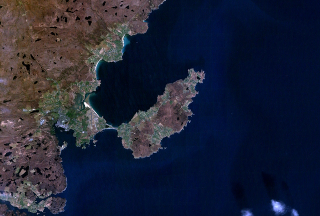
English: Satellite image of the district of Point on the Isle of Lewis, Scotland. |
| Datum | 25 december 2006 (uploaddatum) |
| Bron | Satellite imagery taken from NASA World Wind software (by screenshot) |
| Auteur | NASA |
Licentie
| Deze afbeelding bevindt zich in het publiek domein omdat het een screenshot is van NASA’s software World Wind die gebruik maakt van een publiek domein-laag, zoals Blue Marble, MODIS, Landsat, SRTM, USGS of GLOBE.
|
 |
Bestandsgeschiedenis
Klik op een datum/tijd om het bestand te zien zoals het destijds was.
| Datum/tijd | Miniatuur | Afmetingen | Gebruiker | Opmerking | |
|---|---|---|---|---|---|
| huidige versie | 25 dec 2006 14:19 | | 1.024 × 692 (968 kB) | JamesMorrison | Screengrab of the district of Point on the Isle of Lewis in Nasa World Wind |
Bestandsgebruik
Dit bestand wordt op de volgende pagina gebruikt:
Globaal bestandsgebruik
De volgende andere wiki's gebruiken dit bestand:
- Gebruikt op de.wikipedia.org
- Gebruikt op en.wikipedia.org
- Gebruikt op gd.wikipedia.org
- Gebruikt op nn.wikipedia.org