
Bestand:Przemysl Map WWI.png
Grootte van deze voorvertoning: 800 × 502 pixels. Andere resoluties: 320 × 201 pixels | 640 × 402 pixels | 1.024 × 643 pixels | 1.324 × 831 pixels.
Oorspronkelijk bestand (1.324 × 831 pixels, bestandsgrootte: 156 kB, MIME-type: image/png)
| Dit is een bestand van Wikimedia Commons. Onderstaande beschrijving komt van de beschrijving van het bestand daar. |
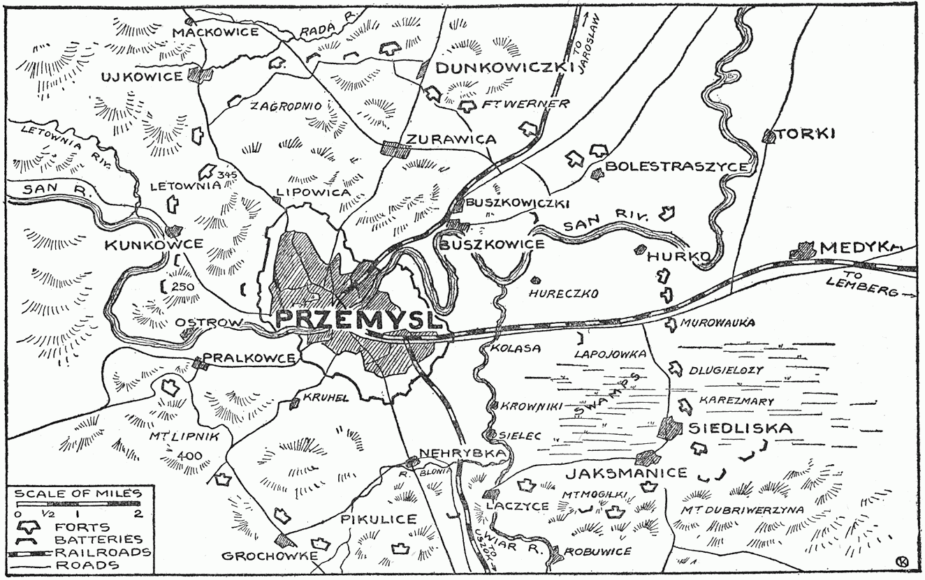
| Beschrijving | Map showing forts of Przemysl and surroundings, 1914 - 1915 | ||||||
| Datum | |||||||
| Bron |
"The Story of the Great War, Volume V (of 12)", published by P. F. COLLIER & SONS, NEW YORK. Downloaded from http://www.gutenberg.org/etext/23861 |
||||||
| Auteur | Francis Trevelyan Miller, Francis J. Reynolds, Allen L. Churchill editors. | ||||||
| Toestemming (Hergebruik van dit bestand) |
|


Bestandsgeschiedenis
Klik op een datum/tijd om het bestand te zien zoals het destijds was.
| Datum/tijd | Miniatuur | Afmetingen | Gebruiker | Opmerking | |
|---|---|---|---|---|---|
| huidige versie | 2 jan 2009 11:24 | | 1.324 × 831 (156 kB) | Rcbutcher | {{Information |Description=Map showing forts of Przemysl and surroundings, 1914 - 1915 |Source="The Story of the Great War, Volume V (of 12)", published by P. F. COLLIER & SONS, NEW YORK. <br>Downloaded from http://www.gutenberg.org/etext/23861 |Date=191 |
Bestandsgebruik
Dit bestand wordt op de volgende pagina gebruikt:
Globaal bestandsgebruik
De volgende andere wiki's gebruiken dit bestand:
- Gebruikt op be.wikipedia.org
- Gebruikt op cs.wikipedia.org
- Gebruikt op da.wikipedia.org
- Gebruikt op de.wikipedia.org
- Gebruikt op en.wikipedia.org
- Gebruikt op es.wikipedia.org
- Gebruikt op fr.wikipedia.org
- Gebruikt op hu.wikipedia.org
- Gebruikt op ja.wikipedia.org
- Gebruikt op ro.wikipedia.org
- Gebruikt op ru.wikipedia.org
- Gebruikt op zh.wikipedia.org