
Bestand:ScotlandOrkneyIslands.png
Geen hogere resolutie beschikbaar.
ScotlandOrkneyIslands.png (225 × 350 pixels, bestandsgrootte: 3 kB, MIME-type: image/png)
| Dit is een bestand van Wikimedia Commons. Onderstaande beschrijving komt van de beschrijving van het bestand daar. |
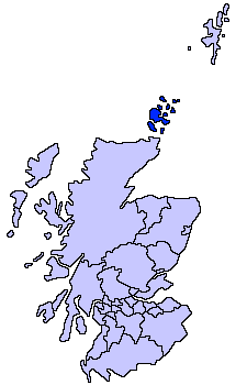
Orkney Islands unitary council
Slightly edited version of a map drawn by Morwen

|
Toestemming wordt verleend voor het kopiëren, verspreiden en/of wijzigen van dit document onder de voorwaarden van de GNU-licentie voor vrije documentatie, versie 1.2 of enige latere versie als gepubliceerd door de Free Software Foundation; zonder Invariant Sections, zonder Front-Cover Texts, en zonder Back-Cover Texts. Een kopie van de licentie is opgenomen in de sectie GNU-licentie voor vrije documentatie. |
| Dit bestand is gelicenseerd onder de Creative Commons-licentie Naamsvermelding-Gelijk delen 3.0 Unported | ||
| ||
| Deze licentietag is toegevoegd aan dit bestand in verband met de GFDL licentie-update. |

|
Bestand:ScotlandOrkneyIslands.svg is een vectorversie van dit bestand. Indien niet van slechtere kwaliteit dient deze gebruikt te worden in plaats van deze rasterafbeelding.
File:ScotlandOrkneyIslands.png → File:ScotlandOrkneyIslands.svg
Zie Help:SVG voor meer informatie. |
 |
derivative works
Afgeleide werken van dit bestand: ScotlandOrkneyIslands.svg
Bestandsgeschiedenis
Klik op een datum/tijd om het bestand te zien zoals het destijds was.
| Datum/tijd | Miniatuur | Afmetingen | Gebruiker | Opmerking | |
|---|---|---|---|---|---|
| huidige versie | 4 aug 2005 18:32 | | 225 × 350 (3 kB) | Tornad | size optimized |
| 17 mei 2005 23:40 |  | 225 × 350 (5 kB) | Voyager | Orkney Islands unitary council Slightly edited version of a map drawn by Morwen {{GFDL}} Category:Maps of Scottish unitary councils |
Bestandsgebruik
Geen enkele pagina gebruikt dit bestand.
Globaal bestandsgebruik
De volgende andere wiki's gebruiken dit bestand:
- Gebruikt op af.wikipedia.org
- Gebruikt op ar.wikipedia.org
- Gebruikt op ast.wikipedia.org
- Gebruikt op be.wikipedia.org
- Gebruikt op bg.wikipedia.org
- Gebruikt op br.wikipedia.org
- Gebruikt op cy.wikipedia.org
- Gebruikt op da.wikipedia.org
- Gebruikt op de.wikipedia.org
- Gebruikt op dsb.wikipedia.org
- Gebruikt op eu.wikipedia.org
- Orkadak
- Lankide:Euskaldunaa
- Mainland (Orkadak)
- Kirkwall
- Hoy uhartea
- Stromness
- Txantiloi:Orkadak
- Wikiproiektu:Irlanda, Gales eta Eskoziako udalerriak
- Balfour (Orkadak)
- Ancumtoun
- Backaland
- Bimbister
- Braeswick
- Brims
- Brinian
- Broughtown
- Burwick (Orkadak)
- Bustatoun
- Dounby
- Evie (Orkadak)
- Finstown
- Herston (Orkadak)
- Houton
- Hoxa (Orkadak)
- Longhope (Orkadak)
- Lyness
- Odness
- Pierowall
- St Margaret's Hope
- St Mary's (Orkadak)
- Stenness
- Tankerness
- Toab (Orkadak)
- Twatt (Orkadak)
- Voy
- Whitehall (Orkadak)
- Birsay
- Cairston
- Deerness
- Firth (Orkadak)
Globaal gebruik van dit bestand bekijken.