
Bestand:TS Norman 09 oct 2006 1849Z.jpg
Grootte van deze voorvertoning: 476 × 599 pixels. Andere resoluties: 190 × 240 pixels | 381 × 480 pixels | 610 × 768 pixels | 813 × 1.024 pixels | 1.626 × 2.048 pixels | 5.400 × 6.800 pixels.
Oorspronkelijk bestand (5.400 × 6.800 pixels, bestandsgrootte: 6,18 MB, MIME-type: image/jpeg)
| Dit is een bestand van Wikimedia Commons. Onderstaande beschrijving komt van de beschrijving van het bestand daar. |
Beschrijving
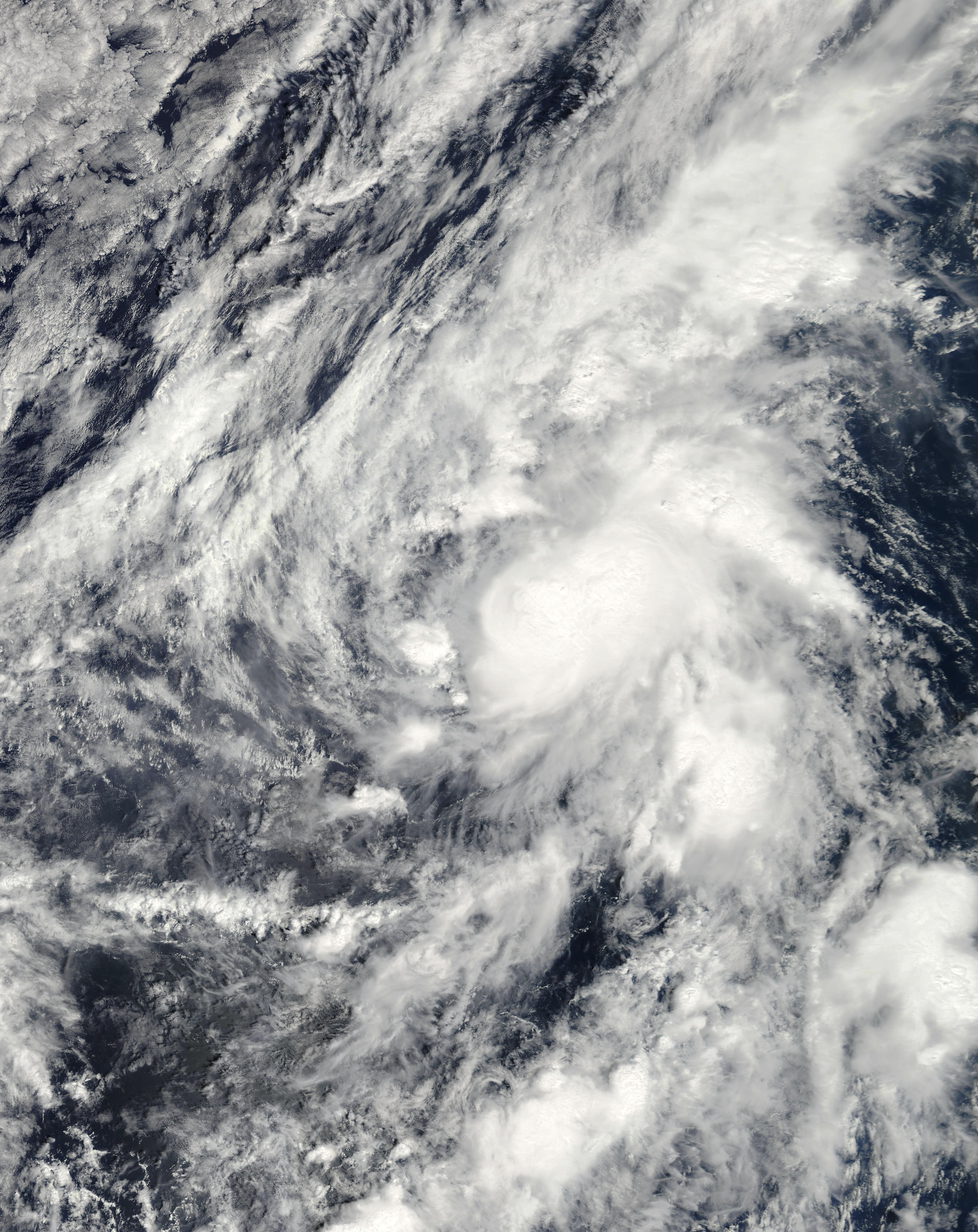
| Beschrijving | This image of Tropical Storm Norman was captured by the MODIS instrument on NASA's Terra satellite at 1849 UTC on October 9, 2006 when it was located in the eastern Pacific Ocean. At the time, maximum sustained winds were 45 mph and the minimum pressure was approximately 1002 mb. | ||||||
| Datum | |||||||
| Bron | http://www.nrlmry.navy.mil/tc_pages/tc_home.html | ||||||
| Auteur | Naval Research Laboratory | ||||||
| Toestemming (Hergebruik van dit bestand) |
|
||||||

Bestandsgeschiedenis
Klik op een datum/tijd om het bestand te zien zoals het destijds was.
| Datum/tijd | Miniatuur | Afmetingen | Gebruiker | Opmerking | |
|---|---|---|---|---|---|
| huidige versie | 7 nov 2020 21:12 | | 5.400 × 6.800 (6,18 MB) | FleurDeOdile | m |
| 14 jun 2019 22:45 |  | 4.401 × 4.401 (7,23 MB) | TheAustinMan | Soften cloud brightnesses | |
| 21 mei 2018 02:41 |  | 4.401 × 4.401 (1,8 MB) | CooperScience | True color | |
| 11 okt 2006 03:09 |  | 3.972 × 3.972 (2,19 MB) | Good kitty | == Summary == {{Information |Description=This image of Tropical Storm Norman was captured by the MODIS instrument on NASA's Terra satellite at 1849 UTC on October 9, 2006 when it was located in the eastern Pacific Ocean. At the time, maximum sustained win |
Bestandsgebruik
Dit bestand wordt op de volgende pagina gebruikt:
Globaal bestandsgebruik
De volgende andere wiki's gebruiken dit bestand:
- Gebruikt op de.wikipedia.org
- Gebruikt op en.wikipedia.org
- Gebruikt op es.wikipedia.org
- Gebruikt op pt.wikipedia.org
- Gebruikt op simple.wikipedia.org
- Gebruikt op zh.wikipedia.org