
Bestand:Towns in Onondaga County, New York.svg

Afmetingen van deze voorvertoning van het type PNG van dit SVG-bestand: 555 × 599 pixels Andere resoluties: 222 × 240 pixels | 444 × 480 pixels | 711 × 768 pixels | 948 × 1.024 pixels | 1.896 × 2.048 pixels | 1.076 × 1.162 pixels.
Oorspronkelijk bestand (SVG-bestand, nominaal 1.076 × 1.162 pixels, bestandsgrootte: 476 kB)
| Dit is een bestand van Wikimedia Commons. Onderstaande beschrijving komt van de beschrijving van het bestand daar. |
Beschrijving
| Beschrijving |
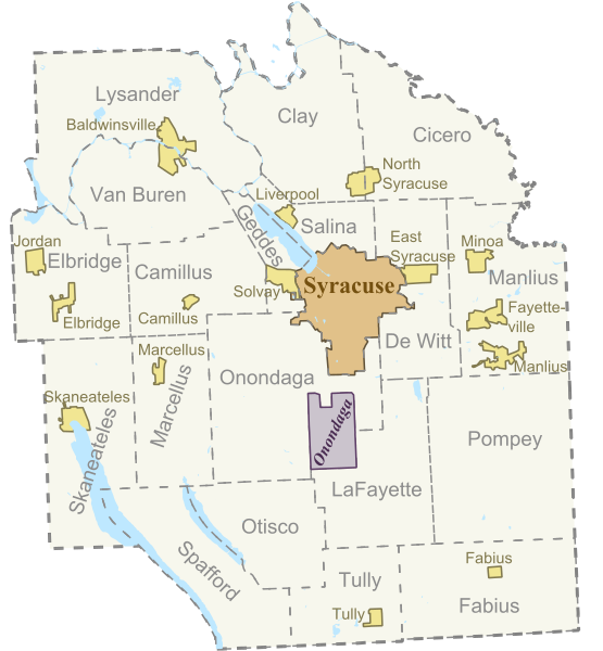
English: Based on Sub-County Map from "http://libremap.org/data/boundary/". Adapted the original file by isolating the map to only towns in Onondaga County, and adding town name labels. Redistributed with the Creative Commons Attribution-ShareAlike 2.0 license (Details at "https://creativecommons.org/licenses/by-sa/2.0/") |
| Datum | 18 juni 2008 (originele uploaddatum) |
| Bron | Verplaatst vanaf en.wikipedia naar Commons door IngerAlHaosului met behulp van CommonsHelper. |
| Auteur | De originele uploader was Smb6009 op de Engelstalige Wikipedia |
Licentie
Dit bestand is gelicenseerd onder de Creative Commons-licentie Naamsvermelding-Gelijk delen 2.0 Unported
- De gebruiker mag:
- Delen – het werk kopiëren, verspreiden en doorgeven
- Remixen – afgeleide werken maken
- Onder de volgende voorwaarden:
- naamsvermelding – U moet op een gepaste manier aan naamsvermelding doen, een link naar de licentie geven, en aangeven of er wijzigingen in het werk zijn aangebracht. U mag dit op elke redelijke manier doen, maar niet zodanig dat de indruk wordt gewekt dat de licentiegever instemt met uw werk of uw gebruik van zijn werk.
- Gelijk delen – Als u het werk heeft geremixt, veranderd, of erop heeft voortgebouwd, moet u het gewijzigde materiaal verspreiden onder dezelfde licentie als het oorspronkelijke werk, of een daarmee compatibele licentie.
Oorspronkelijk uploadlogboek
De oorspronkelijke beschrijving van deze afbeelding stond hier. Alle volgende gebruikersnamen verwijzen naar en.wikipedia.
- 2008-06-18 17:25 Smb6009 200×200× (102630 bytes) {{Information |Description=Based on Sub-County Map from http://libremap.org/data/boundary/. Adapted the original file by isolating the map to only towns in Onondaga County, NY, and adding town name labels. Redistributed with the Creative Commons Attributi
- 2008-06-18 01:25 Smb6009 200×200× (102630 bytes) Based on Sub-County Map from "http://libremap.org/data/boundary/". Adapted the original file by isolating the map to only towns in Onondaga County, and adding town name labels. Redistributed with the Creative Commons Attribution-ShareAlike 2.0 license (De
Bestandsgeschiedenis
Klik op een datum/tijd om het bestand te zien zoals het destijds was.
| Datum/tijd | Miniatuur | Afmetingen | Gebruiker | Opmerking | |
|---|---|---|---|---|---|
| huidige versie | 6 jun 2012 04:29 | | 1.076 × 1.162 (476 kB) | Smb6009 | new version with text converted to paths |
| 6 jun 2012 04:25 |  | 1.076 × 1.162 (211 kB) | Smb6009 | Uploaded new version with Villages included. The data for this map is derived from US Government produced Tiger Line data | |
| 16 mei 2011 01:29 |  | 512 × 583 (97 kB) | Smb6009 | Fixed some broken text issues | |
| 20 mrt 2010 14:35 |  | 512 × 583 (100 kB) | File Upload Bot (Magnus Manske) | {{BotMoveToCommons|en.wikipedia|year={{subst:CURRENTYEAR}}|month={{subst:CURRENTMONTHNAME}}|day={{subst:CURRENTDAY}}}} {{Information |Description={{en|Based on Sub-County Map from "http://libremap.org/data/boundary/". Adapted the original file by isolati |
Bestandsgebruik
Dit bestand wordt op de volgende pagina gebruikt:
Globaal bestandsgebruik
De volgende andere wiki's gebruiken dit bestand:
- Gebruikt op en.wikipedia.org
- Gebruikt op fr.wikipedia.org
- Gebruikt op pl.wikipedia.org