
Bestand:USA Mississippi Tupelo area NPS map.jpg
Geen hogere resolutie beschikbaar.
USA_Mississippi_Tupelo_area_NPS_map.jpg (285 × 305 pixels, bestandsgrootte: 28 kB, MIME-type: image/jpeg)
| Dit is een bestand van Wikimedia Commons. Onderstaande beschrijving komt van de beschrijving van het bestand daar. |
Beschrijving
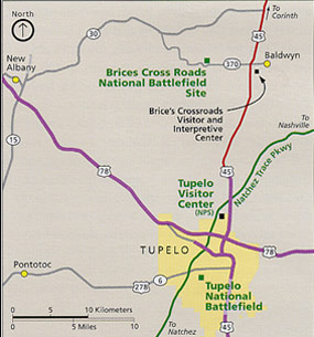
| Beschrijving | Area map of Tupelo, Mississippi, showing city limits, roads, and national parks or historic landmarks. Map by US NPS. |
| Datum | |
| Bron | US National Park Service webpage: http://pagebang.com/cgi/nph-proxy.cgi/111011A/http/www.nps.gov/brcr/planyourvisit/index.htm |
| Auteur | US Federal Government: Department of the Interior |
| Andere versies | (none) |
Licentie
| Dit beeld- of mediabestand bevat materiaal gebaseerd op een werk van een National Park Service medewerker, gemaakt als onderdeel van de officiële taken van die persoon. Als een werk van de Amerikaanse federale overheid, bevindt dergelijk werk zich in het publieke domein in de Verenigde Staten. Zie de NPS website en NPS copyright policy voor meer informatie. |
Bestandsgeschiedenis
Klik op een datum/tijd om het bestand te zien zoals het destijds was.
| Datum/tijd | Miniatuur | Afmetingen | Gebruiker | Opmerking | |
|---|---|---|---|---|---|
| huidige versie | 19 jul 2007 23:41 | | 285 × 305 (28 kB) | Wikid77 | {{Information |Description=Area map of Tupelo, Mississippi, showing city limits, roads, and national parks or historic landmarks. Map by US NPS. |Source=US en:National Park Service webpage: http:// |
Bestandsgebruik
Dit bestand wordt op de volgende pagina gebruikt:
Globaal bestandsgebruik
De volgende andere wiki's gebruiken dit bestand:
- Gebruikt op en.wikipedia.org
- Gebruikt op eo.wikipedia.org
- Gebruikt op he.wikipedia.org
- Gebruikt op ja.wikipedia.org
- Gebruikt op ka.wikipedia.org
- Gebruikt op pt.wikipedia.org
- Gebruikt op sv.wikipedia.org