
Bestand:US Navy 110320-N-OB360-166 An aerial view of ships washed ashore and overturned at a port near the Japan Air Self-Defense Force Matsushima Air Base.jpg
Grootte van deze voorvertoning: 800 × 531 pixels. Andere resoluties: 320 × 212 pixels | 640 × 425 pixels | 1.024 × 680 pixels | 1.280 × 850 pixels | 2.500 × 1.660 pixels.
Oorspronkelijk bestand (2.500 × 1.660 pixels, bestandsgrootte: 835 kB, MIME-type: image/jpeg)
| Dit is een bestand van Wikimedia Commons. Onderstaande beschrijving komt van de beschrijving van het bestand daar. |
Beschrijving
| Beschrijving |
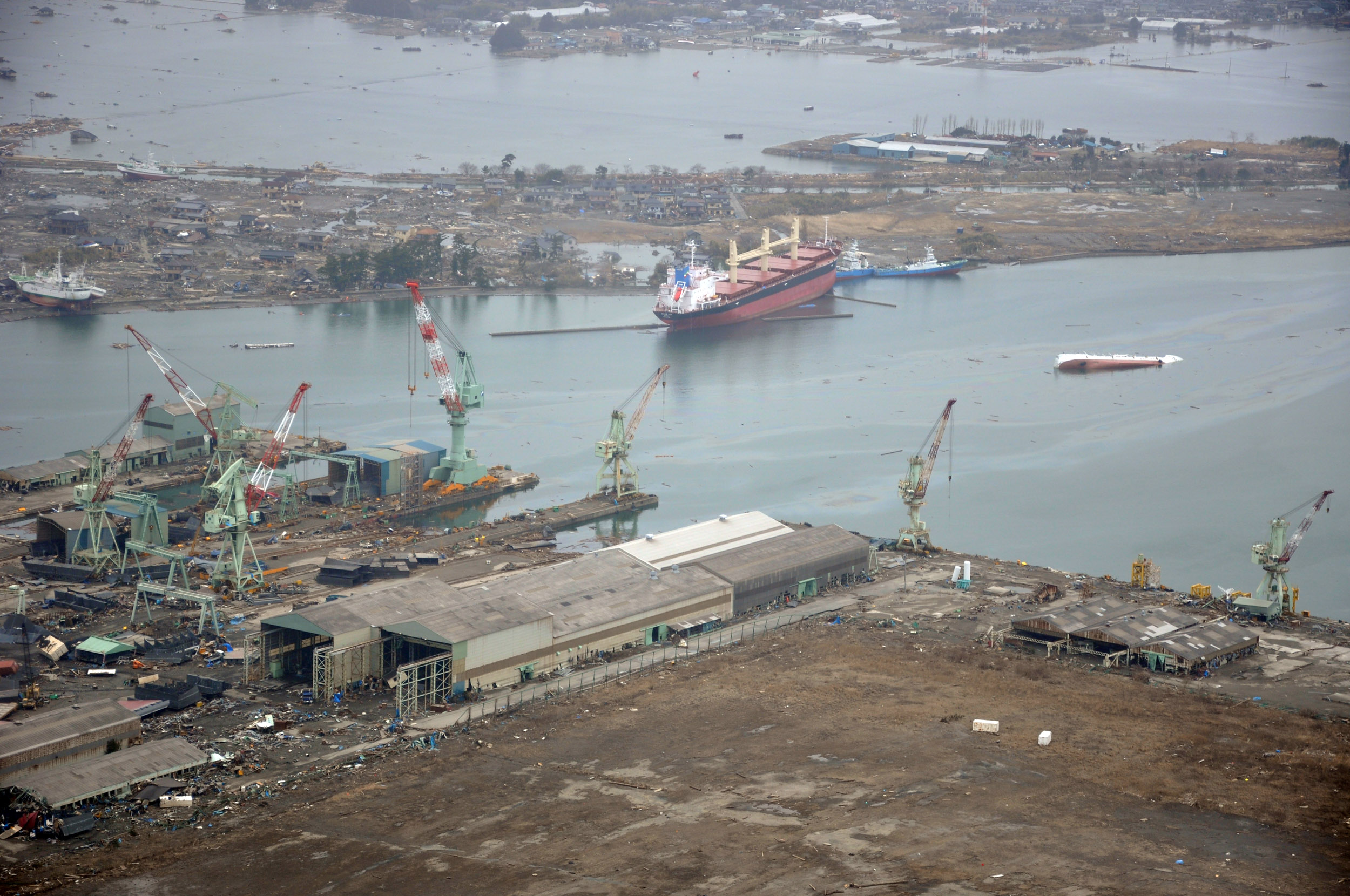
English: NORTHERN JAPAN (March 20, 2011) An aerial view of ships washed ashore and overturned at the port of Ishinomaki near the Japan Air Self-Defense Force Matsushima Air Base. The air base is serving as a refueling station for CH-46 Sea Knight helicopters assigned to Marine Medium Helicopter Squadron (HMM) 265 as they conduct humanitarian assistance missions in Northern Japan as part of Operation Tomodachi. (U.S. navy photo by Mass Communication Specialist 1st Class Ben Farone/Released)
|
|||
| Datum | Genomen op 20 maart 2011 | |||
| Bron |
|
|||
| Auteur | U.S. navy photo by Mass Communication Specialist 1st Class Ben Farone |

| Cameralocatie | | Deze en andere afbeeldingen in: OpenStreetMap |
|---|
Licentie
Dit bestand is een werk van een zeeman of beambte van de U.S. Navy, gemaakt tijdens diens officiële werkzaamheden. Aangezien het een werk van de Amerikaanse federale overheid betreft, bevindt deze afbeelding zich in het publiek domein.
|
 | |
| Van dit bestand is vastgesteld dat er geen bekende auteursrechtaanspraken op rusten, alle aanverwante en naburige rechten daarbij inbegrepen. | ||
Bestandsgeschiedenis
Klik op een datum/tijd om het bestand te zien zoals het destijds was.
| Datum/tijd | Miniatuur | Afmetingen | Gebruiker | Opmerking | |
|---|---|---|---|---|---|
| huidige versie | 22 mrt 2011 04:14 | | 2.500 × 1.660 (835 kB) | BotMultichillT | == {{int:filedesc}} == {{Information |description={{en|1=NORTHERN JAPAN (March 20, 2011) An aerial view of ships washed ashore and overturned at a port near the Japan Air Self-Defense Force Matsushima Air Base. The air base is serving as a refueling stat |
Bestandsgebruik
Dit bestand wordt op de volgende pagina gebruikt:
Globaal bestandsgebruik
De volgende andere wiki's gebruiken dit bestand:
- Gebruikt op de.wikipedia.org
- Gebruikt op en.wikipedia.org
- Gebruikt op fr.wikipedia.org
- Gebruikt op ja.wikipedia.org
- Gebruikt op ko.wikipedia.org
- Gebruikt op ms.wikipedia.org
- Gebruikt op tl.wikipedia.org
- Gebruikt op tr.wikipedia.org
- Gebruikt op zh.wikipedia.org