
Bestand:Aldabra islands seychelles 76.jpg

Grootte van deze voorvertoning: 800 × 353 pixels. Andere resoluties: 320 × 141 pixels | 847 × 374 pixels.
Oorspronkelijk bestand (847 × 374 pixels, bestandsgrootte: 70 kB, MIME-type: image/jpeg)
| Dit is een bestand van Wikimedia Commons. Onderstaande beschrijving komt van de beschrijving van het bestand daar. |
Beschrijving
| Beschrijving |
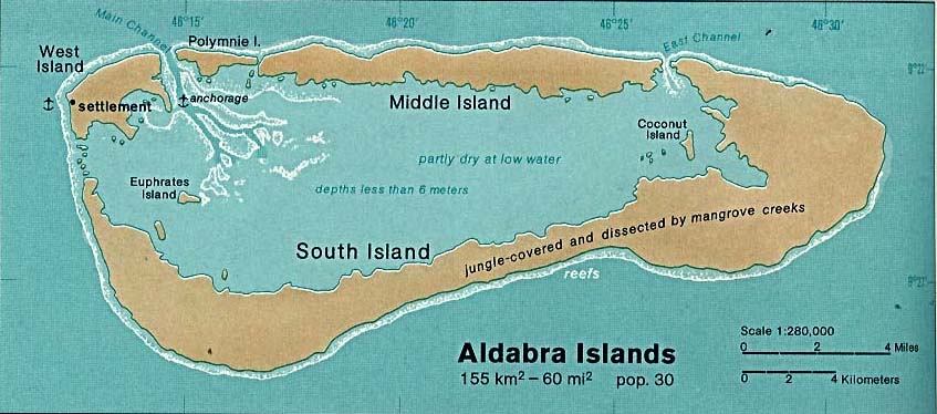
Deutsch: Karte des Aldabra-Atolls, Seychellen
English: Map of Aldabra Atoll, Outer Islands of Seychelles
Español: Mapa de Aldabra, Archipiélago de Seychelles |
| Datum | |
| Bron | http://www.lib.utexas.edu/maps/islands_oceans_poles/aldabra_islands_76.jpg |
| Auteur | Taken from Perry-Castañeda Library (PCL), originally from CIA Indian Ocean Atlas |
Licentie
| This image is a work of a Central Intelligence Agency employee, taken or made as part of that person's official duties. As a Work of the United States Government, this image or media is in the public domain in the United States.
|

|
Bestandsgeschiedenis
Klik op een datum/tijd om het bestand te zien zoals het destijds was.
| Datum/tijd | Miniatuur | Afmetingen | Gebruiker | Opmerking | |
|---|---|---|---|---|---|
| huidige versie | 1 dec 2005 01:40 | | 847 × 374 (70 kB) | Oxam Hartog | en : map(1976) by CIA of Aldabra atoll, Seychelles archipelago source : http://www.lib.utexas.edu/maps/islands_oceans_poles/aldabra_islands_76.jpg |
Bestandsgebruik
Dit bestand wordt op de volgende pagina gebruikt:
Globaal bestandsgebruik
De volgende andere wiki's gebruiken dit bestand:
- Gebruikt op af.wikipedia.org
- Gebruikt op ast.wikipedia.org
- Gebruikt op az.wikipedia.org
- Gebruikt op ca.wikipedia.org
- Gebruikt op da.wikipedia.org
- Gebruikt op en.wikipedia.org
- Gebruikt op eo.wikipedia.org
- Gebruikt op es.wikipedia.org
- Gebruikt op fr.wikipedia.org
- Gebruikt op gl.wikipedia.org
- Gebruikt op it.wikipedia.org
- Gebruikt op ja.wikipedia.org
- Gebruikt op ka.wikipedia.org
- Gebruikt op ko.wikipedia.org
- Gebruikt op lt.wikipedia.org
- Gebruikt op mt.wikipedia.org
- Gebruikt op no.wikipedia.org
- Gebruikt op pl.wikipedia.org
- Gebruikt op ru.wikipedia.org
- Gebruikt op uk.wikipedia.org
- Gebruikt op uz.wikipedia.org