
Bestand:Angola Map.jpg
Grootte van deze voorvertoning: 482 × 599 pixels. Andere resoluties: 193 × 240 pixels | 386 × 480 pixels | 618 × 768 pixels | 1.030 × 1.280 pixels.
Oorspronkelijk bestand (1.030 × 1.280 pixels, bestandsgrootte: 283 kB, MIME-type: image/jpeg)
| Dit is een bestand van Wikimedia Commons. Onderstaande beschrijving komt van de beschrijving van het bestand daar. |
| Beschrijving |
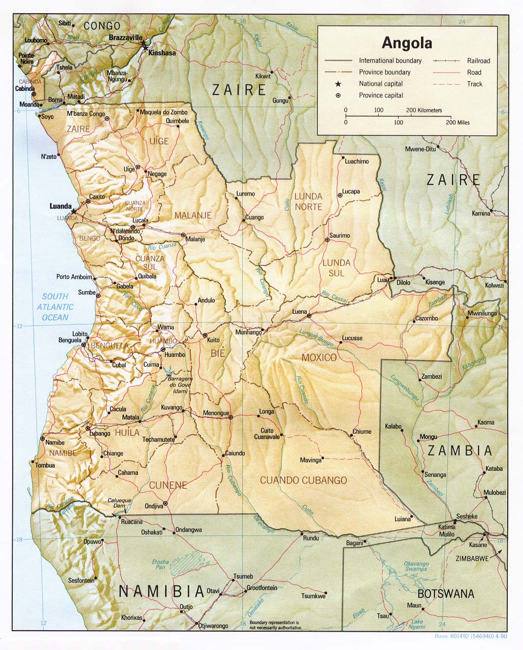
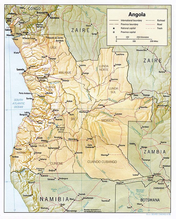
English: Shaded relief map of Angola. |
|||
| Datum | ||||
| Bron | [1] from the Perry-Castañeda Library Map Collection. | |||
| Auteur | CIA | |||
| Toestemming (Hergebruik van dit bestand) |
|

![[1]](http://www.lib.utexas.edu/maps/africa/angola_rel90.jpg)
Bestandsgeschiedenis
Klik op een datum/tijd om het bestand te zien zoals het destijds was.
| Datum/tijd | Miniatuur | Afmetingen | Gebruiker | Opmerking | |
|---|---|---|---|---|---|
| huidige versie | 21 feb 2006 13:32 | | 1.030 × 1.280 (283 kB) | Lupo | Shaded relief map of Angola. Source: [http://www.lib.utexas.edu/maps/africa/angola_rel90.jpg] from the [http://www.lib.utexas.edu/maps/angola.html Perry-Castañeda Library Map Collection]. {{PD-USGov-CIA}} Category:Maps of Angola |
Bestandsgebruik
Dit bestand wordt op de volgende pagina gebruikt:
Globaal bestandsgebruik
De volgende andere wiki's gebruiken dit bestand:
- Gebruikt op ar.wikipedia.org
- Gebruikt op ast.wikipedia.org
- Gebruikt op ca.wikipedia.org
- Gebruikt op ckb.wikipedia.org
- Gebruikt op de.wikipedia.org
- Gebruikt op en.wikipedia.org
- Gebruikt op es.wikipedia.org
- Gebruikt op eu.wikipedia.org
- Gebruikt op fa.wikipedia.org
- Gebruikt op fi.wikipedia.org
- Gebruikt op fr.wikipedia.org
- Gebruikt op hu.wikipedia.org
- Gebruikt op id.wikipedia.org
- Gebruikt op incubator.wikimedia.org
- Gebruikt op it.wikipedia.org
- Gebruikt op mzn.wikipedia.org
- Gebruikt op ny.wikipedia.org
- Gebruikt op pl.wikipedia.org
- Gebruikt op pt.wikipedia.org
- Gebruikt op ru.wikipedia.org
- Gebruikt op simple.wikipedia.org
- Gebruikt op sl.wikipedia.org
- Gebruikt op tl.wikipedia.org
- Gebruikt op tr.wikipedia.org
- Gebruikt op uk.wikipedia.org
- Gebruikt op vec.wikipedia.org
- Gebruikt op www.wikidata.org
- Gebruikt op wo.wikipedia.org
- Gebruikt op zh.wikipedia.org