
Bestand:Antikes Alexandria Karte.JPG
Grootte van deze voorvertoning: 773 × 600 pixels. Andere resoluties: 310 × 240 pixels | 619 × 480 pixels | 990 × 768 pixels | 1.280 × 993 pixels | 1.694 × 1.314 pixels.
Oorspronkelijk bestand (1.694 × 1.314 pixels, bestandsgrootte: 611 kB, MIME-type: image/jpeg)
| Dit is een bestand van Wikimedia Commons. Onderstaande beschrijving komt van de beschrijving van het bestand daar. |
| Beschrijving |
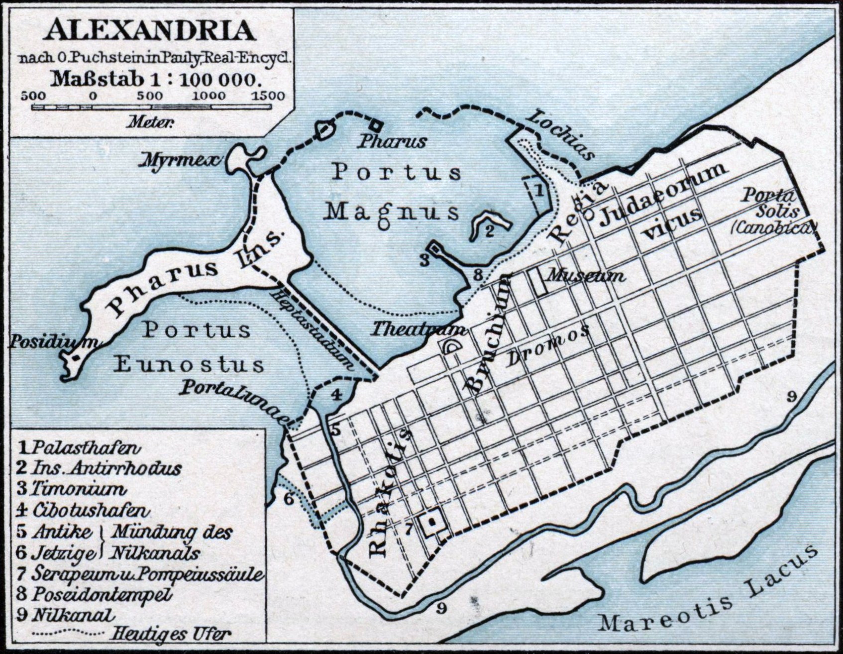
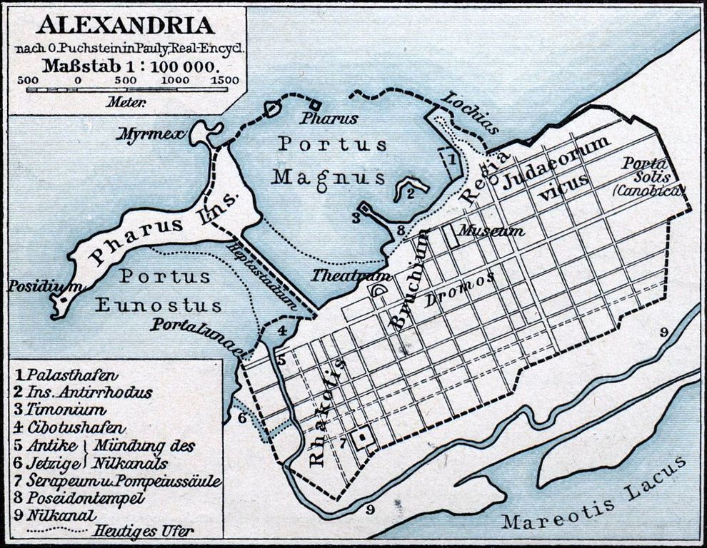
Deutsch: Karte der antiken ägyptischen Stadt Alexandria. |
||||
| Datum | |||||
| Bron | F. W. Putzgers Historischer Schul-Atlas | ||||
| Auteur | Friedrich Wilhelm Putzger (1849-1913), nach O. Puchstein in Pauly, Real-Encycl. | ||||
| Toestemming (Hergebruik van dit bestand) |
|
||||
Bestandsgeschiedenis
Klik op een datum/tijd om het bestand te zien zoals het destijds was.
| Datum/tijd | Miniatuur | Afmetingen | Gebruiker | Opmerking | |
|---|---|---|---|---|---|
| huidige versie | 24 jan 2011 02:23 | | 1.694 × 1.314 (611 kB) | Oltau | Farbkorrektur |
| 24 jan 2011 02:21 |  | 1.694 × 1.314 (610 kB) | Oltau | {{Information |Description={{de|1=Karte der antiken ägyptischen Stadt Alexandria.}} |Source=F. W. Putzgers Historischer Schul-Atlas |Author=Friedrich Wilhelm Putzger |Date=1901 |Permission={{PD-old}} |other_versions= }} Category:Maps of Alexandria |
Bestandsgebruik
Dit bestand wordt op de volgende pagina gebruikt:
Globaal bestandsgebruik
De volgende andere wiki's gebruiken dit bestand:
- Gebruikt op ar.wikipedia.org
- Gebruikt op arz.wikipedia.org
- Gebruikt op ast.wikipedia.org
- Gebruikt op bg.wikipedia.org
- Gebruikt op bs.wikipedia.org
- Gebruikt op ca.wikipedia.org
- Gebruikt op de.wikipedia.org
- Gebruikt op en.wikipedia.org
- Gebruikt op en.wikibooks.org
- Gebruikt op es.wikipedia.org
- Gebruikt op fa.wikipedia.org
- Gebruikt op fr.wikipedia.org
- Gebruikt op fr.wiktionary.org
- Gebruikt op hr.wikipedia.org
- Gebruikt op id.wikipedia.org
- Gebruikt op it.wikipedia.org
- Gebruikt op ja.wikipedia.org
- Gebruikt op ja.wikibooks.org
- Gebruikt op la.wikipedia.org
Globaal gebruik van dit bestand bekijken.