
Bestand:Australia Western Australia relief location map.png

Grootte van deze voorvertoning: 415 × 599 pixels. Andere resoluties: 166 × 240 pixels | 333 × 480 pixels | 532 × 768 pixels | 710 × 1.024 pixels | 1.416 × 2.043 pixels.
Oorspronkelijk bestand (1.416 × 2.043 pixels, bestandsgrootte: 1,1 MB, MIME-type: image/png)
| Dit is een bestand van Wikimedia Commons. Onderstaande beschrijving komt van de beschrijving van het bestand daar. |
Beschrijving
| Beschrijving |
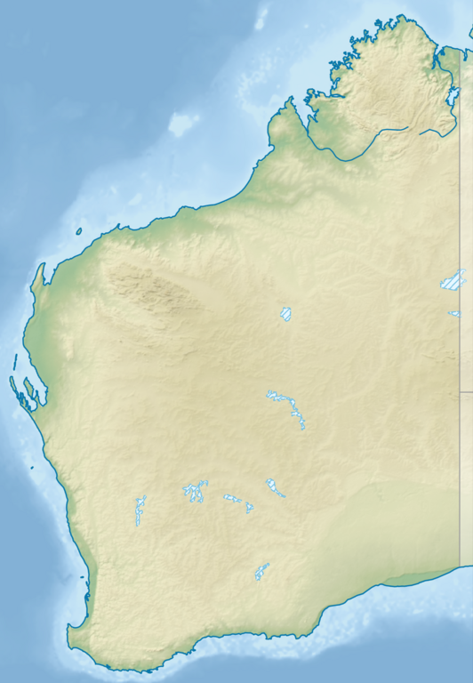
English: Relief location map of Western Australia, Australia
Equidistant cylindrical projection, latitude of true scale 24.62° S (equivalent to equirectangular projection with N/S stretching 110 %). Geographic limits of the map:
|
| Datum | |
| Bron |
|
| Auteur | Tentotwo |
Licentie
Ik, de auteursrechthebbende van dit werk, maak het hierbij onder de volgende licentie beschikbaar:
Dit bestand is gelicenseerd onder de Creative Commons-licentie Naamsvermelding-Gelijk delen 3.0 Unported
- De gebruiker mag:
- Delen – het werk kopiëren, verspreiden en doorgeven
- Remixen – afgeleide werken maken
- Onder de volgende voorwaarden:
- naamsvermelding – U moet op een gepaste manier aan naamsvermelding doen, een link naar de licentie geven, en aangeven of er wijzigingen in het werk zijn aangebracht. U mag dit op elke redelijke manier doen, maar niet zodanig dat de indruk wordt gewekt dat de licentiegever instemt met uw werk of uw gebruik van zijn werk.
- Gelijk delen – Als u het werk heeft geremixt, veranderd, of erop heeft voortgebouwd, moet u het gewijzigde materiaal verspreiden onder dezelfde licentie als het oorspronkelijke werk, of een daarmee compatibele licentie.
Deze PNG rasterafbeelding is gemaakt met QGIS

|
Deze kaart is gemaakt of verbeterd in de Duitse Kartenwerkstatt (Map Lab). Je kunt ook zelf kaarten ter verbetering voorstellen.
|
Bestandsgeschiedenis
Klik op een datum/tijd om het bestand te zien zoals het destijds was.
| Datum/tijd | Miniatuur | Afmetingen | Gebruiker | Opmerking | |
|---|---|---|---|---|---|
| huidige versie | 9 aug 2023 23:25 | | 1.416 × 2.043 (1,1 MB) | Lojwe | Cropped < 1 % horizontally, < 1 % vertically using CropTool with precise mode. |
| 2 feb 2013 20:27 |  | 1.423 × 2.052 (1,12 MB) | Tentotwo | User created page with UploadWizard |
Bestandsgebruik
Dit bestand wordt op de volgende 9 pagina's gebruikt:
Globaal bestandsgebruik
De volgende andere wiki's gebruiken dit bestand:
- Gebruikt op als.wikipedia.org
- Gebruikt op ar.wikipedia.org
- Gebruikt op ast.wikipedia.org
- Gebruikt op az.wikipedia.org
- Gebruikt op ban.wikipedia.org
- Gebruikt op bg.wikipedia.org
- Gebruikt op ceb.wikipedia.org
- Gebruikt op ckb.wikipedia.org
- Gebruikt op da.wikipedia.org
- Gebruikt op de.wikipedia.org
- Easter Group
- Lacepedeinseln
- Lake Argyle
- Purnululu-Nationalpark
- Bungle Bungle
- Windjana-Gorge-Nationalpark
- Wolfe-Creek-Krater-Nationalpark
- Shark Bay
- Cape-Arid-Nationalpark
- Nambung-Nationalpark
- Mirima-Nationalpark
- Tunnel-Creek-Nationalpark
- Mount Augustus
- Mount Gabi
- Karijini-Nationalpark
- Kalbarri-Nationalpark
- Marinefunkstelle Harold E. Holt
- Ningaloo Reef
- Cape-Range-Nationalpark
- Dirk Hartog Island
- Dampier-Archipel
- Buccaneer-Archipel
- Barrow Island (Western Australia)
- François-Péron-Nationalpark
- Houtman-Abrolhos-Archipel
- Wallabi-Inseln
- Pelsaert-Inseln
- North Island (Houtman-Abrolhos)
- Montebello-Inseln
- Mount-Augustus-Nationalpark
Globaal gebruik van dit bestand bekijken.