
Bestand:B454 Verlauf.png
Geen hogere resolutie beschikbaar.
B454_Verlauf.png (320 × 400 pixels, bestandsgrootte: 20 kB, MIME-type: image/png)
| Dit is een bestand van Wikimedia Commons. Onderstaande beschrijving komt van de beschrijving van het bestand daar. |
Beschrijving
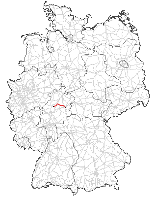
| Beschrijving | Verlauf der B 454 |
| Datum | 12 januari 2006 (originele uploaddatum) |
| Bron | Originally from commons; description page is/was here. |
| Auteur | Original uploader was Boolace at commons |
Licentie
This image was generated with OpenGeoDB. The information there is placed in the public domain, images generated from OpenGeoDB are derivative works without passing the threshold of creativity, they are therefore also public domain.
| Dit werk komt niet in aanmerking voor auteursrechtelijke bescherming, omdat het volledig uit algemeen beschikbare informatie bestaat en geen origineel auteurschap bevat; derhalve valt het werk in het publieke domein. |
Bestandsgeschiedenis
Klik op een datum/tijd om het bestand te zien zoals het destijds was.
| Datum/tijd | Miniatuur | Afmetingen | Gebruiker | Opmerking | |
|---|---|---|---|---|---|
| huidige versie | 13 dec 2007 20:09 | | 320 × 400 (20 kB) | Macia11 | == Opis == {{Information |Description=B454_Verlauf.png |Source=Originally from de.wikipedia |Date=2007.12.13 |Author=modif. by Macia11 |Permission=Released under the GNU Free Documentation License |other_versions=Main map from http://www.opengeodb.de }} |
| 28 okt 2007 21:42 |  | 250 × 312 (71 kB) | Malarz pl | {{Information |Description=Verlauf der B 454 |Source=Originally from '''commons'''; description page is/was here. |Date=2006-01-12 (original upload date) |Author=Original uploader was Boolace at '''commons''' | |
Bestandsgebruik
Dit bestand wordt op de volgende pagina gebruikt:
Globaal bestandsgebruik
De volgende andere wiki's gebruiken dit bestand:
- Gebruikt op de.wikipedia.org
- Gebruikt op www.wikidata.org