
Bestand:BlankEurope.png

Grootte van deze voorvertoning: 595 × 599 pixels. Andere resoluties: 238 × 240 pixels | 477 × 480 pixels | 762 × 768 pixels | 1.236 × 1.245 pixels.
Oorspronkelijk bestand (1.236 × 1.245 pixels, bestandsgrootte: 78 kB, MIME-type: image/png)
| Dit is een bestand van Wikimedia Commons. Onderstaande beschrijving komt van de beschrijving van het bestand daar. |

|
Bestand:Blank map of Europe (with disputed regions).svg is een vectorversie van dit bestand. Indien niet van slechtere kwaliteit dient deze gebruikt te worden in plaats van deze rasterafbeelding.
File:BlankEurope.png → File:Blank map of Europe (with disputed regions).svg
Zie Help:SVG voor meer informatie. |
.svg) |
Beschrijving
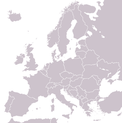
A blank political map of Europe extracted from Image:European Union member states by number of houses.png. +Hexagon1 (t) 04:47, 26 November 2006 (UTC)
Other versions: if you wish to use a map to show historical information before 2008, use Image:BlankEurope-BeforeKosovo.png
Licentie

|
Toestemming wordt verleend voor het kopiëren, verspreiden en/of wijzigen van dit document onder de voorwaarden van de GNU-licentie voor vrije documentatie, versie 1.2 of enige latere versie als gepubliceerd door de Free Software Foundation; zonder Invariant Sections, zonder Front-Cover Texts, en zonder Back-Cover Texts. Een kopie van de licentie is opgenomen in de sectie GNU-licentie voor vrije documentatie. |
| Dit bestand is gelicenseerd onder de Creative Commons-licentie Naamsvermelding-Gelijk delen 3.0 Unported | ||
| ||
| Deze licentietag is toegevoegd aan dit bestand in verband met de GFDL licentie-update. |
Bestandsgeschiedenis
Klik op een datum/tijd om het bestand te zien zoals het destijds was.
| Datum/tijd | Miniatuur | Afmetingen | Gebruiker | Opmerking | |
|---|---|---|---|---|---|
| huidige versie | 26 sep 2022 15:31 | | 1.236 × 1.245 (78 kB) | BlackShadowG | Reverted to version as of 14:55, 27 October 2008 (UTC) |
| 24 feb 2009 00:40 |  | 1.236 × 1.245 (78 kB) | Avala | ||
| 27 okt 2008 16:55 |  | 1.236 × 1.245 (78 kB) | Quilbert | Reverted to version as of 05:53, 5 April 2008 – there is already Image:BlankEurope-BeforeKosovo.png | |
| 24 okt 2008 20:13 |  | 1.236 × 1.245 (78 kB) | Avala | ||
| 5 apr 2008 07:53 |  | 1.236 × 1.245 (78 kB) | Hoshie | redid microstates, beefed up Spanish N. Africa, SBAs, and Gibraltar | |
| 25 feb 2008 20:42 |  | 1.236 × 1.245 (78 kB) | Hoshie | fixed Gibraltar, Ceuta and Melilla, and the SBAs | |
| 24 feb 2008 04:39 |  | 1.236 × 1.245 (78 kB) | Hoshie | Added Kosovo since it has been internationally recognized | |
| 4 jan 2008 00:40 |  | 1.236 × 1.245 (78 kB) | Hoshie | Re-drew ESBA and WSBA with circles until I study the CIA maps, boundary between Gibraltar and Spain. | |
| 26 nov 2006 06:47 |  | 1.236 × 1.245 (44 kB) | Happenstance | A blank map of Europe extracted from Image:European Union member states by number of houses.png. ~~~~ |
Bestandsgebruik
Geen enkele pagina gebruikt dit bestand.
Globaal bestandsgebruik
De volgende andere wiki's gebruiken dit bestand:
- Gebruikt op de.wiktionary.org
- Gebruikt op hu.wikipedia.org
- Gebruikt op incubator.wikimedia.org
- Gebruikt op it.wiktionary.org
- Gebruikt op sl.wiktionary.org
- Gebruikt op uk.wikipedia.org