
Bestand:Chad Topography.png

Grootte van deze voorvertoning: 397 × 599 pixels. Andere resoluties: 159 × 240 pixels | 318 × 480 pixels | 509 × 768 pixels | 678 × 1.024 pixels | 1.574 × 2.375 pixels.
Oorspronkelijk bestand (1.574 × 2.375 pixels, bestandsgrootte: 4,01 MB, MIME-type: image/png)
| Dit is een bestand van Wikimedia Commons. Onderstaande beschrijving komt van de beschrijving van het bestand daar. |
Beschrijving
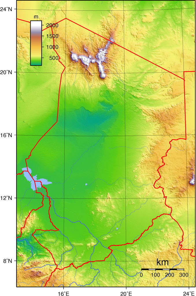
| Beschrijving | Topographic map of Chad. Created with GMT from GLOBE data. |
| Datum | |
| Bron | Eigen werk |
| Auteur | Sadalmelik |
Licentie
| Dit werk vrijgegeven in het publieke domein door de auteur, I, Sadalmelik. Dit is wereldwijd van toepassing. In sommige landen is dit wettelijk niet mogelijk; in die gevallen geldt: I, Sadalmelik staat iedereen toe dit werk voor eender welk doel te gebruiken, zonder enige voorwaarden, tenzij zulke voorwaarden door de wet worden voorgeschreven. |
| Aantekeningen | Deze afbeelding is aangetekend: Bekijk de aantekeningen op Commons |
Bestandsgeschiedenis
Klik op een datum/tijd om het bestand te zien zoals het destijds was.
| Datum/tijd | Miniatuur | Afmetingen | Gebruiker | Opmerking | |
|---|---|---|---|---|---|
| huidige versie | 29 jun 2007 21:23 | | 1.574 × 2.375 (4,01 MB) | Sadalmelik | Better data/better colours |
| 17 jun 2007 18:02 |  | 1.574 × 2.375 (2,89 MB) | Sadalmelik | {{Information |Description= |Source=self-made |Date= |Author= Sadalmelik }} | |
| 14 jun 2007 19:54 |  | 1.574 × 2.375 (2,74 MB) | Sadalmelik | {{Information |Description=Topographic map of Chad. Created with GMT from GLOBE data. |Source=self-made |Date=June 14, 2007 |Author= Sadalmelik }} Category:Maps of Chad Category:Topographic maps of Africa |
Bestandsgebruik
Geen enkele pagina gebruikt dit bestand.
Globaal bestandsgebruik
De volgende andere wiki's gebruiken dit bestand:
- Gebruikt op am.wikipedia.org
- Gebruikt op ast.wikipedia.org
- Gebruikt op avk.wikipedia.org
- Gebruikt op en.wikipedia.org
- Gebruikt op es.wikipedia.org
- Gebruikt op fa.wikipedia.org
- Gebruikt op hu.wikipedia.org
- Gebruikt op ig.wikipedia.org
- Gebruikt op io.wikipedia.org
- Gebruikt op ka.wikipedia.org
- Gebruikt op mdf.wikipedia.org
- Gebruikt op uk.wikipedia.org
- Gebruikt op vep.wikipedia.org