
Bestand:Dalby City of Troy turf maze.jpg
Grootte van deze voorvertoning: 800 × 511 pixels. Andere resoluties: 320 × 205 pixels | 640 × 409 pixels | 1.134 × 725 pixels.
Oorspronkelijk bestand (1.134 × 725 pixels, bestandsgrootte: 1,05 MB, MIME-type: image/jpeg)
| Dit is een bestand van Wikimedia Commons. Onderstaande beschrijving komt van de beschrijving van het bestand daar. |
Beschrijving
| Beschrijving |
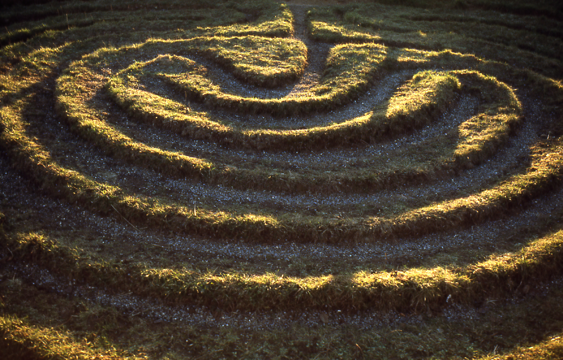
English: City of Troy. The only surviving example in the North Riding of this type of grass maze. It is located by a roadside in the Howardian Hills of Yorkshire, England, near the villages of Dalby, and Skewsby, close to Sheriff Hutton, a few miles north of York.
It is at grid reference SE6252871886 in Bonnygate Lane / High Lane. For some reason neither the Landranger map nor the Victorian Ordnance Survey map mark it. See the Megalithic Portal. Another image from Geograph. |
| Datum | |
| Bron | This is a scan of a transparency which I took in the 1970s, scanned and uploaded 8 May 2005. It has been slightly cleaned-up in Photoshop. |
| Auteur | User:SiGarb |
| Toestemming (Hergebruik van dit bestand) |
Own work, all rights released. This version of the image is in the Public Domain. If it is used outside Wikipedia, a photographer's credit (Simon Garbutt) would be appreciated! |
| Andere versies | (I retain the ownership and copyright of the original transparency and any higher-resolution scans derived from it.) SiGarb 18:46, 8 November 2005 (UTC) |
| Cameralocatie | | Deze en andere afbeeldingen in: OpenStreetMap |
|---|
Licentie
| Ik, de auteursrechthebbende van dit werk, geef dit werk vrij in het publieke domein. Dit is wereldwijd van toepassing. In sommige landen is dit wettelijk niet mogelijk; in die gevallen geldt: Ik sta iedereen toe dit werk voor eender welk doel te gebruiken, zonder enige voorwaarden, tenzij zulke voorwaarden door de wet worden voorgeschreven. |
Bestandsgeschiedenis
Klik op een datum/tijd om het bestand te zien zoals het destijds was.
| Datum/tijd | Miniatuur | Afmetingen | Gebruiker | Opmerking | |
|---|---|---|---|---|---|
| huidige versie | 8 nov 2005 20:46 | | 1.134 × 725 (1,05 MB) | SiGarb | This is a scan of a transparency which I took in the 1970s. It has been slightly cleaned-up in Photoshop. It shows "The City of Troy", a roadside turf maze in the Howardian Hills of Yorkshire, England, near the villages of Dalby, and Skewsby, close to S |
Bestandsgebruik
Dit bestand wordt op de volgende 3 pagina's gebruikt:
Globaal bestandsgebruik
De volgende andere wiki's gebruiken dit bestand:
- Gebruikt op cs.wikipedia.org
- Gebruikt op de.wikipedia.org
- Gebruikt op en.wikipedia.org
- Gebruikt op es.wikipedia.org
- Gebruikt op et.wikipedia.org
- Gebruikt op fi.wikipedia.org
- Gebruikt op gl.wikipedia.org
- Gebruikt op ja.wikipedia.org
- Gebruikt op ru.wikipedia.org
- Gebruikt op th.wikipedia.org