
Bestand:Districts of St Helena.svg

Afmetingen van deze voorvertoning van het type PNG van dit SVG-bestand: 652 × 521 pixels Andere resoluties: 300 × 240 pixels | 601 × 480 pixels | 961 × 768 pixels | 1.280 × 1.023 pixels | 2.560 × 2.046 pixels.
Oorspronkelijk bestand (SVG-bestand, nominaal 652 × 521 pixels, bestandsgrootte: 1,01 MB)
| Dit is een bestand van Wikimedia Commons. Onderstaande beschrijving komt van de beschrijving van het bestand daar. |
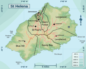
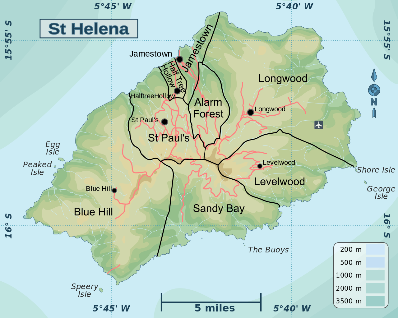
| Beschrijving | Map of St Helena showing the districts and main features | ||
| Datum | |||
| Bron | |||
| Auteur | Hogweard | ||
| Toestemming (Hergebruik van dit bestand) |
|
||
| Andere versies |
|

Bestandsgeschiedenis
Klik op een datum/tijd om het bestand te zien zoals het destijds was.
| Datum/tijd | Miniatuur | Afmetingen | Gebruiker | Opmerking | |
|---|---|---|---|---|---|
| huidige versie | 11 apr 2016 23:58 | | 652 × 521 (1,01 MB) | Hogweard | Fixed font issue (I hope) |
| 11 apr 2016 23:55 |  | 652 × 521 (1,01 MB) | Hogweard | {{Information |Description=Map of St Helena showing the districts and main features |Source=*Saint Helena regions map.svg *District map of Saint Helena.png |Date=2016-04-... |
Bestandsgebruik
Dit bestand wordt op de volgende pagina gebruikt:
Globaal bestandsgebruik
De volgende andere wiki's gebruiken dit bestand:
- Gebruikt op en.wikipedia.org
- Gebruikt op id.wikipedia.org
- Gebruikt op lt.wikipedia.org
- Gebruikt op sl.wikipedia.org
- Gebruikt op zh.wikipedia.org