
Bestand:Dominican Republic location map.svg

Afmetingen van deze voorvertoning van het type PNG van dit SVG-bestand: 737 × 600 pixels Andere resoluties: 295 × 240 pixels | 590 × 480 pixels | 944 × 768 pixels | 1.259 × 1.024 pixels | 2.517 × 2.048 pixels | 1.400 × 1.139 pixels.
Oorspronkelijk bestand (SVG-bestand, nominaal 1.400 × 1.139 pixels, bestandsgrootte: 182 kB)
Dit is een bestand van Wikimedia Commons.
Onderstaande beschrijving komt van de beschrijving van het bestand daar.
Onderstaande beschrijving komt van de beschrijving van het bestand daar.
queretaro
Beschrijving
| Beschrijving |
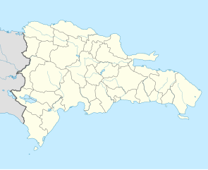
Deutsch: Positionskarte Dominikanische Republik mit Provinzen, Quadratische Plattkarte, N-S-Streckung 105 %. Geographische Begrenzung der Karte:
English: Location map Dominican Republic with Provinces, Equirectangular projection, N/S stretching 105 %. Geographic limits of the map:
|
||
| Datum | |||
| Bron |
Eigen werk,VMAP0, http://www.one.gob.do, http://lib.utexas.edu/maps/dominican_republic.html
|
||
| Auteur | Alexrk2 | ||
| Andere versies |
|
||
| SVG ontwikkeling | De broncode van dit SVG-bestand is deugdelijk.
|


Licentie
Ik, de auteursrechthebbende van dit werk, maak het hierbij onder de volgende licentie beschikbaar:
Dit bestand is gelicenseerd onder de Creative Commons-licentie Naamsvermelding-Gelijk delen 3.0 Unported
- De gebruiker mag:
- Delen – het werk kopiëren, verspreiden en doorgeven
- Remixen – afgeleide werken maken
- Onder de volgende voorwaarden:
- naamsvermelding – U moet op een gepaste manier aan naamsvermelding doen, een link naar de licentie geven, en aangeven of er wijzigingen in het werk zijn aangebracht. U mag dit op elke redelijke manier doen, maar niet zodanig dat de indruk wordt gewekt dat de licentiegever instemt met uw werk of uw gebruik van zijn werk.
- Gelijk delen – Als u het werk heeft geremixt, veranderd, of erop heeft voortgebouwd, moet u het gewijzigde materiaal verspreiden onder dezelfde licentie als het oorspronkelijke werk, of een daarmee compatibele licentie.
Bestandsgeschiedenis
Klik op een datum/tijd om het bestand te zien zoals het destijds was.
| Datum/tijd | Miniatuur | Afmetingen | Gebruiker | Opmerking | |
|---|---|---|---|---|---|
| huidige versie | 10 feb 2010 20:39 | | 1.400 × 1.139 (182 kB) | Alexrk2 | fixed boundary style |
| 7 feb 2010 15:17 |  | 1.400 × 1.139 (181 kB) | Alexrk2 | == Summary == {{Information |Description= {{de|Positionskarte Dominikanische Republik mit Provinzen, Quadratische Plattkarte, N-S-Streckung 105 %. Geographische Begrenzung der Karte:}} {{en|Location map [[:en:Dominican Repu |
Bestandsgebruik
Meer dan 100 pagina's gebruiken dit bestand. De volgende lijst geeft alleen de eerste 100 pagina's weer die dit bestand gebruiken. Er is ook een volledige lijst beschikbaar.
- Altos de Chavón
- Azua (provincie)
- Azua (stad)
- Bajos de Haina
- Baní
- Baoruco
- Barahona (provincie)
- Barahona (schiereiland)
- Barahona (stad)
- Bayahíbe
- Boca Chica (Dominicaanse Republiek)
- Boca de Yuma
- Bonao
- Cabarete
- Cabral (gemeente)
- Calle El Conde
- Comendador
- Concepción de La Vega
- Cotuí
- Dajabón (provincie)
- Dajabón (stad)
- Distrito Nacional
- Don Pedro
- Duarte (provincie)
- El Seibo (provincie)
- El Seibo (stad)
- Elías Piña
- Enriquillo (plaats)
- Espaillat
- Esperanza (Dominicaanse Republiek)
- Fort Resoli
- Fort Santo Tomás
- Fortaleza Ozama
- Guayubín
- Hato Mayor (provincie)
- Hato Mayor (stad)
- Hermanas Mirabal (provincie)
- Higüey
- Independencia (provincie)
- Isla Beata
- Isla Catalina
- Isla Saona
- Jimaní
- Juan Dolio
- Kathedraal van Santo Domingo
- La Altagracia
- La Isabela
- La Peñuela
- La Romana (provincie)
- La Romana (stad)
- La Union Airport
- La Vega (provincie)
- Laguna Salada (Dominicaanse Republiek)
- Las Américas International Airport
- Los Alcarrizos
- Mao (Dominicaanse Republiek)
- María Trinidad Sánchez
- Miches
- Moca (Dominicaanse Republiek)
- Monseñor Nouel
- Monte Cristi (provincie)
- Monte Cristi (stad)
- Monte Plata (provincie)
- Monte Plata (stad)
- Nagua
- Neiba
- Paleis van Diego Columbus
- Paraíso (Dominicaanse Republiek)
- Pedernales (provincie)
- Pedernales (stad)
- Peravia
- Puerta de la Misericordia
- Puerta del Conde
- Puerto Plata (provincie)
- Puerto Plata (stad)
- Punta Cana
- Punta Cana International Airport
- Quisqueya (gemeente)
- Sabaneta (Dominicaanse Republiek)
- Salcedo (Dominicaanse Republiek)
- Samaná (provincie)
- Samaná (schiereiland)
- San Cristóbal (Dominicaanse Republiek)
- San Cristóbal (provincie)
- San Francisco de Macorís
- San José de Ocoa (provincie)
- San José de Ocoa (stad)
- San Juan (Dominicaanse Republiek)
- San Juan (provincie van de Dominicaanse Republiek)
- San Pedro de Macorís (provincie)
- San Pedro de Macorís (stad)
- Santa Bárbara de Samaná
- Santiago (provincie in de Dominicaanse Republiek)
- Santiago Rodríguez
- Santiago de los Caballeros
- Santo Domingo (Dominicaanse Republiek)
- Santo Domingo (provincie)
- Sosúa
- Sánchez Ramírez
- Valverde (provincie)
Meer koppelingen naar dit bestand bekijken.
Globaal bestandsgebruik
De volgende andere wiki's gebruiken dit bestand:
- Gebruikt op af.wikipedia.org
- Gebruikt op an.wikipedia.org
- Gebruikt op ar.wikipedia.org
- Gebruikt op ast.wikipedia.org
- La Barraquera (San José de Ocoa)
- Oviedo (República Dominicana)
- Santu Domingu
- Módulu:Mapa de llocalización/datos/República Dominicana
- Bancu Central de la República Dominicana
- Módulu:Mapa de llocalización/datos/República Dominicana/usu
- Copa Panamericana de Voleibol Femenín de 2018
- Aeródromu de Cabo Rojo
- Aeropuertu Domésticu de Constanza
- Aeropuertu Osvaldo Virgil
- Aeródromu de Portillo
- Puertu de Puerto Plata
- Puertu de San Pedro de Macorís
- Puertu de Santu Domingu
- Ríu Ozama
- Gebruikt op az.wikipedia.org
- Gebruikt op ba.wikipedia.org
- Gebruikt op be-tarask.wikipedia.org
- Gebruikt op be.wikipedia.org
- Gebruikt op bg.wikipedia.org
- Gebruikt op bn.wikipedia.org
- Gebruikt op bs.wikipedia.org
- Gebruikt op ca.wikipedia.org
- Gebruikt op ceb.wikipedia.org
Globaal gebruik van dit bestand bekijken.