
Bestand:Europe countries map local lang 2.png
Grootte van deze voorvertoning: 737 × 600 pixels. Andere resoluties: 295 × 240 pixels | 590 × 480 pixels | 944 × 768 pixels | 1.259 × 1.024 pixels | 1.475 × 1.200 pixels.
Oorspronkelijk bestand (1.475 × 1.200 pixels, bestandsgrootte: 837 kB, MIME-type: image/png)
| Dit is een bestand van Wikimedia Commons. Onderstaande beschrijving komt van de beschrijving van het bestand daar. |
Beschrijving
| Beschrijving |
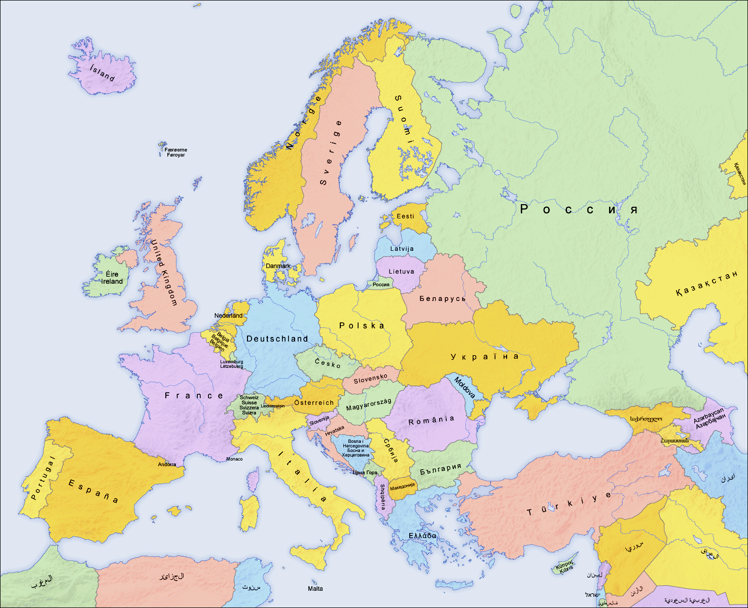
English: Map of countries in Europe and the surrounding region |
||||||||||
| Datum | 02.04.2006 | ||||||||||
| Bron | derivative work of Europe countries map local lang.png by San Jose, based on the Generic Mapping Tools and ETOPO2 | ||||||||||
| Auteur | San Jose (map), Hayden120 (retouch) | ||||||||||
| Toestemming (Hergebruik van dit bestand) |
|
||||||||||
| Andere versies |
[]
|


| Dit is een geretoucheerde foto, wat betekent dat de originele versie digitaal aangepast is. Aanpassingen: Saturation, brightness, contrast. Het origineel kan hier bekeken worden: Europe countries map local lang.png. Aanpassingen gedaan door Hayden120.
|
See also
_en.png)
.png)
.jpg)
Bestandsgeschiedenis
Klik op een datum/tijd om het bestand te zien zoals het destijds was.
| Datum/tijd | Miniatuur | Afmetingen | Gebruiker | Opmerking | |
|---|---|---|---|---|---|
| huidige versie | 11 sep 2009 09:59 | | 1.475 × 1.200 (837 kB) | Hayden120 | == {{int:filedesc}} == {{Information |Description= {{en|Map of countries in Europe}} |Source=derivative work of Europe countries map local lang.png by San Jose, based on the [http://gmt.soest |
Bestandsgebruik
Dit bestand wordt op de volgende pagina gebruikt:
Globaal bestandsgebruik
De volgende andere wiki's gebruiken dit bestand:
- Gebruikt op de.wikipedia.org
- Gebruikt op de.wiktionary.org
- Gebruikt op la.wikipedia.org
- Gebruikt op ro.wikipedia.org
- Gebruikt op ru.wikipedia.org