
Bestand:FortTiconderogaLayout1758.png
Oorspronkelijk bestand (1.327 × 859 pixels, bestandsgrootte: 2,42 MB, MIME-type: image/png)
| Dit is een bestand van Wikimedia Commons. Onderstaande beschrijving komt van de beschrijving van het bestand daar. |
| Beschrijving |
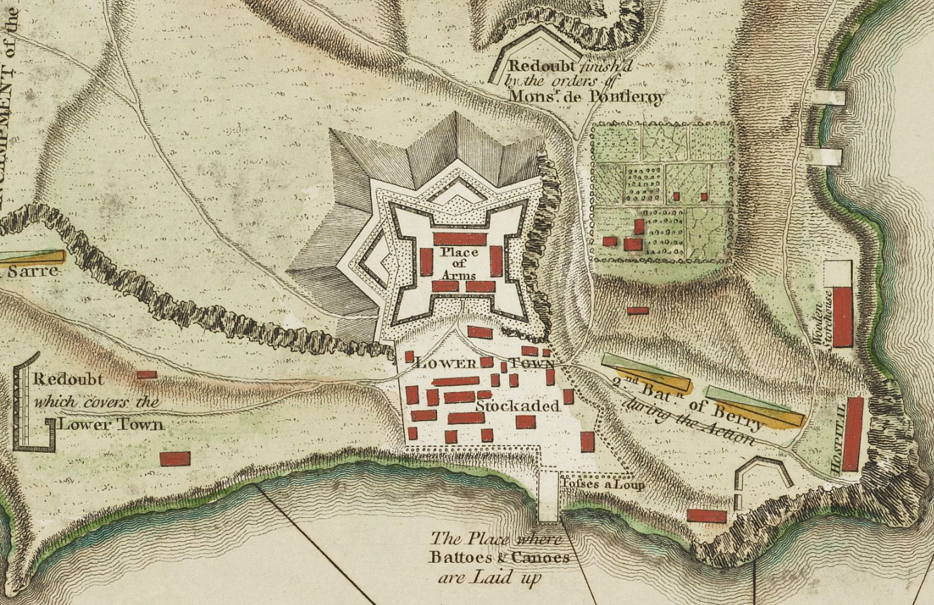
English: This is a detail from the source map showing the the layout of Fort Ticonderoga (then known as Fort Carillon) in 1758. |
||||||||||||||||||||||
| Datum |
|
||||||||||||||||||||||
| Bron |
The source image is from the Library and Archive of Quebec. |
||||||||||||||||||||||
| Auteur |
|
||||||||||||||||||||||
| Toestemming (Hergebruik van dit bestand) |
|
||||||||||||||||||||||
| Andere versies |
Afgeleide werken van dit bestand: Fort Ticonderoga 1758 Restored.png File:TiconderogaJeffreys1758.jpg (original uncropped map) |
||||||||||||||||||||||
| Dit is een geretoucheerde foto, wat betekent dat de originele versie digitaal aangepast is. Aanpassingen: Detail showing only the fort and its immediate outbuildings. Het origineel kan hier bekeken worden: TiconderogaJeffreys1758.jpg. Aanpassingen gedaan door Magicpiano.
|
Bestandsgeschiedenis
Klik op een datum/tijd om het bestand te zien zoals het destijds was.
| Datum/tijd | Miniatuur | Afmetingen | Gebruiker | Opmerking | |
|---|---|---|---|---|---|
| huidige versie | 10 feb 2009 18:17 | | 1.327 × 859 (2,42 MB) | Magicpiano | {{Information |Description={{en|1=This is a period map showing the forces arrayed at the Battle of Carillon at Fort Ticonderoga (then known as Fort Carillon) in 1758. It is captioned ''A Plan of the Town |
Bestandsgebruik
Geen enkele pagina gebruikt dit bestand.
Globaal bestandsgebruik
De volgende andere wiki's gebruiken dit bestand:
- Gebruikt op en.wikipedia.org
- Gebruikt op fr.wikipedia.org
- Gebruikt op ja.wikipedia.org
- Gebruikt op sv.wikipedia.org