
Bestand:Greenland 1.PNG

Grootte van deze voorvertoning: 307 × 599 pixels. Andere resoluties: 123 × 240 pixels | 246 × 480 pixels | 720 × 1.404 pixels.
Oorspronkelijk bestand (720 × 1.404 pixels, bestandsgrootte: 33 kB, MIME-type: image/png)
| Dit is een bestand van Wikimedia Commons. Onderstaande beschrijving komt van de beschrijving van het bestand daar. |
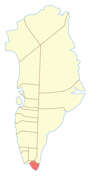
Map showing location of the Nanortalik municipality in w:Greenland
Ik, de auteursrechthebbende van dit werk, maak het hierbij onder de volgende licentie beschikbaar:

|
Toestemming wordt verleend voor het kopiëren, verspreiden en/of wijzigen van dit document onder de voorwaarden van de GNU-licentie voor vrije documentatie, versie 1.2 of enige latere versie als gepubliceerd door de Free Software Foundation; zonder Invariant Sections, zonder Front-Cover Texts, en zonder Back-Cover Texts. Een kopie van de licentie is opgenomen in de sectie GNU-licentie voor vrije documentatie. |
| Dit bestand is gelicenseerd onder de Creative Commons-licentie Naamsvermelding-Gelijk delen 3.0 Unported | ||
| ||
| Deze licentietag is toegevoegd aan dit bestand in verband met de GFDL licentie-update. |
Bestandsgeschiedenis
Klik op een datum/tijd om het bestand te zien zoals het destijds was.
| Datum/tijd | Miniatuur | Afmetingen | Gebruiker | Opmerking | |
|---|---|---|---|---|---|
| huidige versie | 9 feb 2006 12:05 | | 720 × 1.404 (33 kB) | Roke~commonswiki | Map showing location of the Nanortalik municipality in w:Greenland {{GFDL-self}} Category: Greenland municipalities |
Bestandsgebruik
Dit bestand wordt op de volgende pagina gebruikt:
Globaal bestandsgebruik
De volgende andere wiki's gebruiken dit bestand:
- Gebruikt op da.wikipedia.org
- Gebruikt op de.wikipedia.org
- Gebruikt op frr.wikipedia.org
- Gebruikt op it.wikipedia.org
- Prins Christians Sund (stretto)
- Fiordo di Lindenow
- Qaleqitaa
- Qallimiut Tasia
- Qorlortorsuup Tasia
- Alleruusakasit
- Arpatsivik
- Monte Iffit
- Monte Ippissuasiip
- Issuttussoq
- Monte Marrat
- Matorsuaq
- Monte Naajatsiaat
- Monte Nuussuup
- Monte Paarnaliarsuup
- Monte Puilasorsuit
- Monte Qajarsuup
- Qalutaassuaq
- Qasigeerneq
- Monte Qingassat
- Monte Sermitsiap
- Suikkassuaq
- Monte Tininnertuup
- Tuvilissuaq
- Uilorsuaq
- Monte Usumeersip
- Utsussuatsiaat
- Uumannanngua
- Itilleq (isola)
- Pamialluk
- Sammisoq
- Sermersooq (isola)
- Fiordo di Uunartoq
- Comune di Nanortalik
- Gebruikt op ja.wikipedia.org
- Gebruikt op kl.wikipedia.org
- Gebruikt op no.wikipedia.org
- Gebruikt op sv.wikipedia.org
Globaal gebruik van dit bestand bekijken.