
Bestand:Isle of Wight outline map with UK.png

Grootte van deze voorvertoning: 800 × 506 pixels. Andere resoluties: 320 × 203 pixels | 640 × 405 pixels | 907 × 574 pixels.
Oorspronkelijk bestand (907 × 574 pixels, bestandsgrootte: 96 kB, MIME-type: image/png)
| Dit is een bestand van Wikimedia Commons. Onderstaande beschrijving komt van de beschrijving van het bestand daar. |

|
Deze kaartafbeelding zou opnieuw moeten worden aangemaakt als een SVG-bestand door vectorafbeeldingen te gebruiken. Dit heeft een aantal voordelen; zie Commons:Media for cleanup voor meer informatie. Als er een SVG-formaat van deze afbeelding bestaat, dan deze graag uploaden. Nadat u dit heeft gedaan, gelieve dit sjabloon te vervangen door het sjabloon {{vector version available|nieuwe bestandsnaam.svg}} op deze afbeeldingspagina.
|
Beschrijving
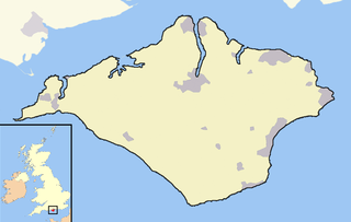
An outline map of the Isle of Wight for use within templates on Wikipedia.
Own work - created 12th April 2007 - derived from data from the OpenStreetMap project
Licentie
Ik, de auteursrechthebbende van dit werk, maak het hierbij onder de volgende licentie beschikbaar:
Dit bestand is gelicenseerd onder de Creative Commons-licentie Naamsvermelding-Gelijk delen 2.0 Unported
- De gebruiker mag:
- Delen – het werk kopiëren, verspreiden en doorgeven
- Remixen – afgeleide werken maken
- Onder de volgende voorwaarden:
- naamsvermelding – U moet op een gepaste manier aan naamsvermelding doen, een link naar de licentie geven, en aangeven of er wijzigingen in het werk zijn aangebracht. U mag dit op elke redelijke manier doen, maar niet zodanig dat de indruk wordt gewekt dat de licentiegever instemt met uw werk of uw gebruik van zijn werk.
- Gelijk delen – Als u het werk heeft geremixt, veranderd, of erop heeft voortgebouwd, moet u het gewijzigde materiaal verspreiden onder dezelfde licentie als het oorspronkelijke werk, of een daarmee compatibele licentie.
Bestandsgeschiedenis
Klik op een datum/tijd om het bestand te zien zoals het destijds was.
| Datum/tijd | Miniatuur | Afmetingen | Gebruiker | Opmerking | |
|---|---|---|---|---|---|
| huidige versie | 21 dec 2007 05:00 | | 907 × 574 (96 kB) | Jza84 | Fixing some minor pantone and composition issues |
| 12 apr 2007 21:20 |  | 907 × 574 (44 kB) | RichardB | ||
| 12 apr 2007 21:17 |  | 907 × 574 (44 kB) | RichardB | An outline map of the Isle of Wight for use within templates on Wikipedia. Own work - created 12th April 2007 - derived from data from the OpenStreetMap project | |
| 12 apr 2007 03:14 |  | 907 × 574 (44 kB) | RichardB | An outline map of the Isle of Wight for use within templates on Wikipedia. Own work - created 12th April 2007 - derived from data from the OpenStreetMap project |
Bestandsgebruik
Geen enkele pagina gebruikt dit bestand.
Globaal bestandsgebruik
De volgende andere wiki's gebruiken dit bestand:
- Gebruikt op ca.wikipedia.org
- Gebruikt op en.wikipedia.org
- Gebruikt op vi.wikipedia.org