
Bestand:Lebanon districts Aley.png

Grootte van deze voorvertoning: 486 × 599 pixels. Andere resoluties: 194 × 240 pixels | 600 × 740 pixels.
Oorspronkelijk bestand (600 × 740 pixels, bestandsgrootte: 41 kB, MIME-type: image/png)
| Dit is een bestand van Wikimedia Commons. Onderstaande beschrijving komt van de beschrijving van het bestand daar. |
Beschrijving
| Beschrijving |
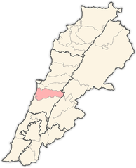
English: Map of districts in Lebanon, highlighting the Aley District |
| Datum | |
| Bron | Eigen werk |
| Auteur | Hanhil |
Based on Image:Lebanon districts Matn.png
Licentie
| Ik, de auteursrechthebbende van dit werk, geef dit werk vrij in het publieke domein. Dit is wereldwijd van toepassing. In sommige landen is dit wettelijk niet mogelijk; in die gevallen geldt: Ik sta iedereen toe dit werk voor eender welk doel te gebruiken, zonder enige voorwaarden, tenzij zulke voorwaarden door de wet worden voorgeschreven. |
Bestandsgeschiedenis
Klik op een datum/tijd om het bestand te zien zoals het destijds was.
| Datum/tijd | Miniatuur | Afmetingen | Gebruiker | Opmerking | |
|---|---|---|---|---|---|
| huidige versie | 31 mei 2008 12:24 | | 600 × 740 (41 kB) | Hanhil | {{Information |Description={{en|1=Map of districts in Lebanon, highlighting the Aley District}} |Source=eigen werk (own work) |Author=Hanhil |Date=2008-05-31 |Permission= |other_versions= }} Based on Image:Lebanon districts Matn.png { |
Bestandsgebruik
Dit bestand wordt op de volgende pagina gebruikt:
Globaal bestandsgebruik
De volgende andere wiki's gebruiken dit bestand:
- Gebruikt op ar.wikipedia.org
- قائمة مدن لبنان
- بيصور
- عين داره
- صوفر
- سوق الغرب
- قالب:قضاء عاليه
- عاليه (لبنان)
- عين عنوب
- عبيه
- أغميد
- عرمون
- بدادون
- بشامون
- بسوس
- شملان
- كحالة
- كيفون
- نبع الصفا
- قماطية
- سلفاية
- بتاتر
- بحمدون الضيعة
- بحمدون المحطة
- بحوارة
- بخشتيه
- بدغان
- بساتين (عاليه)
- بسرين
- بطلون
- بعلشميه
- بعورته
- بليبل
- بمكين
- بمهريه
- بنيه
- بوزريده
- تعزانية
- حبرمون
- حومال
- دفون
- دقون
- دويرالرمان
- دير قوبل
- رجمة
- رشميا
- رمحالا
- رملية
- رويسة النعمان
- سرحمول
- سلفايا
Globaal gebruik van dit bestand bekijken.