
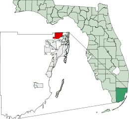
Bestand:Map of Florida highlighting Miami Gardens.svg

Afmetingen van deze voorvertoning van het type PNG van dit SVG-bestand: 333 × 307 pixels Andere resoluties: 260 × 240 pixels | 521 × 480 pixels | 833 × 768 pixels | 1.111 × 1.024 pixels | 2.221 × 2.048 pixels.
Oorspronkelijk bestand (SVG-bestand, nominaal 333 × 307 pixels, bestandsgrootte: 133 kB)
| Dit is een bestand van Wikimedia Commons. Onderstaande beschrijving komt van de beschrijving van het bestand daar. |
Location: 25°56′32″N 80°16′12″W / 25.94212222°N 80.26991944°W
Created using coordinate data from US Census Bureau, modified in accordance with incorporation data from 2000-2005 in Adobe Illustrator.

|
Toestemming wordt verleend voor het kopiëren, verspreiden en/of wijzigen van dit document onder de voorwaarden van de GNU-licentie voor vrije documentatie, versie 1.2 of enige latere versie als gepubliceerd door de Free Software Foundation; zonder Invariant Sections, zonder Front-Cover Texts, en zonder Back-Cover Texts. Een kopie van de licentie is opgenomen in de sectie GNU-licentie voor vrije documentatie. |
| Dit bestand is gelicenseerd onder de Creative Commons-licentie Naamsvermelding-Gelijk delen 3.0 Unported | ||
| ||
| Deze licentietag is toegevoegd aan dit bestand in verband met de GFDL licentie-update. |
Bestandsgeschiedenis
Klik op een datum/tijd om het bestand te zien zoals het destijds was.
| Datum/tijd | Miniatuur | Afmetingen | Gebruiker | Opmerking | |
|---|---|---|---|---|---|
| huidige versie | 14 jun 2007 15:29 | | 333 × 307 (133 kB) | Bastique | |
| 6 jun 2007 19:09 |  | 333 × 307 (136 kB) | Bastique | ||
| 6 jun 2007 19:03 |  | 333 × 307 (137 kB) | Bastique | {{coor dms|25|56|31.64|N|80|16|11.71|W|city}} Created using coordinate data from US Census Bureau, modified in accordance with incorporation data from 2000-2005 in Adobe Illustrator. {{GDFL}} [[Category:Maps of Miami |
Bestandsgebruik
Dit bestand wordt op de volgende pagina gebruikt:
Globaal bestandsgebruik
De volgende andere wiki's gebruiken dit bestand:
- Gebruikt op azb.wikipedia.org
- Gebruikt op en.wikipedia.org
- Gebruikt op eo.wikipedia.org
- Gebruikt op et.wikipedia.org
- Gebruikt op fa.wikipedia.org
- Gebruikt op fi.wikipedia.org
- Gebruikt op io.wikipedia.org
- Gebruikt op it.wikipedia.org
- Gebruikt op ja.wikipedia.org
- Gebruikt op pnb.wikipedia.org
- Gebruikt op pt.wikipedia.org
- Gebruikt op sh.wikipedia.org
- Gebruikt op sr.wikipedia.org
- Gebruikt op tr.wikipedia.org
- Gebruikt op ur.wikipedia.org
- Gebruikt op vi.wikipedia.org
- Gebruikt op zh.wikipedia.org