
Bestand:NepalBajuraDistrictmap.png
Oorspronkelijk bestand (2.479 × 3.508 pixels, bestandsgrootte: 249 kB, MIME-type: image/png)
| Dit is een bestand van Wikimedia Commons. Onderstaande beschrijving komt van de beschrijving van het bestand daar. |
| Beschrijving |
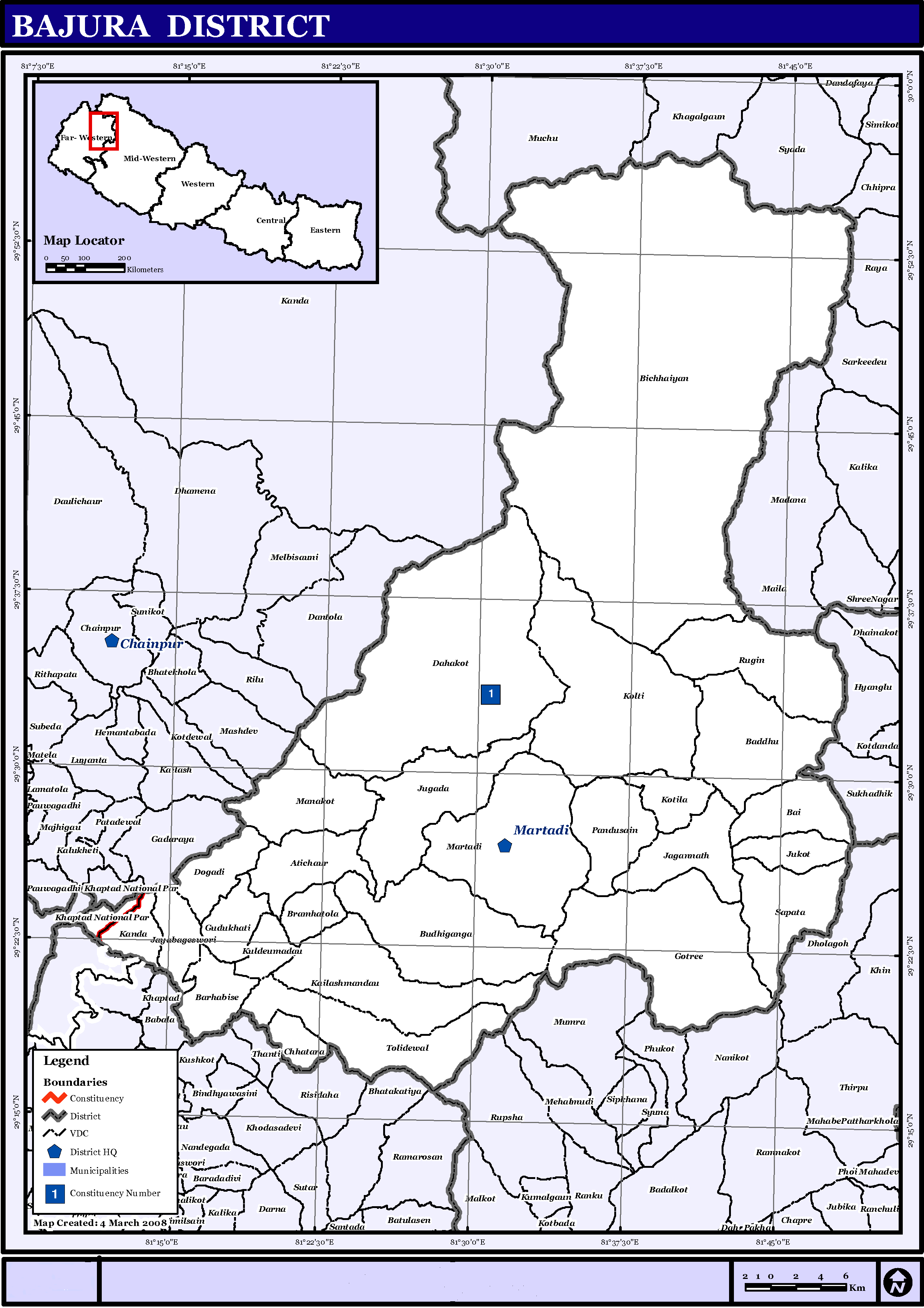
English: Map displaying Village Development Committees in Bajura District, Nepal |
|||
| Datum | ||||
| Bron | http://www.un.org.np/maps/district-maps/far-western/Bajura.pdf | |||
| Auteur | United Nations | |||
| Toestemming (Hergebruik van dit bestand) |
|

Bestandsgeschiedenis
Klik op een datum/tijd om het bestand te zien zoals het destijds was.
| Datum/tijd | Miniatuur | Afmetingen | Gebruiker | Opmerking | |
|---|---|---|---|---|---|
| huidige versie | 21 mei 2016 17:21 | | 2.479 × 3.508 (249 kB) | Timeshifter | Removed UN logo and info. Only UN maps without UN info are allowed. |
| 6 nov 2008 03:40 |  | 2.479 × 3.508 (272 kB) | Sadalmelik | {{Information |Description={{en|1=Map displaying Village Development Committees in Bajura District, Nepal}} |Source=http://www.un.org.np/maps/district-maps/far-western/Bajura.pdf |Date=March 4, 2008 |Author=United Nations |Permission={{PD-UN}} |other_ |
Bestandsgebruik
Dit bestand wordt op de volgende pagina gebruikt:
Globaal bestandsgebruik
De volgende andere wiki's gebruiken dit bestand:
- Gebruikt op de.wikipedia.org
- Gebruikt op en.wikipedia.org
- Gebruikt op fi.wikipedia.org
- Gebruikt op it.wikipedia.org
- Gebruikt op mai.wikipedia.org
- Gebruikt op ms.wikipedia.org
- Gebruikt op ne.wikipedia.org
Globaal gebruik van dit bestand bekijken.